
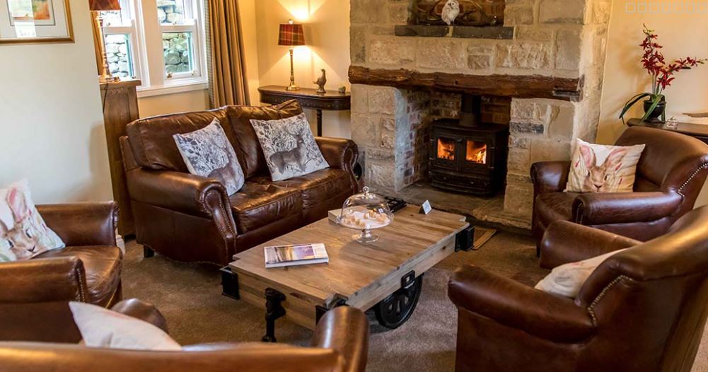
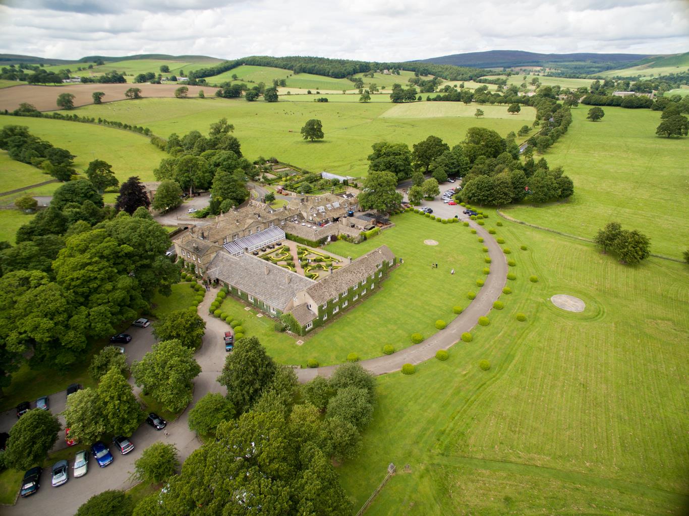
The Devonshire Arms Hotel & Spa
Dating back to the 17th century, The Devonshire Arms, owned by the Duke and Duchess of…

From Addingham to Ilkley, along a stretch of the lovely River Wharfe.
Addingham
5.5 miles (8.8kms)
Addingham is not one of those compact Yorkshire villages that huddles around a village green. The houses extend for a mile (1.6km) on either side of the main street, with St Peter's Church at the eastern end of the village, close to the river. So it's no surprise that the village used to be known as 'Long Addingham', and that it is actually an amalgamation of three separate communities that grew as the textile trades expanded.
Having been by-passed in recent years, Addingham is now a quiet backwater. Within 50 years, from the end of the 17th century, Addingham's population quadrupled, from 500 to 2,000. Even here, at the gateway to the Yorkshire Dales, the textile industries flourished. At the height of the boom, there were six woollen mills in the village. Low Mill, built in 1787, was the scene of a riot by a band of Luddites – weavers and shearers who objected to their jobs being done by machines.
Though the mill itself was demolished in 1972, more houses were added to the mill-hands' cottages to create Low Mill Village, a pleasant riverside community. Ilkley Visitors from, say, Bath or Cheltenham should feel quite at home in Ilkley, a town that seems to have more in common with Harrogate, its even posher neighbour to the north, than with the textile towns of West Yorkshire.
The Romans established an important fort here – believed to be Olicana – on a site close to where the parish church is today. Two Roman altars were incorporated into the base of the church tower, and taken into the church for safekeeping are three Anglo-Saxon crosses that date to sometime between the 8th or 9th century. One of the few tangible remains of the Roman settlement is a short stretch of wall near the handsome Manor House, which is now a museum.
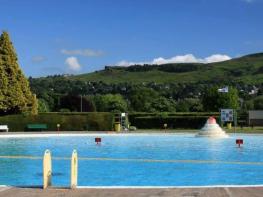
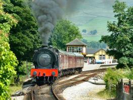
Like nearby Harrogate, Ilkley's commercial fortunes changed dramatically with the discovery of medicinal springs. During the reign of Queen Victoria, the great and the good would come here to 'take the waters' and socialise at the town's hydros and hotels. Visitor numbers increased with the coming of the railway, and included such luminaries as Madame Tussaud, George Bernard Shaw and Charles Darwin, taking a well-earned rest after the publication of The Origin of Species. With its open-air swimming pool and riverside promenades, Ilkley was almost an inland resort. Though we have replaced water cures with more sophisticated quackery, Ilkley remains a prosperous town, unashamedly dedicated to the good things of life.
Walk 50yds (46m) up the road, and take stone steps down to the right, (signed 'Dales Way'). Turn immediately right again, dropping to cross the River Wharfe on a suspension bridge. Follow a metalled path along a field edge. Turn over a stream at the end and follow a farm track left to emerge on the bend of a minor road. Go right here; after about 0.5 miles (800m) of road walking you reach the little community of Nesfield.
About 100yds (91m) beyond the last house, and immediately after the road crosses a stream, bear left up a stony track (signed as a footpath to High Austby). Immediately take a stile between two gates. Cross to the gate in the far-right corner. Through it, there is no obvious path, but follow the boundary on your right, heading towards Low Austby Farm. Carry on in the final field past the farm, bearing slightly left beneath a gnarled oak towards the wood ahead.
Cross a footbridge over a stream; beyond a stile you enter woodland. Follow a path downhill, leaving the wood by another step stile. Bear right across the slope of a field to a stile at the far end, to enter more woodland. Follow an obvious path through the trees, before reaching a road via a wall stile. Go right, downhill, to reach a road junction. Go right again, cross Nesfield Road, and take a path to the left of an electricity sub-station. Leading to the river, it accompanies the wooded bank to Ilkley's old stone bridge. Cross to the south side.
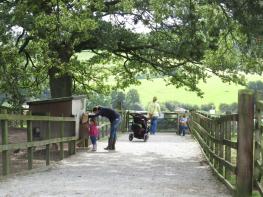
To explore the town, go left by the river through the park. Swing right towards its far end to come out by the ancient church. Otherwise, follow the Dales Way back to Addingham by turning right on a riverside path. At its end, keep ahead along the drive to Ilkley Tennis Club. Reaching the clubhouse, bear off left through a kissing gate across pasture. Part-way along the second field, take a kissing gate on the left and walk beside two more fields back to the river. Over a stream, continue through trees. Beyond a second stream, a stony path drops back down to the Wharfe. Carry on at the edge of grazing, emerging at the far end onto a now-quiet lane, once the main Skipton road.
Walk right for just over 0.25 miles (400m) before turning off along Old Lane. Reaching Low Mill village, bear right to follow the street between cottages. At the end, keep ahead on a path that quickly reverts to a lane. After another 0.25 miles (400m), beyond the old Rectory set back within spacious grounds, look for a gate on the right from which steps drop to a tiny arched bridge over Town Beck. Swing left across a pasture in front of the church to join a drive at the far side. Go left but immediately bear off right through a gate over another bridge. Wind between cottages to emerge onto North Road and turn right back to the parking spot.
Riverside path and field paths, some road walking, several stiles
Rolling country and the River Wharfe
Not advised due to loose dogs at Low Austby Farm
OS Explorer 297 Lower Wharfedale & Washburn Valley
Lay-by at eastern end of Addingham, on bend where North Street becomes Bark Lane by information panel
Ilkley
Read our tips to look after yourself and the environment when following this walk.
Everybody knows that Yorkshire has some special landscapes. The Dales and the Moors first spring to mind, but what about West Yorkshire? That’s Leeds and Bradford isn’t it? Back-to-back houses and blackened mills… Certainly if you had stood on any of the hills surrounding Hebden Bridge a hundred years ago, and gazed down into the valley, all you would have seen was the pall of smoke issuing from the chimneys of 33 textile mills. But thankfully, life changes very quickly in West Yorkshire. The textile trade went into terminal decline, the mills shut down forever and in a single generation Hebden Bridge became a place that people want to visit.
The surrounding countryside offers walking every bit as good as the more celebrated Yorkshire Dales; within minutes you can be tramping across the moors. And this close proximity of town and country is repeated all across West Yorkshire. There’s such diversity in the area that you can find yourself in quite unfamiliar surroundings, even close to places you may know very well. Take time to explore this rich county and you will be thrilled at what you find to shatter old myths and preconceptions.
Discover more than 15,000 professionally rated places to stay, eat and visit from across the UK and Ireland.
Choose a place to stay safe in the knowledge that it has been expertly assessed by trained assessors.
Search by location or the type of place you're visiting to find your next ideal holiday experience.
Read our articles, city guides and recommended things to do for inspiration. We're here to help you explore the UK.