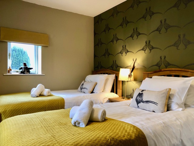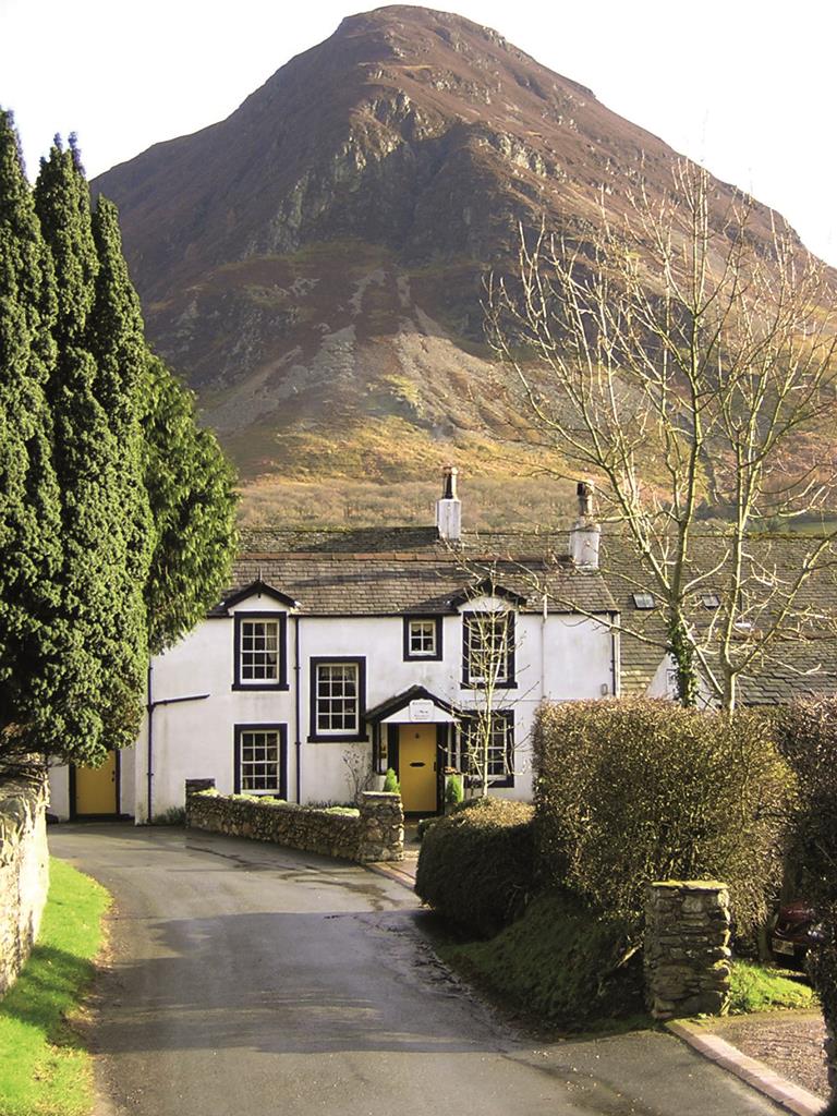


YHA Buttermere
Overlooking the lake and surrounded by some of the highest mountains in England, YHA Buttermere…

2.9 miles (4.7kms)
This peculiar little mountain is worth the effort at most times of the year. The rugged face it sets against the valley of Crummock Water looks unassailable until you find the key, a winding staircase of grass and rock steps, breaching its craggy summit after only a relatively short burst of exertion. Even in low cloud this creates an exhilarating experience of loftiness. On clear days the view is nothing short of magnificent. Crummock Water’s depths below the end of Rannerdale’s crags plunge to over 70ft (21.3m) barely 8ft (2.4m) from the road. Little wonder then that in former times folk chose a route to Buttermere over the shoulder of this fell, steering clear of those terrifying underwater depths. The modern car required a more level approach, and so the lakeside road was blasted out of the rock.
The road disarms Rannerdale Knotts of its most dramatic power – that of a barrier to the secret valley of Buttermere beyond. This at least was the theory developed by Nicholas Size (1866–1953), who once ran the Buttermere (now the Bridge) Hotel in the village. Size, a former railwayman, forsook his life as the goods manager at the old Bradford Exchange Station to become an outspoken proponent of tourist ‘development’ in the valley. A man of many schemes, one such was to open a nine hole golf course on the meadows between Buttermere and Crummock Water, and another involved a cable car up to High Crag.
Size is not remembered by posterity as an eccentric hotelier, however, but as an author. He was captivated by the absence of historical records about the area, particularly before the Normans exerted effective control in the 12th century. There were folk tales, and of course the place-names, with their Norse and Celtic origins. Size set about putting some flesh on the stories and in The Secret Valley (1930) created a historical novella using the backdrop of his valley as a storyline. Earl Bothar, the last of the Celtic warrior chiefs, defends his homeland from Norman invaders, coming up the dale from their castle at Cockermouth. Faced with the barrier of Rannerdale Knotts, the British lure their attackers into the dead-end valley to the north, before descending on them from the surrounding heights in a massacre. It’s gripping stuff, and the book sold in vast quantities to a 1930s public keen to read of resistance to foreign invaders. The bluebells that flourish on Rannerdale’s open fellsides are supposed to have grown up from the corpses of the Norman invaders.
With your back to the parking area turn left along the road for a few paces to a footpath sign on the left. Here you’ll find a steep, pitched path that begins a snaking ascent of the precipitous slope.
Keep to the clearest path, which swings left and climbs through the bracken. On reaching a knoll, you’re treated to views of Buttermere and Crummock Water in the valley below. The path zig-zags back to the left now. At the top of a short rise, keep to the right of a small pile of slate, ignoring the inviting, grassy path and instead climb a stony trail that quickly becomes a flight of rocky steps through a rocky ravine. As the grassy slopes return you are confronted by a pair of crags looming ahead. Your upward path is deflected to the right, emerging on a grassy shoulder before bearing right to the summit. The slightly underwhelming highest point is made worthwhile by taking a few paces towards the edge to reveal a magnificent vista up and down the valley.
Follow the obvious ridge path, which includes one awkward rocky section before settling down to become an airy high-level route across a series of bracken-coated grassy knolls. As you approach the final humps, a short cut drops down to the left, but completists will want to carry on to the end of the ridge, where it terminates at a grassy crossing of paths above the valley of Mill Beck beneath Whiteless Breast.
Turn left and immediately left again down the valley path that now mirrors your high-level outward journey. Follow the path all the way down to a gate near a wall corner by a footbridge.
In spring it’s worth crossing here to immerse yourself in the fellside bluebells, however, please observe any National Trust path signs to avoid damaging the wild flowers. At other times of the year, continue with the water on your right on a path that clings to the foot of the fell. This soon swerves left away from the beck. When faced with any choices, keep left to stay close to the base of the rocky slope. Pass through a kissing gate and continue with a wall now on your right to emerge at the back of the little parking area.
Steep rocky paths, grassy paths and tracks
Steep fellside, open fell, valley and lake
Sheep grazing – keep dogs on lead throughout
OS Explorer OL4 The English Lakes (NW)
Roadside layby near start
None on route
Read our tips to look after yourself and the environment when following this walk.
Cumbria's rugged yet beautiful landscape is best known for the Lake District National Park that sits within its boundaries. It’s famous for Lake Windermere, England’s largest lake, and Derwent Water, ‘Queen of the English Lakes'. This beautiful countryside once inspired William Wordsworth and his home, Dove Cottage, in Grasmere is a popular museum. Another place of literary pilgrimage is Hill Top, home of Beatrix Potter, located near Windermere. Tom Kitten, Samuel Whiskers and Jemima Puddleduck were all created here.
Much of Cumbria is often overlooked in favour of the Lake Distirct. In the south, the Lune Valley remains as lovely as it was when Turner painted it. The coast is also a secret gem. With its wide cobbled streets, spacious green and views of the Solway Firth, Silloth is a fine Victorian seaside resort. Other towns along this coastline include Whitehaven, Workington and Maryport. Carlisle is well worth a look – once a Roman camp, its red-brick cathedral dates back to the early 12th century and its 11th-century castle was built by William Rufus.
Discover more than 15,000 professionally rated places to stay, eat and visit from across the UK and Ireland.
Choose a place to stay safe in the knowledge that it has been expertly assessed by trained assessors.
Search by location or the type of place you're visiting to find your next ideal holiday experience.
Read our articles, city guides and recommended things to do for inspiration. We're here to help you explore the UK.