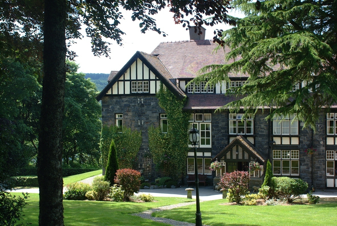
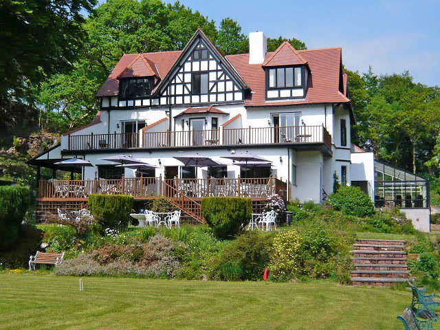

Palé Hall Hotel & Restaurant
Palé Hall was originally built in 1871 by industrialist Henry Robertson with the instruction…

Bala
5 miles (8kms)
'It was a beautiful evening...the wind was blowing from the south, and tiny waves were beating against the shore, which consisted of small brown pebbles. The lake has certainly not its name, which signifies Lake of Beauty, for nothing...'
George Borrow, Wild Wales, 1862
Borrow had been staying at the White Lion in Bala and had been impressed with the place and its people. Bala is an austere town, close to the banks of two great rivers, the Tryweryn and the Dee, and the shore of Wales’ largest natural lake, Llyn Tegid.
The town’s many chapels give a hint to its religious roots. You’ll see the statue of Dr Lewis Edwards, founder of the Methodist College, and one of the Revd Thomas Charles, a founder of the British and Foreign Bible Society. Bala’s employment was based around the woollen industry, and the town was noted for its stockings. Thomas Pennant came here in 1786 and painted a fascinating picture of life in the town: ‘Round the place, women and children are in full employ, knitting along the roads; and mixed with them Herculean figures appear, assisting their omphales in this effeminate employ.’
Llyn Tegid is every bit as beautiful as Borrow suggests and it’s popular for watersports. It’s favoured by anglers too. Pike, perch, trout, salmon and roach are plentiful, but the fish Llyn Tegid is famous for is the gwyniad, which is not unlike a freshwater herring. It is said these fish were trapped here after the last Ice Age. The walk also passes a steam railway station, right next to the old castle site, and it’s fascinating to see the old steam engines puffing along the lakeside. However, we are in search of higher things, so climb through woods and upland fields until you get your view. From up high you can see Tegid’s blue waters, seemingly perfect and still from this distance, and stretching 4.5 miles (7.2km) along its rift valley towards Dolgellau. The Dee, so wide downriver from Bala, has its beginnings in the peat bogs beneath the dark cargs of Dduallt. It’s time to descend, through more oak woods, and further, beneath western hemlock and larch, finally to reach the town. It’s worth visiting the old Norman motte-and-bailey castle of Tomen y Bala in Bala. Some say that the mound goes back to Roman times, but it is known that the castle was captured from the Normans by Llewelyn ap Iowerth in 1202.
Go to the north corner of the car park in Bala to access the riverside path. Turn right to follow a raised embankment along the west bank of the Tryweryn. After a dog-leg to the right, passing through two kissing gates, the footpath continues, first by the banks of the Tryweryn, then by the north banks of the Dee.
On reaching the road, cross the bridge over the River Dee, then a smaller, older bridge. Go through a kissing gate to cross a small field to Bala Station on Bala Lake Railway. A footbridge allows you to cross the track before traversing two small fields.
Turn right along a cart track, and continue to pass behind the Bala Lake Hotel. A waymarker points the direction up beneath trees on the left, and the path continues to a kissing gate and then follows a fence on the right.
Descend slightly to cross a stream beside a small cottage; go up again then along a level fence to a metal gate. Bear left up through some steep bracken, then continue on a grass path to a tarmac lane.
Turn left along the lane, which climbs through new plantations of birch, rowan and spruce.
When you reach a waymark point just before the isolated house of Encil y Coed turn left off the lane to a ladder stile. Continue straight ahead on a grooved grass track across gorse-covered slopes. Keep left at a fork and then drop down to a stile. The clearly waymarked path continues north, with Bala town ahead.
Go over a partially hidden step stile into the commercial forestry plantations of Coed Pen-y-bont. A narrow footpath descends to the bottom edge of the woods (ignore the forestry track you meet on the way down).
At the bottom of the woods turn right along a track that reaches the road past the Pen-y-Bont Campsite. Turn left along the road and cross the Dee again
Bear left and then follow the lakeside footpath past the leisure centre. When you reach the main road (A494), turn right to explore walk through the town centre.
Woodland and field paths, many stiles
Woods and upland pasture
Dogs should be on a lead at all times
OS Explorer OL23 Cadair Idris & Llyn Tegid, or OS Explorer OL18 Harlech, Porthmadog & Bala
Pay car park in Bala, off B4391
In car park
Read our tips to look after yourself and the environment when following this walk.
The county of Gwynedd is home to most of the Snowdonia National Park – including the wettest spot in Britain, an arête running up to Snowdon’s summit that receives an average annual rainfall of 4,473mm. With its mighty peaks, rivers and strong Welsh heritage (it has the highest proportion of Welsh-speakers in all of Wales), it’s always been an extremely popular place to visit and live. The busiest part is around Snowdon; around 750,000 people climb, walk or ride the train to the summit each year.
Also in Gwynedd is the Llyn Peninsula, a remote part of Wales sticking 30 miles out into the Irish Sea. At the base of the peninsula is Porthmadog, a small town linked to Snowdonia by two steam railways – the Welsh Highland Railway and the Ffestiniog Railway. Other popular places are Criccieth, with a castle on its headland overlooking the beach, Pwllheli, and Abersoch and the St Tudwal Islands. Elsewhere, the peninsula is all about wildlife, tranquillity, and ancient sacred sites. Tre’r Ceiri hill fort is an Iron Age settlement set beside the coastal mountain of Yr Eifl, while Bardsey Island, at the tip of the peninsula, was the site of a fifth-century Celtic monastery.
Discover more than 15,000 professionally rated places to stay, eat and visit from across the UK and Ireland.
Choose a place to stay safe in the knowledge that it has been expertly assessed by trained assessors.
Search by location or the type of place you're visiting to find your next ideal holiday experience.
Read our articles, city guides and recommended things to do for inspiration. We're here to help you explore the UK.