


Fishguard Bay Resort
Set high up on cliffs with outstanding views of Fishguard Bay, this site has the Pembrokeshire…

A coastal exploration of Pembrokeshire's Newport and a stiff climb to one of Britain's most sacred hilltops.
Newport, Pembrokeshire
5.5 miles (8.8kms)
Carn Ingli appears to peep over the shoulder of the small coastal town of Newport in the same way as Table Mountain does in Cape Town, South Africa. The domination of the town’s skyline by the bold, rock-capped summit seems to make them inseparable and it therefore makes sense to explore both in one walk. The coastal section is easy to follow and thoroughly enjoyable as the path traces a varied line along the Nyfer Estuary, at one stage following the actual sea wall itself. The tracks that cross the common, on the other hand, are rough and, in late summer, when the bracken is fully grown, difficult to follow in places. They’re worth sticking with though, for the views from the jagged rocks of the peak are among the best in the whole of the Pembrokeshire Coast National Park.
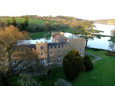
Once a busy port immersed predominantly in the wool trade, Newport was the former capital of the Marcher Lordship of Cemmaes, the only one to escape the abolition imposed by Henry VIII in the 16th-century Acts of Union. William Fitz-Martin, who moved to Newport from nearby Nevern, granted a number of privileges to the town, including the election of its own mayor, something which it still has to this day, and the beating of the bounds on horseback by the mayor, which takes place every August. Its castle, once the home of the aforementioned lord, has since been incorporated into a mansion house and is now in private ownership.
Often described as one of the most sacred sites in Britain, the lofty heights of Carn Ingli were well known by the mystical St Brynach, who scaled them in order to commune with angels. After a life of persecution – the Irish-born saint was made most unwelcome by the Welsh when he returned from his pilgrimage to the Holy Land – he finally settled in Nevern, where he built his church. It remains one of the most visited in Pembrokeshire due to its ancient Celtic cross and a yew tree that appears to actually bleed. A second cross, carved into the rocky hillside, has seen so many visitors that the stones beneath it are now as smooth as glass. Judging from the remains of both Iron Age fortresses and Bronze Age huts, there was human activity on Mynydd Carningli long before Christianity. The size of the settlements suggests that the windswept hillside would have once supported fairly large communities. Perhaps the existence of standing stones near by demonstrates that these early settlers were also aware of the mountain’s special powers.
Turn right out of the car park in Long Street and left on to East Street (A487). Fork left into Pen y Bont and continue to the bridge, where a waymarked footpath leads off to the left. Follow this along the banks of the estuary to a small road.
Turn right on the road and walk past the toilets to its end, where the path then follows the sea wall. Continue to another lane and turn left to follow it up to the A487. Turn right on to this road, then turn left to continue walking up the drive of Hendre farm.
Pass the farmhouse on your right to go through the gate and follow the track to another gate where you turn left to follow a small stream. The path emerges on to open ground and hugs the left edge of the field to reach another gate. Continue in the same line along a hedged section, which is boggy for most of the year. Climb over a stile and keep straight ahead to climb up to the road.
Turn right on to the road and then fork left to continue past some houses to a pair of huge upright stones on the left. Pass through these stones and follow the faint track up to a rocky tor. Head up from this towards the larger tor of Carn Ffoi. From the top of here you’ll be able to pick up a clearer path that leads through an old field system defined by small, ruined walls. Navigate your way through the old fields heading southeast to the right-hand side of a fenced field.
Now bear half right onto a clear footpath (to the left of the path that runs between lines of low gorse) that leads across the hillside, aiming towards the obvious top of Carn Ingli, which will come into view as you climb. Fork left after 50yds (46m) and then continue across the hillside beneath the high point of Carningli Common. The path bears right to climb into the saddle between Carningli Common and the rocky top of Mynydd Carningli. Continue to the far end of the rocky ridge and then bear left to follow a faint path up on to the ridge top.
Carry on to Carn Ingli and bear left along the path to pass in front of it, to join a good, clear track that runs straight down the hillside. Continue on this, keeping straight ahead at two crossroads. This drops you down to a gate in a corner, where a path leads on to a concrete track.
Take the lane to a T-junction and turn left. Follow this road down to a junction in College Square, where you turn left. This is Church Street. Continue into the centre and turn right into Market Street to the main road, which you cross into Long Street.
Easy coastal footpaths, boggy farm tracks, rough paths over bracken and heather-covered hillsides
Attractive harbour, farmland and rock-capped moor
Care on roads, poop scoop on coast path section
OS Explorer OL35 North Pembrokeshire
Car park opposite information centre in Long Street
At start and also in Parrog car park
Read our tips to look after yourself and the environment when following this walk.
Wales meets the Atlantic Ocean in spectacular fashion at Pembrokeshire. Unlike the West Country, Pembrokeshire can offer the coast without the crowds, and quaint fishing villages without those huge coach parks. Volcanic eruptions and earth movements have left a tortured rocky coastline of some 160 miles, whose beauty and drama have been recognised by National Park status.
Sometimes known as ‘Little England Beyond Wales’, the county has held a fascination for English visitors ever since the first Norman warlords forced their way in 800 years ago, leaving a string of 50 fine castles in their wake. The anonymous author of The Mabinogion, an 11th-century collection of Welsh folk legends, started it all. His description of the old Celtic kingdom of Dyfed (which encompasses Cardiganshire, Carmarthenshire and Pembrokeshire) as ‘the land of magic and enchantment’ was perhaps the earliest written attempt to sum up the outstanding natural beauty of this wonderful westernmost outpost of Wales. This is a county where you can take it easy on the sandy beaches, make sport out of those Atlantic waves, or discover the mysteries of St David’s or the ancient Preseli Hills.
Discover more than 15,000 professionally rated places to stay, eat and visit from across the UK and Ireland.
Choose a place to stay safe in the knowledge that it has been expertly assessed by trained assessors.
Search by location or the type of place you're visiting to find your next ideal holiday experience.
Read our articles, city guides and recommended things to do for inspiration. We're here to help you explore the UK.


