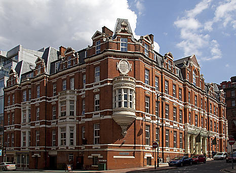
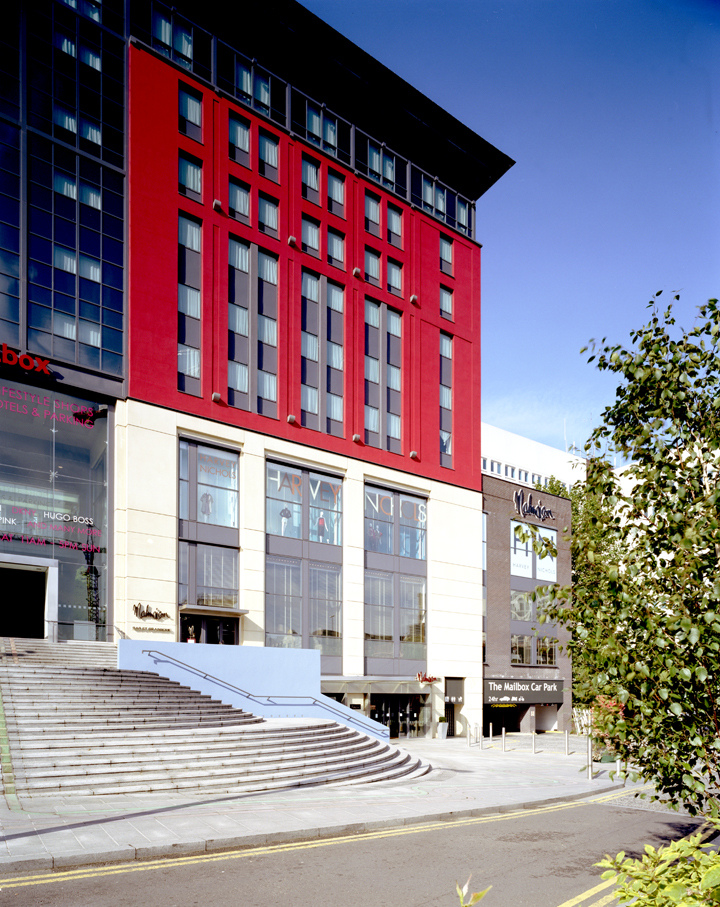
Malmaison Birmingham
The 'Mailbox' development, of which this stylish and contemporary hotel is a part, incorporates…

Halesowen
4 miles (6.4kms)
The Leasowes was a mixed farm of arable and pasture when William Shenstone (1714–63) inherited it from his uncle in the early 1740s. William freely admitted he would rather be known as a poet than as a farmer, and he set about transforming the surrounding fields into a ferme ornée – an ornamental farm, or the Romantic movement’s answer to landscape gardening. Shenstone was not a rich landowner, however, so many of the innovations he made were borne of necessity rather than extravagance. He transformed the local water courses into cascades and pools, planted trees and installed benches and even strategically sited ‘ruins’ to enhance the pleasurable aspect.
In 1755 a collection of his poems became a bestseller, and Shenstone could relax into the role of garden innovator. It wasn’t until after his death, however, that A Description of The Leasowes was published by Robert Dodsley, and the landscape’s fame spread far and wide, attracting salubrious visitors such as Benjamin Franklin, Thomas Jefferson and even John Wesley.
The arrival of the Dudley No. 2 canal in 1779 finally interrupted the sylvan scene, and from then on Shenstone’s vision began to fade. The parklands came into municipal ownership in 1932, and the Ruined Priory survived until demolition in the 1960s, but it had to wait until 2008 for the centre piece, Virgil’s Grove, to be restored with the aid of a Heritage Lottery Fund grant.
Today The Leasowes is recognised as an important milestone in landscape design, with English Heritage listing and a management plan to ensure this important parkland is retained for future generations.
Leave the car park at the north end by walking east past the Warden’s base, uphill along a tarmac driveway. At the junction, near a couple of houses, bear right through a gateway and continue along the driveway past a small pool, then between the greens below Halesowen Golf Club clubhouse. Where the tarmac track arcs to the left near the clubhouse and through a gate, turn right. At the top of the hill the drive leads into Leasowes Lane and a residential area.
At the end of the lane go right along Manor Lane (B4043). After passing Stennels Avenue, the lane bends sharp right. Here go left up a narrow public footpath to the right of No. 61. Follow this fenced footpath into Hiplands Road; go right, then right again into Manor Abbey Road at the T-junction. In about 20yds (18m), go left down Longlands Road and continue as it bends right. After passing Lavina and Christopher roads, go left through a public footpath barrier to reach the A456.
Cross the busy road at the pedestrian crossing and proceed down Lapal Lane South opposite. After about 275yds (251m), go right over a stile and into open countryside. Follow the direction of the fingerpost signed to Illey, and take the path up along the left edge of a large field. Now go left over a second stile and bear right to the hedged path, heading southwards. Where another path joins from the left, the path becomes a track. At a junction of paths, continue ahead, then walk through trees to the left of Cooper’s Wood. At the end of the wood, over a stile, go right. Cross over another stile, then bear quarter-left to a stile to cross pasture. Over a stile the path arcs right, and then left over another stile onto a track.
Follow this track and in about 100yds (91m) go right over a pair of stiles (if you walk to the end of the track you reach a road and will find The Black Horse pub on the corner opposite). Continue to the right of a field hedge with Bartley Green football pitch on the other side. At the field corner, go left over a stile and walk around the bottom end of the football field, leaving via the football club gate onto the farm drive near Illey Hall Farm. Go left along the farm drive for 30yds (27m), then right over a stile and take the path to the left of the field hedge. Follow this path, soon merging with the Monarch’s Way, over several fields and stiles, later crossing to the other side of the hedge via a stile where there is a stream to the right. The path arcs right to a bridge and becomes a farm track arcing left towards Manor Abbey Farm. Bear right as you approach the farm, picking out a field corner stile and continuing across a large cultivated field.
Cross the stile and go left, then bear right over a footbridge to a pair of stiles that take you back to the side of the A456. Go right for 25yds (23m), then over the road at the crossing. Go right again, then left to follow the tarmac footpath at a sign, ‘Leasowes Park and Breaches Pool’.
This path passes along the back of residential properties. Continue ahead to the right of a chain-link fence and soon the path becomes the tow path of the Lapal Canal (formally known as the Dudley No. 2). The canal is covered with water plants, and there are houses up to the right. After about 400yds (366m) a bank crosses the canal, just before a former lock. Cross this and head along the tow path, now to the right of the canal (there is visible water here), with The Leasowes to your right. In 150yds (137m) stop to enjoy the fine view over Breaches Pool, then continue up the tow path and return to the car park.
Pavements, field paths and tow path, many stiles
Nature reserve and open countryside around urban area
Off lead along tow path, otherwise under control
OS Explorer 219 Wolverhampton & Dudley
The Leasowes car park, off A458
None on route
Read our tips to look after yourself and the environment when following this walk.
After Greater London, the West Midlands is the UK’s biggest county by population, and after London, Birmingham is the UK’s largest city. There’s a lot to seek out here – it has a vibrant culture, with exceptionally good nightlife. Coventry used to be more important than Birmingham, until the 18th century when the Industrial Revolution started and Brum forged ahead.
Apart from Lady Godiva, Coventry is best known for its cathedrals. The medieval parish church became a cathedral in 1918, but the Blitz on Coventry in 1940 left only the spire and part of the walls. After the war, it was decided to build a new cathedral alongside linked to the ruins.
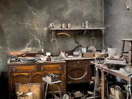
Dudley was one of the birthplaces of the Industrial Revolution, and this history is reflected in its architecture and the Black Country Living Museum, a recreation of an industrial village, with shops and a pub, cottages and a chapel. Stourbridge is also worth a visit, mainly due to its involvement in glassmaking, which has been going on since the 17th century, and is still a part of the town’s culture; there’s a glass museum and a bi-annual glass festival.
Discover more than 15,000 professionally rated places to stay, eat and visit from across the UK and Ireland.
Choose a place to stay safe in the knowledge that it has been expertly assessed by trained assessors.
Search by location or the type of place you're visiting to find your next ideal holiday experience.
Read our articles, city guides and recommended things to do for inspiration. We're here to help you explore the UK.