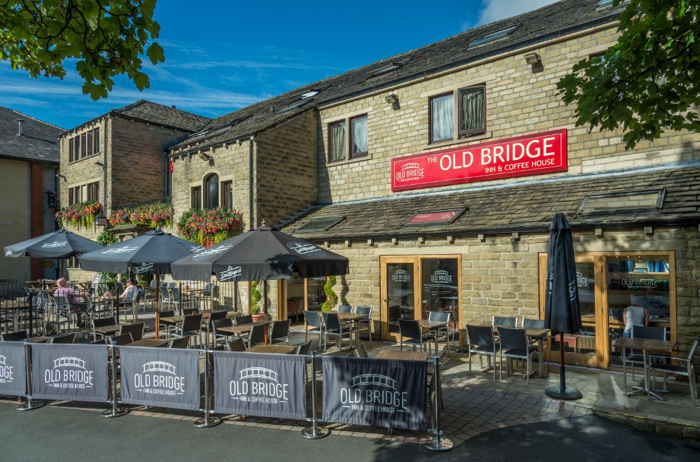


Old Bridge Inn & Coffee House
The Old Bridge Inn & Coffee House is a modern inn in the centre of the popular town of…

Gentle pastures and wide-open views before crossing the Penistone Line.
Thurstonland
1.5 miles (2.4kms)
In the mid-1800s the North’s industrial might couldn’t grow fast enough. To cope with the need to transport goods from recently mechanised factories, a wonderfully engineered canal system had been built: three canals, the Leeds and Liverpool, the Rochdale and the Huddersfield Narrow Canal, were cut through the Pennines to connect major cities and centres of industry. But by the 1840s waterways were beginning to be regarded as too slow, and railway mania took hold.
The Huddersfield and Sheffield Junction Railway was formed to connect those two cities by rail. From the start, though, the company faced severe difficulties. Their route had to be bored beneath hills, several rivers had to be bridged, and great cuttings had to be dug and embankments raised.
Work on the line began in 1845, even before all the land necessary had been purchased. The company was quickly absorbed by the Manchester and Leeds Railway, which in turn became the Lancashire and Yorkshire Railway. Costs soared, as Parliament refused to allow the line to meet the Manchester route in a tunnel just outside Huddersfield, on grounds of safety.
Engineers had to build 2.25 miles (3.6km) of tunnels, and construct 57 bridges, along with four major viaducts; Lockwood Viaduct, bridging the River Holme near Huddersfield, has 34 arches and was one of the country’s largest. The line eventually opened on 1 July, 1850, but to the railway company’s embarrassment the inaugural train stalled in Thurstonland Tunnel, between Brockholes and Stocksmoor stations. Half the coaches had to be uncoupled. The engine took the front carriages to Stocksmoor Station, while the others remained in the 1,631-yard (1,491m) tunnel, awaiting rescue. Wet rails, with which the underpowered locomotive engine couldn’t cope, were blamed – possibly the first recorded case of 'wrong kind of water on the line'.
Future years saw major problems: Denby Dale’s viaduct, built of timber, collapsed twice before someone thought of rebuilding it in stone. Penistone’s stone viaduct collapsed in 1916, though the driver and fireman of the loco crossing it at the time survived by leaping from the footplate.
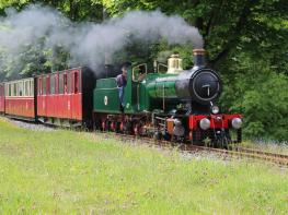
The Beeching cuts of the early 1960s threatened the line with closure but then-Transport Minister Barbara Castle rejected the idea. In more recent years the line has been given a new lease of life with the creation of a new halt to serve Meadowhall, the gigantic shopping complex near Sheffield. The line’s role as a community asset is also promoted by the Penistone Line Partnership of users, operators and local authorities, and music and real ale trains are a regular attraction on the line.
Take the signed footpath next door-but-one to the left of the Rose & Crown pub, past The Barn, Upperfold. The obvious green lane beyond immediately offers views across the Holme Valley on your left and soon, on your right, across the valley of Shepley Dike, to Emley Moor telecommunications and TV transmitter mast, the highest free-standing structure in the UK. Cross a tricky stone stile into the field ahead, through which a less-pronounced path follows the wall on your left, to a stone gap stile. Keep ahead, the wall now on your right, to cross another stile beyond which the path continues diagonally ahead-right over the subsequent field, to meet and follow a wall on your right. Where this bears off, continue ahead and across to a stone gatepost.
Although the right of way turns left here to follow the wall downhill, the easier, more frequented option is to cross the wooden step stile to the right of the gate ahead and turn left down a well-worn grassy path, which becomes a lane passing through Great Place Wood, then cuts diagonally across the next field to its lowest corner.
Here a bridge carries you over the Penistone railway line, near Thurstonland Tunnel, scene of the 1850 humiliation. Beyond, take the continuing path, ignoring stiles on your right, up to a kissing gate in the top right-hand corner of the wood. Continue ahead up a well-worn path by a shallow wooded clough, to a stone stile. The slippery walled lane beyond leads to a surfaced driveway. Carry on up this, trending right past cottages and farmhouses known as Top of the Hill, back to Thurstonland Bank Road. Turn left, along the pavement, back to the village.
Good field paths and tracks, some mud; several stiles
Pastoral countryside, with one climb
Free to exercise unless livestock is grazing
OS Explorer 288 Bradford & Huddersfield
Roadside parking in the village – please be considerate to residents
None on route
Read our tips to look after yourself and the environment when following this walk.
Discover more than 15,000 professionally rated places to stay, eat and visit from across the UK and Ireland.
Choose a place to stay safe in the knowledge that it has been expertly assessed by trained assessors.
Search by location or the type of place you're visiting to find your next ideal holiday experience.
Read our articles, city guides and recommended things to do for inspiration. We're here to help you explore the UK.