"Wide open countryside, superb views and the site of a ruined castle"
Walk directions
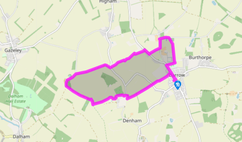
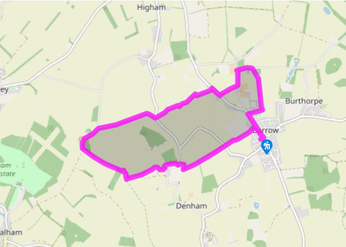
Turn right out of the car park up Britton’s Road and turn immediately left with the war memorial to your right and a duck pond to your left. After the Cave Adullam Baptist Church and a second duck pond, turn left at a footpath sign into a private road marked ‘Orchard Farm Barns’. Look for a narrow path along a brick wall to the left of house no. 2. This passes a field to the left as it continues in between a fence and a high hedge hiding an apple orchard. Cross a footbridge and carry straight on to a road.
Cross the road and walk straight ahead between fields. Turn sharp left then immediately right to climb gently over a further field. At the far side cross a footbridge and go through a very large metal gate to follow a track along a line of sycamores with farmed deer in a field to your left. The path eventually swings hard to the right to lead to a road. Turn left then right after 20yds (18m) at a footpath sign to go through a gate. Keep to the right-hand edge of the field which borders another apple orchard until you leave by a gate at the top end to arrive at an information board.
You are now in front of what remains of the motte and bailey Denham Castle. Pass the info board and follow the path as it makes its way around the stump of the motte. It peels away onto a low bank that makes its way along the left-hand side of a large field used for grazing sheep. Walk the length of the field then swing right with the fence to the far corner and a row of poplars. Go through a kissing gate, then straight ahead, turning right after 10yds (9m) to skirt a field with a spinney to your left and fantastic views to the north. Beyond a row of cottages a seemingly endless succession of fields and trees stretches far into Norfolk. The wide grassy track leaves the wood to cross an enormous arable field.
At a lane turn right to walk through farm buildings, many of them built of flint. Hidden behind them stands Desning Hall to which the inhabitants of Denham Castle fled to escape the plague. Go through a gap next to a large black gate that spans the road like a level crossing gate and turn right on a concrete lane to walk in front of a row of semi-detached cottages built to house estate workers. When the lane swings left, keep straight on up the right-hand side of a hedge and continues ahead as it takes you into the field next door along a line of telegraph poles. At the end of the field it bears right to follow the right-hand side of the next field.
Cross a road and follow a bridleway down between fields across a brook and up along the right-hand side of a further field. At this point it’s easy to go wrong so do look out for the point where the field edge suddenly turns right (about half-way up the field). Follow this hedge right to the corner and go straight ahead through a gap in the hedge. You’ll probably only see the footpath sign once you’re through the hedge. Descend a few steps and turn left to follow this hedge upwards around the field. At the top of the field cross a footbridge hidden in the hedge, followed by a stile. Bear half-right across a field aiming for the left-hand edge of a bungalow. Cross the garden to a road and turn right. After 150yds (137m) turn left up a footpath opposite the pond at Frogs Hall. This soon breaks out of a copse to follow the right-hand edge of a field to emerge at a road by a sign for Barrow Hall Stables.
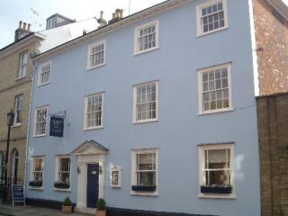
Turn left to walk along the pavement. Follow the road sharp right past All Saints church. After 200yds (183m) right up a green lane that passes along a tunnel of trees next to a cemetery. This comes out onto a field and keeps straight ahead. Ignore a path to the left and shortly afterwards fork right through a belt of trees and over a footbridge to a recreation ground. Bear half-right to cross the football pitch and leave at the far corner. When you reach the road, the Three Horseshoes pub is just to your right. Turn left to return to the start.
The wander across farmland to Denham Castle gives walkers ample time to imagine themselves into the world of petty fiefdoms, rebellions and ever changing allegiances that was the hallmark of this part of the country in the 12th century. The castle – known locally as Castle Holes – was a motte and... bailey affair built on top of an Anglo-Saxon lordship centre in 1142 by the 3rd Earl of Clare. He was a supporter of King Stephen in his war against rival throne-claimant Matilda. The earl built the stronghold – then known as Desning Castle – in something of a hurry in reaction to the rebellion of the Geoffrey de Mandeville against the king earlier in the year. The castle had an artificial lake protecting it and served as the headquarters of a small group of knights who, from its tower, could control the road to Cambridge from Bury St Edmunds and Thetford. Such is the flatness of the landscape in these parts that it was even possible for them to send signals to Ely Cathedral some 13 miles (21km) away. Five years after constructing the castle, the 3rd Earl of Clare switch sides, joining the rebellion against Stephen. This was a tactical error in that he almost instantly found Desning and all the other castles he owned taken from him by the king. In 1154, Henry II – Matilda’s son who was adopted by Stephen as his heir – ordered the destruction of all castles built during the Stephen’s reign and Desning’s 12-year life as a fortified position came to an abrupt end. However, the hall and other buildings inside the bailey were seemingly left untouched and they continued as the hub of a manorial estate until fears of the plague drove its occupants to flee to nearby Desning Hall in the 1300s. Great Barrow Challenge The unremarkable village of Barrow is the unlikely home of an endurance event called the Great Barrow Challenge inspired by the four-day Nijmegen marches held in the Netherlands. This is a four-day challenge that takes place every September in which participants must walk 26.2 miles, run 26.2 miles, or cycle 120 miles (or any combination of these) on each of the four days. There are no winners or losers and there are shorter distances on offer, but in order to win the coveted GBC medal the entrants must complete the full distances on all four days. Cave Adullam Baptist Church This oddly named and somewhat bijou place of worship is built of flint and takes its inspiration from an Old Testament passage in which the fugitive David leaves the land of the Philistines ‘and escaped to the cave Adullam’. This was a place of refuge probably located near Bethlehem.
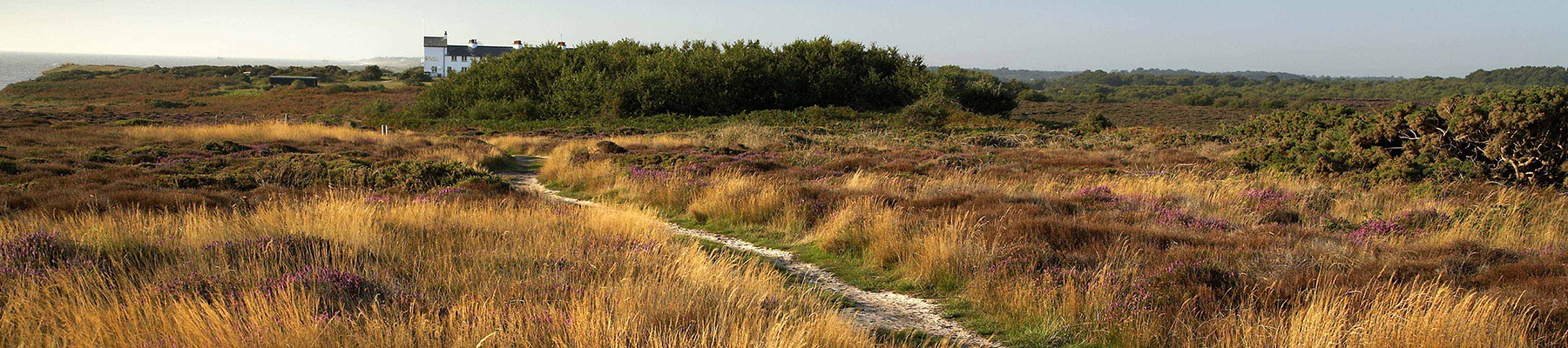
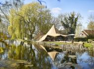
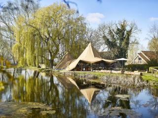
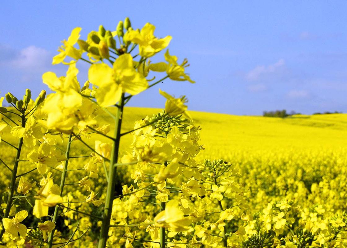
Suffolk is Constable country, where the county’s crumbling, time-ravaged coastline spreads itself under wide skies to convey a wonderful sense of remoteness and solitude. Highly evocative and atmospheric, this is where rivers wind lazily to the sea and notorious 18th-century smugglers hid from the excise men.
"Wide open countryside, superb views and the site of a ruined castle"
Walk details
2hrs
Difficulty:
Medium
Gradient:
Moderate
Distance:
5 miles (8kms)
Ascent:
213ft (649m)
Walk directions
Turn right out of the car park up Britton’s Road and turn immediately left with the war memorial to your right and a duck pond to your left. After the Cave Adullam Baptist Church and a second duck pond, turn left at a footpath sign into a private road marked ‘Orchard Farm Barns’. Look for a narrow path along a brick wall to the left of house no. 2. This passes a field to the left as it continues in between a fence and a high hedge hiding an apple orchard. Cross a footbridge and carry straight on to a road.
1 of 6
Cross the road and walk straight ahead between fields. Turn sharp left then immediately right to climb gently over a further field. At the far side cross a footbridge and go through a very large metal gate to follow a track along a line of sycamores with farmed deer in a field to your left. The path eventually swings hard to the right to lead to a road. Turn left then right after 20yds (18m) at a footpath sign to go through a gate. Keep to the right-hand edge of the field which borders another apple orchard until you leave by a gate at the top end to arrive at an information board.
2 of 6
You are now in front of what remains of the motte and bailey Denham Castle. Pass the info board and follow the path as it makes its way around the stump of the motte. It peels away onto a low bank that makes its way along the left-hand side of a large field used for grazing sheep. Walk the length of the field then swing right with the fence to the far corner and a row of poplars. Go through a kissing gate, then straight ahead, turning right after 10yds (9m) to skirt a field with a spinney to your left and fantastic views to the north. Beyond a row of cottages a seemingly endless succession of fields and trees stretches far into Norfolk. The wide grassy track leaves the wood to cross an enormous arable field.
3 of 6
At a lane turn right to walk through farm buildings, many of them built of flint. Hidden behind them stands Desning Hall to which the inhabitants of Denham Castle fled to escape the plague. Go through a gap next to a large black gate that spans the road like a level crossing gate and turn right on a concrete lane to walk in front of a row of semi-detached cottages built to house estate workers. When the lane swings left, keep straight on up the right-hand side of a hedge and continues ahead as it takes you into the field next door along a line of telegraph poles. At the end of the field it bears right to follow the right-hand side of the next field.
4 of 6
Cross a road and follow a bridleway down between fields across a brook and up along the right-hand side of a further field. At this point it’s easy to go wrong so do look out for the point where the field edge suddenly turns right (about half-way up the field). Follow this hedge right to the corner and go straight ahead through a gap in the hedge. You’ll probably only see the footpath sign once you’re through the hedge. Descend a few steps and turn left to follow this hedge upwards around the field. At the top of the field cross a footbridge hidden in the hedge, followed by a stile. Bear half-right across a field aiming for the left-hand edge of a bungalow. Cross the garden to a road and turn right. After 150yds (137m) turn left up a footpath opposite the pond at Frogs Hall. This soon breaks out of a copse to follow the right-hand edge of a field to emerge at a road by a sign for Barrow Hall Stables.
5 of 6
Turn left to walk along the pavement. Follow the road sharp right past All Saints church. After 200yds (183m) right up a green lane that passes along a tunnel of trees next to a cemetery. This comes out onto a field and keeps straight ahead. Ignore a path to the left and shortly afterwards fork right through a belt of trees and over a footbridge to a recreation ground. Bear half-right to cross the football pitch and leave at the far corner. When you reach the road, the Three Horseshoes pub is just to your right. Turn left to return to the start.
The wander across farmland to Denham Castle gives walkers ample time to imagine themselves into the world of petty fiefdoms, rebellions and ever changing allegiances that was the hallmark of this part of the country in the 12th century. The castle – known locally as Castle Holes – was a motte and... bailey affair built on top of an Anglo-Saxon lordship centre in 1142 by the 3rd Earl of Clare. He was a supporter of King Stephen in his war against rival throne-claimant Matilda. The earl built the stronghold – then known as Desning Castle – in something of a hurry in reaction to the rebellion of the Geoffrey de Mandeville against the king earlier in the year. The castle had an artificial lake protecting it and served as the headquarters of a small group of knights who, from its tower, could control the road to Cambridge from Bury St Edmunds and Thetford. Such is the flatness of the landscape in these parts that it was even possible for them to send signals to Ely Cathedral some 13 miles (21km) away. Five years after constructing the castle, the 3rd Earl of Clare switch sides, joining the rebellion against Stephen. This was a tactical error in that he almost instantly found Desning and all the other castles he owned taken from him by the king. In 1154, Henry II – Matilda’s son who was adopted by Stephen as his heir – ordered the destruction of all castles built during the Stephen’s reign and Desning’s 12-year life as a fortified position came to an abrupt end. However, the hall and other buildings inside the bailey were seemingly left untouched and they continued as the hub of a manorial estate until fears of the plague drove its occupants to flee to nearby Desning Hall in the 1300s. Great Barrow Challenge The unremarkable village of Barrow is the unlikely home of an endurance event called the Great Barrow Challenge inspired by the four-day Nijmegen marches held in the Netherlands. This is a four-day challenge that takes place every September in which participants must walk 26.2 miles, run 26.2 miles, or cycle 120 miles (or any combination of these) on each of the four days. There are no winners or losers and there are shorter distances on offer, but in order to win the coveted GBC medal the entrants must complete the full distances on all four days. Cave Adullam Baptist Church This oddly named and somewhat bijou place of worship is built of flint and takes its inspiration from an Old Testament passage in which the fugitive David leaves the land of the Philistines ‘and escaped to the cave Adullam’. This was a place of refuge probably located near Bethlehem.
Suffolk is Constable country, where the county’s crumbling, time-ravaged coastline spreads itself under wide skies to convey a wonderful sense of remoteness and solitude. Highly evocative and atmospheric, this is where rivers wind lazily to the sea and notorious 18th-century smugglers hid from the excise men.