

Cragside Cottage
Awaiting description.

Quiet lanes and farm tracks lead across the marshlands that line the River Caldew, in the shadow of Carrock Fell.
Mosedale
3 miles (4.8kms)
This is a boundary walk, in more ways than one. Driving towards the Lake District on the A66 from Penrith, you’ll barely notice the rise of the limestone uplands that form their white stone ‘polo mint’ around the core of the Lakeland fells. But as you enter the National Park, and drop down the bank from the junction at Troutbeck, something changes. Ahead of you the massif of Skiddaw and Blencathra rears up like an alpine vision – all pointy summits and airy ridges. This is a landscape created by glacial activity working on the underlying geology, clothed in the work of humans.
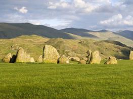
The biggest change is caused by the Carrock End Fault, a geological faultline running north–south, cutting the limestone off and marking the rise of a new rock form – the Skiddaw slates. Into this gap poured millennia of glacial ice, choking the valleys with a silty debris and sculpting their sides into still more vertiginous slopes. Mosedale takes its name from the Old Norse for valley of the bog (or moss), with good reason: the River Caldew shoots out of the ‘dale’ part of Mosedale at a considerable pace, only to get sucked into the ‘mose’ part, where the raised bogs of Bowscale and Mosedale draw it in and hold it. The result is a valley where the Caldew turns sharp left to eventually reach the Eden near Carlisle, while a few paces to the right, the River Glenderamackin flows south then west to the Greta and Derwent, finally making the sea at Workington. Of all Lakeland’s watersheds, this is possibly the most peculiar. You get several good glimpses of the mosses on this walk. Mosedale and Bowscale mosses form a distinct Site of Special Scientific Interest, harbouring a rich bogland ecology that is quite rare on a global scale.
From the parking area, walk over the old bridge and up the grassy lane beyond to return to the road. Turn right and walk into the hamlet of Mosedale, passing the Quaker Friends Meeting House to the left with its ancient burial ground on the right (by the car park). Walk through the hamlet and opposite the last buildings (Mosedale End Farm) turn right, along a walled track signposted towards Hutton Roof.
Follow the track to a gate, beyond which it continues to the River Caldew. Cross by the footbridge and ascend the rough lane opposite, eventually to emerge at a T-junction with a minor road.
Turn right and follow this for 400yds (366m) – ignoring the turning for Crook-a-Fleet – to a minor lane signposted for Low Mill. Turn right down the lane, following it as it threads between farm buildings. About 100yds (91m) beyond the turning for Low Mill Farm, as you approach a bridge across the Caldew, look for a gate into the field on the left.
Go though this and follow the river bank levee, crossing a pair of stiles before swinging away from the river slightly to reach a stile and gate. Beyond these, stay with the left-hand edge of the field to another gate and stile, after which a rough track leads to a further gate and stile out on to a track heading out across Bowscale Moss. Turn right up this rough lane to reach the hamlet of Bowscale.
At the junction with the road, turn right, following the road between the buildings and down the lane beyond, taking care as it narrows between hedges, to return to your car.
Minor roads, farm tracks and grassy paths, some muddy, 5 stiles
Open marshland valley and farmland surrounded by rough fells
A few road sections and sheep in the fields means you will have your dog on lead more often than not
OS Explorer OL5 The English Lakes (NE)
Parking area on south side of the Caldew bridge in Mosedale, or in Friends Meeting House car park (donation)
None on route
Read our tips to look after yourself and the environment when following this walk.
Cumbria's rugged yet beautiful landscape is best known for the Lake District National Park that sits within its boundaries. It’s famous for Lake Windermere, England’s largest lake, and Derwent Water, ‘Queen of the English Lakes'. This beautiful countryside once inspired William Wordsworth and his home, Dove Cottage, in Grasmere is a popular museum. Another place of literary pilgrimage is Hill Top, home of Beatrix Potter, located near Windermere. Tom Kitten, Samuel Whiskers and Jemima Puddleduck were all created here.
Much of Cumbria is often overlooked in favour of the Lake Distirct. In the south, the Lune Valley remains as lovely as it was when Turner painted it. The coast is also a secret gem. With its wide cobbled streets, spacious green and views of the Solway Firth, Silloth is a fine Victorian seaside resort. Other towns along this coastline include Whitehaven, Workington and Maryport. Carlisle is well worth a look – once a Roman camp, its red-brick cathedral dates back to the early 12th century and its 11th-century castle was built by William Rufus.
Discover more than 15,000 professionally rated places to stay, eat and visit from across the UK and Ireland.
Choose a place to stay safe in the knowledge that it has been expertly assessed by trained assessors.
Search by location or the type of place you're visiting to find your next ideal holiday experience.
Read our articles, city guides and recommended things to do for inspiration. We're here to help you explore the UK.