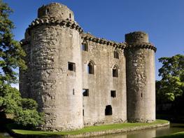


Spread Eagle Inn
Set in the beautiful grounds of Stourhead House with its Palladian temples, lakes and inspiring…

An expedition through parts of Somerset, Dorset and Wiltshire, to Stourhead and Alfred’s Tower.
Alfred's Tower
8.5 miles (13.7kms)
Patriotic English people tend to think of Arthur and of Alfred, almost interchangeably, as the first king of their land; this is odd, as they were mortal enemies. Arthur, if he existed, ruled the Britons: a small, dark, Celtic people who spoke what we now call Old Welsh. Alfred spoke Old English, and belonged to the Saxon invaders. Eventually the invaders were themselves attacked by the Vikings and so started to think of themselves as the home side.
Arthur's kingdom was Logres – which may or may not have been somewhere hereabouts. Alfred was King of Somerset and, beyond that, King of Wessex; England had yet to be invented. Somerset, however, was a civilisation worth fighting for. Alfred fortified Burrow Mump as a strongpoint against the Danes, whose longships came at him up the River Parrett. Defeated, he took refuge in the swamps of the 'Sumer Saete'. It was on the marsh island of Muchelney, south of Langport, that the demoralised and preoccupied King took shelter in the winter of AD 878 in a swine-herd's mud hut. The peasant's wife set him to watch the cakes, with disastrous results for the cookery but an eventual good outcome for Wessex… Emerging from his fen island, Alfred gathered the Saxons at Egbert's Stone. This was probably at the present-day site of Alfred's Tower, although today's 'Ecgberht's Stone' stands at the junction of Wiltshire, Somerset and Dorset. He defeated the Danes at Edington, now in Wiltshire.
Alfred reigned from AD 873 to 888. He set up burhs, fortified towns, at Axbridge, Bath (where he reused the Roman defences), Langport and Watchet. His palace was at Cheddar. Alfred was a wise king who mixed thoughtfulness with ruthlessness: government based partly on consent worked better than government by force. His laws were put to a (non-elected) parliament of his witan: churchmen, nobles and local leaders. The tower on this walk was placed in romantic commemoration of King Alfred; but its real point is as a place to turn round at the top of a scenic carriage drive from Stourhead – the turning circle for the carriages is still visible in the grass.
Today, while we decorate the hills with various money-making structures such as phone masts and television transmitters, to build a tower simply for decorative effect would as likely as not be dismissed instantly as a wicked intrusion on the landscape.
There is a small charge if you want to go up the tower, but if its a clear day, it's the only way to get above the treetops for the total, three-county view.
Go to the right through the churchyard to join a road beyond. Turn left through Bleak Farm village, bear right 'Bourton', then left into an inconspicuous sunken track. This ends at the top of a tarred lane; here turn left through a white gate, signed 'Pen Mill Hill'. The path on the right heads diagonally down a field to a kissing gate in a dip. Follow a green track past a pond to a road.
From here towards Bonham Manor is marked 'Stour Valley Way'. Cross on to a path waymarked 'Coombe Street'. Pass below Orchard Cottages, then turn up left over a stile, and right over another. Cross a stream in a dip to a stile below a thatched cottage. A woodland path bends to the right to a footbridge over the tiny River Stour.
Go up on a tarred lane and turn left briefly. Keep ahead into a hedged way for 30yds (27m) to a stile on the right. Go up and round left to another stile. Head to right up the lane beyond, to a T-junction; go across and turn left on to a bridleway track. Go through a gate to follow the left edge of a field into a hedged track to emerge opposite Bonham Manor.
Turn left, and at the second signpost bear right to a road below. Follow this to the right, now leaving the Stour Valley Way, to a rustic rock arch. A track on the left is signposted 'Alfred's Tower'.
The main track (blue arrows) heads into a wooded valley with Alfred's Tower visible ahead. At a fork take the track ahead, along the foot of the wood then into it. Finally it reaches open ground at the hilltop, with a road ahead. Turn left, in a grassy avenue, to Alfred's Tower.
Join the road ahead for 220yds (200m), down to a sunken path on the left before the wood end. In 220yds (200m) ignore a fork left, and stay on the main path until it joins a track descending to a major junction. Here bear right to a lane. Bear right again, on a tarmac road signed 'Penselwood'. This leads over a hilltop containing a Roman fort. At the road's highest point, open ground appears on the left.
Cross a stile to bend to the right down a grassy glade. At the wood foot, turn right down field-edges with stiles, the mature trees of Castle Wood still on your left. After several fields, a gate on the left would lead into the wood.
Don't go through the gate, instead turn right around the foot of the field to two gates on the left. Through these turn right over a pair of stiles then bear left down two fields to a road bend. Keep ahead to a sharp right-hand bend, where the right-hand of two gates starts a field path to Pen Selwood church.
Some tracks and some small paths and field-edges, many stiles
Tree-covered ridge
Moderate freedom on tracks and in woodland
OS Explorer 142 Shepton Mallet
Pen Selwood church; some verge parking at Bleak Farm
None on route; nearest are at Stourton
Read our tips to look after yourself and the environment when following this walk.
Somerset means ‘summer pastures’ – appropriate given that so much of this county remains rural and unspoiled. Ever popular areas to visit are the limestone and red sandstone Mendip Hills rising to over 1,000 feet, and by complete contrast, to the south and southwest, the flat landscape of the Somerset Levels. Descend to the Somerset Levels, an evocative lowland landscape that was the setting for the Battle of Sedgemoor in 1685. In the depths of winter this is a desolate place and famously prone to extensive flooding. There is also a palpable sense of the distant past among these fields and scattered communities. It is claimed that Alfred the Great retreated here after his defeat by the Danes.
Away from the flat country are the Quantocks, once the haunt of poets Samuel Taylor Coleridge and William Wordsworth. The Quantocks are noted for their gentle slopes, heather-covered moorland expanses and red deer. From the summit, the Bristol Channel is visible where it meets the Severn Estuary. So much of this hilly landscape has a timeless quality about it and large areas have hardly changed since Coleridge and Wordsworth’s day.
Discover more than 15,000 professionally rated places to stay, eat and visit from across the UK and Ireland.
Choose a place to stay safe in the knowledge that it has been expertly assessed by trained assessors.
Search by location or the type of place you're visiting to find your next ideal holiday experience.
Read our articles, city guides and recommended things to do for inspiration. We're here to help you explore the UK.