"Discover a pretty harbour and a fascinating fishing museum."
Walk directions
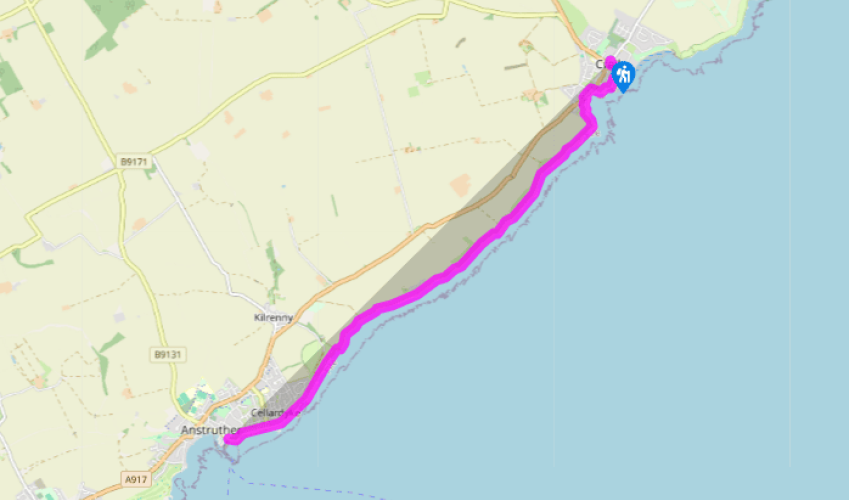
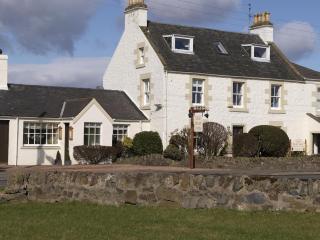
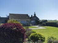
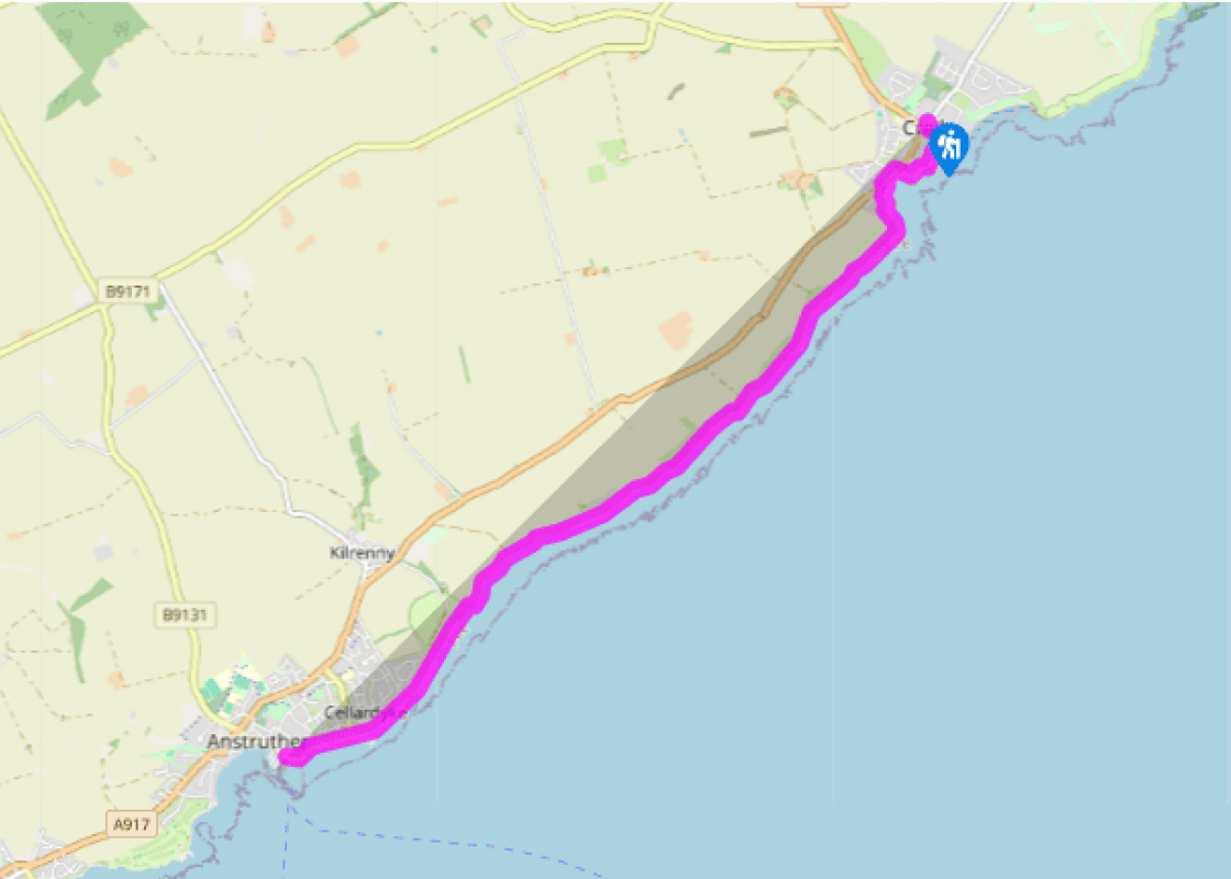
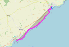
From the tourist information centre in Crail, walk down Tolbooth Wynd. At the end turn right and, where the road divides, bear left. Walk beside the old castle wall to a lookout point, which gives a grand view of the picturesque harbour. Bear right and then walk on to reach the High Street.
Turn left and walk along the road out of the village, passing the two white beacons which help guide boats into the harbour. Turn left and walk down West Braes, following signs for the Coastal Path. When you reach Osbourne Terrace turn left down a narrow path, then go down some steps, through a kissing gate and onto a grassy track by the shore.
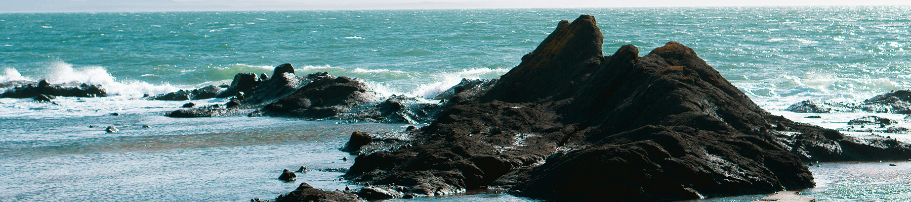
Follow the path as it hugs the shoreline. You will probably see cormorants perched on rocks to your left and will also get views of the Isle of May. Go down some steps, over a slightly boggy area, and continue walking until you reach two derelict cottages – an area known as The Pans.
Walk past the cottages and continue along the shore, then hop over a stone stile. Pass flat rocks on the left, which are covered with interesting little rock pools. Cross the burn by the footbridge – you'll now be able to see the Bass Rock and Berwick Law on your left and the village of Anstruther ahead – and soon reach a set of natural rock arches known as The Coves.
Pass these, then cross a little stone stile on the left-hand side and go over a footbridge. Your track is narrower now and takes you past fields on the right, then some maritime grasses on the left. Stone steps lead to another stile. Climb over it and cross a wooden footbridge to reach Caiplie.
Go through the kissing gate to pass in front of houses, follow the wide grassy track, then go through another kissing gate to walk past a field. The path now runs past fields and up to a caravan park.
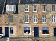
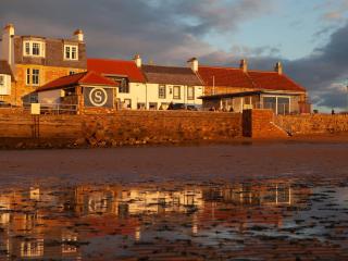
Pass through a gate and continue along the shore on a tarmac track, to reach a play area and war memorial on the right. Maintain direction now as you enter the village of Cellardyke and continue to the harbour. Pass the harbour and The Haven restaurant and continue along John Street, then James Street.
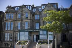
At the end of James Street maintain direction, then follow the road as it bends down to the left. Walk past a guiding beacon and reach Anstruther's busy little harbour. You can now either walk back to Crail or take the hourly bus (no. 95) which leaves from the harbour, opposite the Fisheries Museum, to return to the start.
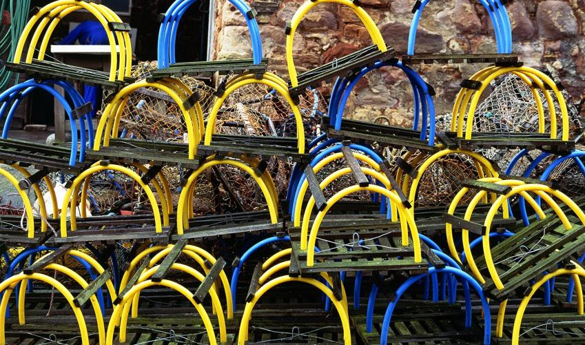
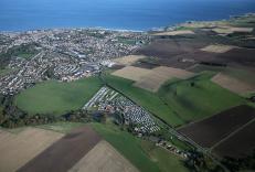
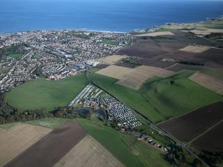
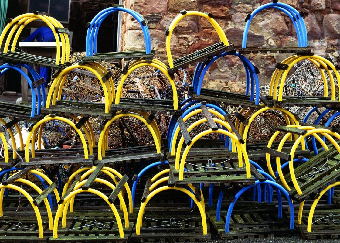
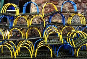
Scotland's James II described the East Neuk (pronounced 'nook') of Fife as 'a fringe of gold on a beggar's mantle'. This corner of the east coast is dotted with picturesque fishing villages, which nestle close together yet retain their own distinctive character. The artists' village Crail is... perhaps the prettiest village, with a neat little harbour which attracts many artists and photographers. It was once the largest fishmarket in Europe and, like all the East Neuk villages, used to trade with the Low Countries and Scandinavia; you can see the Dutch influence in the houses with their crow-stepped gables and pantiled roofs. Focus on fishery Further down the coast is Anstruther (known locally as 'Enster'), the largest and busiest of all the villages and home of the local lifeboat and the excellent Fisheries Museum. Fishing has always been the focus of life here. The village was the capital of the Scottish herring trade, and the harbour was once so busy that you could cross it by stepping over the boats. Look at the houses as you pass and you'll see that many of them have spacious lofts with a pulley outside – designed to store fishing gear and provide an area for mending the nets. Fishing dominated the lives of people in the past, and each of the East Neuk villages was a closely knit community. It was rare for people to marry outside their own village, and women were as heavily involved in the work as the men. They prepared the fish, baited the hooks, mended the nets and took the fish to market for sale, carrying enormous baskets of herrings on their backs. They also used to carry their husbands out to sea on their backs so that the men could board their boats without getting their feet wet. Fishing had its dangers, and many local superstitions were attached to the industry. Women weren't allowed aboard when a boat was working, and it was considered unlucky to utter the word 'minister' on a boat – he had to be referred to as 'the fellow with the white throat' or 'man in the black coat'. Other words to be avoided were 'pig', 'rat' and 'salmon'. These were known as 'curlytail', 'lang-tail' and 'red fish' (or 'silver beastie') respectively. If these words were spoken on a fishing boat the men would cry 'cauld airn' (cold iron) and grab the nearest piece of iron. It's the equivalent of touching wood and was meant to break the bad luck.
This 20-mile wide peninsula between the Firth of Forth and the Firth of Tay is an ancient kingdom, once the home of Scotland’s kings and saints. Despite its modern bridges it still seems curiously detached from the rest of the country.
"Discover a pretty harbour and a fascinating fishing museum."
Walk details
1hr 30min
Difficulty:
Easy
Gradient:
Gentle
Distance:
4 miles (6.4kms)
Ascent:
49ft (15m)
Walk directions
From the tourist information centre in Crail, walk down Tolbooth Wynd. At the end turn right and, where the road divides, bear left. Walk beside the old castle wall to a lookout point, which gives a grand view of the picturesque harbour. Bear right and then walk on to reach the High Street.
1 of 8
Turn left and walk along the road out of the village, passing the two white beacons which help guide boats into the harbour. Turn left and walk down West Braes, following signs for the Coastal Path. When you reach Osbourne Terrace turn left down a narrow path, then go down some steps, through a kissing gate and onto a grassy track by the shore.
2 of 8
Follow the path as it hugs the shoreline. You will probably see cormorants perched on rocks to your left and will also get views of the Isle of May. Go down some steps, over a slightly boggy area, and continue walking until you reach two derelict cottages – an area known as The Pans.
3 of 8
Walk past the cottages and continue along the shore, then hop over a stone stile. Pass flat rocks on the left, which are covered with interesting little rock pools. Cross the burn by the footbridge – you'll now be able to see the Bass Rock and Berwick Law on your left and the village of Anstruther ahead – and soon reach a set of natural rock arches known as The Coves.
4 of 8
Pass these, then cross a little stone stile on the left-hand side and go over a footbridge. Your track is narrower now and takes you past fields on the right, then some maritime grasses on the left. Stone steps lead to another stile. Climb over it and cross a wooden footbridge to reach Caiplie.
5 of 8
Go through the kissing gate to pass in front of houses, follow the wide grassy track, then go through another kissing gate to walk past a field. The path now runs past fields and up to a caravan park.
6 of 8
Pass through a gate and continue along the shore on a tarmac track, to reach a play area and war memorial on the right. Maintain direction now as you enter the village of Cellardyke and continue to the harbour. Pass the harbour and The Haven restaurant and continue along John Street, then James Street.
7 of 8
At the end of James Street maintain direction, then follow the road as it bends down to the left. Walk past a guiding beacon and reach Anstruther's busy little harbour. You can now either walk back to Crail or take the hourly bus (no. 95) which leaves from the harbour, opposite the Fisheries Museum, to return to the start.
Scotland's James II described the East Neuk (pronounced 'nook') of Fife as 'a fringe of gold on a beggar's mantle'. This corner of the east coast is dotted with picturesque fishing villages, which nestle close together yet retain their own distinctive character. The artists' village Crail is... perhaps the prettiest village, with a neat little harbour which attracts many artists and photographers. It was once the largest fishmarket in Europe and, like all the East Neuk villages, used to trade with the Low Countries and Scandinavia; you can see the Dutch influence in the houses with their crow-stepped gables and pantiled roofs. Focus on fishery Further down the coast is Anstruther (known locally as 'Enster'), the largest and busiest of all the villages and home of the local lifeboat and the excellent Fisheries Museum. Fishing has always been the focus of life here. The village was the capital of the Scottish herring trade, and the harbour was once so busy that you could cross it by stepping over the boats. Look at the houses as you pass and you'll see that many of them have spacious lofts with a pulley outside – designed to store fishing gear and provide an area for mending the nets. Fishing dominated the lives of people in the past, and each of the East Neuk villages was a closely knit community. It was rare for people to marry outside their own village, and women were as heavily involved in the work as the men. They prepared the fish, baited the hooks, mended the nets and took the fish to market for sale, carrying enormous baskets of herrings on their backs. They also used to carry their husbands out to sea on their backs so that the men could board their boats without getting their feet wet. Fishing had its dangers, and many local superstitions were attached to the industry. Women weren't allowed aboard when a boat was working, and it was considered unlucky to utter the word 'minister' on a boat – he had to be referred to as 'the fellow with the white throat' or 'man in the black coat'. Other words to be avoided were 'pig', 'rat' and 'salmon'. These were known as 'curlytail', 'lang-tail' and 'red fish' (or 'silver beastie') respectively. If these words were spoken on a fishing boat the men would cry 'cauld airn' (cold iron) and grab the nearest piece of iron. It's the equivalent of touching wood and was meant to break the bad luck.
This 20-mile wide peninsula between the Firth of Forth and the Firth of Tay is an ancient kingdom, once the home of Scotland’s kings and saints. Despite its modern bridges it still seems curiously detached from the rest of the country.