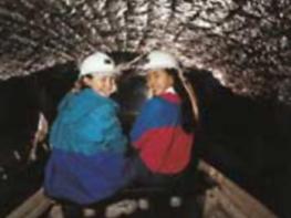

YHA Edale
An impressive, country house, YHA Edale Activity Centre is one of the highest residences in the…

Fairholmes
9.75 miles (15.7kms)
The walk begins in the Derwent Valley, beneath the great stone ramparts of the impressive Derwent Dam. Your start point, Fairholmes car park, has a history all of its own. At the south end, the crumbling foundations of Fairholmes Farm are an evocative reminder that this was once agricultural land. During the construction of the reservoirs the upper car park was a masons’ yard reverberating to the sounds of workmen cutting, shaping and dressing stone for the dams. The stone came from the Longshaw Quarry and was transported here by a specially constructed railway, which linked the LMS sidings in Bamford.
You don’t stay long in the valley – the route has higher things in mind and climbs through Lockerbrook Coppice. After emerging from the trees, the route follows the top edge of the vast Hagg Side spruce plantation before climbing to Bellhag Tor. Here you get the first view of the landslips that have occurred in the region. However, by climbing northwest along the peaty ridge of Rowlee Pasture, England’s largest landslip will be revealed beneath your feet. They call it Alport Castles and, as you stand on the edge of the cliff looking across to the Tower, you can see why. A huge gritstone tor towers above a chaotic jumble of tumbled boulders and the grassy mounds that have been separated from the main ridge. The reason for the instability lies in the shales that are squeezed between the tiers of gritstone here. In wetter times, after the last Ice Age, the river eroded these soft bands, resulting in a 0.5-mile (800m) long landslide that dropped 100ft (30m) below the main cliff.
Your route takes you on a little path down towards Alport Castles Farm. On the first Sunday of every July they hold the Woodlands Lovefeast service in the barn. These non-conformist religious ceremonies started during the reign of Charles II when Presbyterianism was against the law, and the services had to be held in remote places, far from the eyes of the King’s loyal subjects.
Past the farm you follow the valley to its meeting with the Ashop Valley. Here an old Roman road that linked forts at Melandra (at Glossop) and Navio (at Brough, near Hope) takes you across the lower grassy slopes of Kinder Scout, where a jaggers’ track is waiting to take you down to the site of a former packhorse bridge at Haggwater then over the hill towards Fairholmes.
The walk begins diagonally opposite the car park exit along a gated track signed ‘Lockerbrook’. It climbs through Hagg Side Wood to a bridge over a water leat. Fork left towards Lockerbrook Farm. On meeting a foresters’ track, go left, and after 200yds (183m), round a bend, look for a narrow path doubling back left. Climb on, eventually leaving the trees through a gate.
Continue up beside a stone wall to come out on to a rough track. Turn left past Lockerbrook Farm.
On reaching a junction at the crest by Woodcock Coppice, turn sharp right along a grass path, clambering over a stile towards Bellhag Tor.
The path crosses to open moor and becomes paved, tracing the broad spine of Rowlee Pasture. Continue beyond the flags beside a broken wall. The wall ends just short of the ‘Castles’ and the way down leaves 100yds (91m) further on, but first wander on above the cliffs to savour the sight.
Retrace your steps to the descending path, which drops to follow a boundary. The way remains clear, eventually descending to a footbridge spanning the River Alport.
On the far bank, walk 70yds (64m) upstream to a waymarker and climb to a stile. Cross a small field to a track and follow it down the valley from Alport Farm for a mile (1.6km).
Where the track curves right, watch for a sign marking a path off left to a stile. Follow this path, passing through trees to the A57. Opposite, a stony track leads to a footbridge over the River Ashop. Follow the track left, shortly joining another from Upper Ashop Farm. At a fork bear right, rising across the shoulder of Blackley Hey to cross Blackley Clough. Carry on for half a mile (800m) to a junction before a gate.
Turn left to descend beside a plantation, later passing into the trees. Some 60yds (55m) beyond a sharp right bend, look for an initially indistinct path leaving left and follow it down to Haggwater Bridge.
Climb beyond to the A57 and cross to the drive opposite. Where it bends to Hagg Farm Outdoor Centre, keep ahead through a gate on a rising track. Eventually at the top, join a track from the right. Walk on to a junction and go right to reverse your outward route back to Fairholmes.
Well-defined paths and tracks in forests and on moorland, some stiles
Afforested hillsides and peaty moorland
Much is across farmland and access agreement land; dogs should be kept on lead
OS Explorer OL1 Peak District - Dark Peak Area
Fairholmes pay car park
At car park
Read our tips to look after yourself and the environment when following this walk.
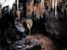
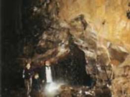
The natural features of this central English county range from the modest heights of the Peak District National Park, where Kinder Scout stands at 2,088 ft (636 m), to the depths of its remarkable underground caverns, floodlit to reveal exquisite Blue John stone. Walkers and cyclists will enjoy the High Peak Trail which extends from the Derwent Valley to the limestone plateau near Buxton, and for many, the spectacular scenery is what draws them to the area.
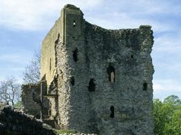
The county is well endowed with stately homes – most notably Chatsworth, the palatial home of the Duke and Duchess of Devonshire, with its outstanding collections of paintings, statuary and art. Other gems include the well preserved medieval Haddon Hall, the Elizabethan Hardwick Hall, and Kedleston Hall, whose entrance front has been described as the grandest Palladian façade in Britain.
The spa town of Matlock is the county’s administrative centre and other major towns of interest include Derby and the old coal mining town of Chesterfield, with its crooked spire. Around the villages of Derbyshire, look out for the ancient tradition of well dressing, the decorating of springs and wells – the precious sources of life-sustaining water – with pictures formed from flowers.
Discover more than 15,000 professionally rated places to stay, eat and visit from across the UK and Ireland.
Choose a place to stay safe in the knowledge that it has been expertly assessed by trained assessors.
Search by location or the type of place you're visiting to find your next ideal holiday experience.
Read our articles, city guides and recommended things to do for inspiration. We're here to help you explore the UK.