


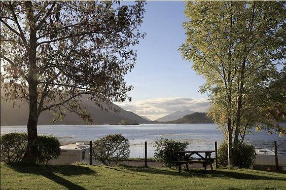
Invercoe Caravan & Camping Park
A level grass site set on the shore of Loch Leven, with excellent mountain views. The area is…

A sea loch, a mountain loch and a pipeline path above deep wooded glens.
Kinlochleven
7.5 miles (12.1kms)
Aluminium is a very common metal: around 8 per cent of the earth’s crust is made up of it. But, it’s very reactive, which means that it’s extremely difficult to extract the aluminium atoms out of the ore called bauxite. There is no chemical method for this process. Instead, it’s done by dissolving the ore in molten cryolite (a fluoride mineral) and applying vast quantities of electricity. As a result, aluminium processing doesn’t take place where you find the bauxite, but where you find the electricity, with lots of water coming down steep hillsides, and a deep-water harbour at the bottom, such as Kinlochleven.
The village of Kinlochleven was built around the smelter. Two lochs above have been dammed for hydro-electricity, and six huge pipes bring the water down from a control station above the Devil’s Staircase footpath.
A pipeline on the OS Landranger map is a dotted line, rather like a path. And it may be that the path of this walk happened by mistake, as walkers mistook the pipeline for a path, walked along it and so created the path that they thought was there in the first place.
The pipeline path leads from the outflow of Loch Eilde Mor, around the head of Loch Leven along the 1,100ft (330m) contour, giving superb views towards the Pap of Glencoe and the loch’s foot. Eventually it carries Loch Eilde’s water to the Blackwater Reservoir.
Why has the water from Loch Eilde been taken all the way round this hillside to the Blackwater Reservoir, instead of straight down to the turbines where it’s actually needed? You need to glance across the valley at the six descending pipes for the answer. At the foot of those huge reinforced pipes the water is under 30 tons per sq ft (300 tonnes/sq m) of pressure. A second such set from Loch Eilde would cost far more than the much longer, unpressurised pipe to the other reservoir.
The Kinlochmore smelter started as one of the largest in the world, but by the end of the 1900s it was the world’s smallest. It closed in 2000, although its turbines continue to generate electricity, which is now diverted to the smelter at Fort William or into the National Grid. The smelter had been the reason for Kinlochleven, and its main employer. Projects to keep Kinlochleven alive include the newly constructed path system, the visitor centre and the Atlas Brewery (now closed) on the site where carbon electrical connectors were once made.
A smooth gravel path leads up out of the car park to a T-junction where you turn left towards Grey Mare's Tail Waterfall. After the path drops to cross a footbridge, down left takes you to the foot of the impressive waterfall, and up right is for the uphill path. This soon bends up sharp left and climbs steeply through birches to more open ground.
Fork right, with a yellow-and-green waymarker, to pass under two power lines. The path runs up to a gate in a deer fence, then bends left to cross over two streams. Immediately after the second one is another junction.
Turn right, following a yellow waymarker. The path climbs beside a stream, then bends right to cross it. It passes through a deer fence gate to reach a track. A continuation path rises briefly past a stone bench on an outcrop of red-orange rhyolite, then rejoins the track. Follow the track uphill to a wide pass. Just before it, a path on the right is a short-cut back to Kinlochleven.
At the pass is a view ahead along Loch Eilde Mor, which is Gaelic for Big Loch of the Hind. Descend for 0.25 miles (400m) to a path forking off on the right. After 330yds (300m), bend right. A smaller path ahead goes only to the loch foot, while the main path leads to the right of a knoll to a dam over the Allt na h-Eilde.
Turn right onto a rough and soggy track. This follows a concrete pipeline across the hill face, high above Kinlochleven, with fine views. After 1.25 miles (2km), the path drops below the pipeline and, in another 200yds (183m), a cairn marks a steep path descending on the right.
Turn down this path. To the left you can see the Crowberry Tower on distant Buachaille Etive Mor, outlined against the sky. The path zig-zags downhill until it enters the wood, but then rises slightly to join another path. Turn right on this. Look out for a waterfall view on your right; the path crosses the stream below it on a high footbridge. When you see buildings ahead, the main path forks down left to the edge of Kinlochleven.
The track ahead has a West Highland Way marker. Shortly it becomes a street; look for the tarred path on the left where the WHW turns back to the riverside. You pass the tailrace from the former smelter and continue to the road bridge. Continue under the bridge to a riverside path. It bends right, past black garages, to an earth path upstream alongside the Allt Coire na Ba. Where the path ends, you cross the B863 into Wades Road. This leads to the car park.
Hill paths and track, a steep, rough ascent at the start and a wet path alongside the pipeline
High path with long views along Loch Leven
Off lead unless sheep nearby
OS Explorer 384 Glen Coe & Glen Etive or 392 Ben Nevis & Fort William
Grey Mare's Tail car park, Kinlochleven
Kinlochleven, at Ice Factor climbing centre
Read our tips to look after yourself and the environment when following this walk.
Apart from the Orkneys and the Shetlands, Highland is Scotland’s northernmost county. Probably its most famous feature is the mysterious and evocative Loch Ness, allegedly home to an ancient monster that has embedded itself in the world’s modern mythology, and the region’s tourist industry. Monster or no, Loch Ness is beautiful and it contains more water than all the lakes and reservoirs in England and Wales put together. The loch is 24 miles long, one mile wide and 750 feet deep, making it one of the largest bodies of fresh water in Europe.
At the very tip of the Highlands is John o’ Groats, said to be named after a Dutchman, Jan de Groot, who lived here in the early 16th century and operated a ferry service across the stormy Pentland Firth to Orkney. In fact, the real northernmost point of the British mainland is Dunnet Head, whose great cliffs rise imposingly above the Pentland Firth some two miles further north than John o’ Groats.
The Isle of Skye is the largest and best known of the Inner Hebrides. Its name is Norse, meaning ‘isle of clouds’, and the southwestern part of the island has some of the heaviest rainfall on the whole of the British coast. Despite this, it’s the most visited of all the islands of the Inner Hebrides. It’s dominated from every view by the high peaks of the Cuillins, which were only conquered towards the end of the 19th century.
Discover more than 15,000 professionally rated places to stay, eat and visit from across the UK and Ireland.
Choose a place to stay safe in the knowledge that it has been expertly assessed by trained assessors.
Search by location or the type of place you're visiting to find your next ideal holiday experience.
Read our articles, city guides and recommended things to do for inspiration. We're here to help you explore the UK.


