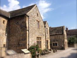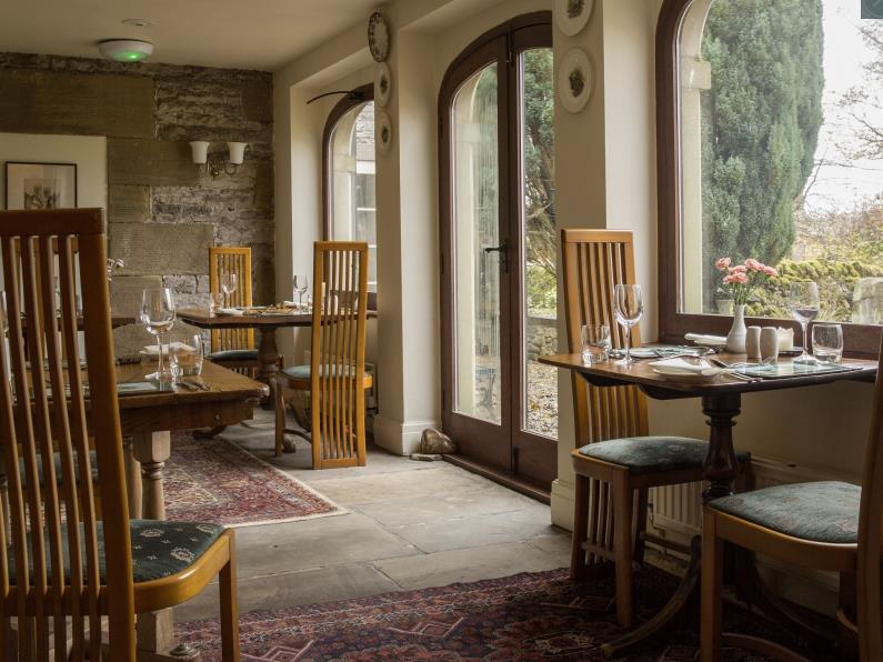
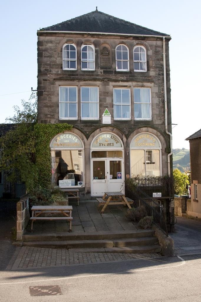
YHA Youlgreave
YHA Youlgreave is one of the gateway hostels to the Peak District National Park and is perfectly…

Limestone dales lead to The Stonehenge of the North
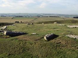
Arbor Low
6.25 miles (10.1kms)
Arbor Low is probably one of the most important prehistoric monuments in Britain. Like other mysterious stone circles, no one really knows why it was built or what function it served. Various theories suggest that it may have been a giant astronomical calculator, a religious centre, a meeting place or perhaps the earliest known supermarket.
Research has shown that by the late neolithic period, around about 2500 bc, complex trading networks had built up throughout Britain. Evolving from simple methods of exchange, their development mirrors the building of the henges. Throughout the Peak District axes have been discovered. These highly polished weapons were made from hard stone and originated from places as far away as North Wales, the Lake District and Northern Ireland.
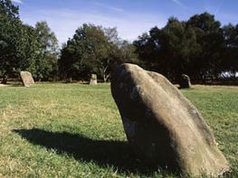
Arbor Low, built near well-established trading routes, might have been the trading centre for the distribution of goods like these. The name, a corruption of the Anglo-Saxon Eorthburg Hlaw, means simply earthwork mound. It consists of a circular earthwork bank with two entrances, an internal ditch and a raised inner platform with a circle of limestone blocks. The stones may have stood upright when Arbor Low was built, but nowadays they lie flat. The passage of time may have caused them to fall over, or, as has been speculated, they were deliberately knocked over by people who knew their true purpose and significance and were afraid of them.
At the centre of the circle are the fallen stones of what is known as the cove. This, the most sacred part of the site, was made up of seven stone slabs and may have been rectangular when they were erect. No one knows what rites and ceremonies were conducted here. Only initiates would have been allowed to enter, their actions concealed from everyone else by the strategic placing of two of the larger stone slabs. During excavations the skeleton of a man was discovered in the cove, lying on his back and surrounded by blocks of stone. This is atypical of the period – the usual form of burial from that period had the knees drawn up – but reasons for the difference are unclear.
Across the field to the west from Arbor Low lies a long barrow, with a round one built on top of it. The name Gib Hill suggests that it was once used for a gibbet (a gallow with a projecting arm at the top), probably in the Middle Ages. Recent research indicates that it may have been a site of execution further back in time. In the Dark Ages people feared places like Arbor Low. New, emerging rulers, anxious to establish their power, found that one way to do it was to organise executions in such places of local superstition.
Exit the car park on Moor Lane, turn left and then follow the road to the T-junction. Cross the road, go through the gap in the wall, through a gate, and follow the Limestone Way across a field.
Bend diagonally right and cross three fields with two stiles in quick succession. Enter Low Moor Wood through a kissing gate in a stone wall.
Follow the path at the edge of woodland. Leave via a gate and diagonally across a field towards a farm (Calling Low). Take the diverted path right of the farm via two gates, then go through a woodland surrounding a field and three more gates to return to open meadow.
Follow this path downhill then bear right and downhill through fields with gates into the Lathkill Dale National Nature Reserve. Head downhill on a polished limestone path and steps. Cross a path to Lathkill Dale in the valley bottom. Rise up a short, steep slope then fork left towards One Ash Grange Farm.
This heads under a crag then up polished limestone steps, passing an adit on your left at the top of the steps. Keep rising on the path and through a gate into farmyard fields. Enter the farmstead via some stone steps and continue gently uphill on a stone track following yellow-topped Limestone Way markers to the right past the camping barn and to a track junction beyond a large barn.
Turn left on a concessionary path (not the earlier footpath), here following the farm track out past Cales Farm. At a junction of paths shortly beyond the farm bear diagonally right across fields and under a power line to the main road. Turn right and continue for 0.4 miles (600m), then turn left on to the drive for Upper Oldhams Farm, following the signs for Arbor Low.
Go through the farmyard following the signs. There is a small fee for using the path. Leave it in the honesty box at the farm entrance. Go through a gate, turn left along a path, then cross another stile to reach the henge. Retrace your steps to the main road, turn right, and walk about 2.5 miles (4km) back to the car park.
Mostly well-defined paths, some road walking; limestone steps in Cales Dale can be very slippery when wet; a few stiles
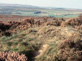
Limestone dales and woodland
Keep on lead on farmland, access land, country lane
OS Explorer OL24 Peak District – White Peak Area
Moor Lane car park
None on route
Read our tips to look after yourself and the environment when following this walk.
The natural features of this central English county range from the modest heights of the Peak District National Park, where Kinder Scout stands at 2,088 ft (636 m), to the depths of its remarkable underground caverns, floodlit to reveal exquisite Blue John stone. Walkers and cyclists will enjoy the High Peak Trail which extends from the Derwent Valley to the limestone plateau near Buxton, and for many, the spectacular scenery is what draws them to the area.
The county is well endowed with stately homes – most notably Chatsworth, the palatial home of the Duke and Duchess of Devonshire, with its outstanding collections of paintings, statuary and art. Other gems include the well preserved medieval Haddon Hall, the Elizabethan Hardwick Hall, and Kedleston Hall, whose entrance front has been described as the grandest Palladian façade in Britain.
The spa town of Matlock is the county’s administrative centre and other major towns of interest include Derby and the old coal mining town of Chesterfield, with its crooked spire. Around the villages of Derbyshire, look out for the ancient tradition of well dressing, the decorating of springs and wells – the precious sources of life-sustaining water – with pictures formed from flowers.
Discover more than 15,000 professionally rated places to stay, eat and visit from across the UK and Ireland.
Choose a place to stay safe in the knowledge that it has been expertly assessed by trained assessors.
Search by location or the type of place you're visiting to find your next ideal holiday experience.
Read our articles, city guides and recommended things to do for inspiration. We're here to help you explore the UK.