


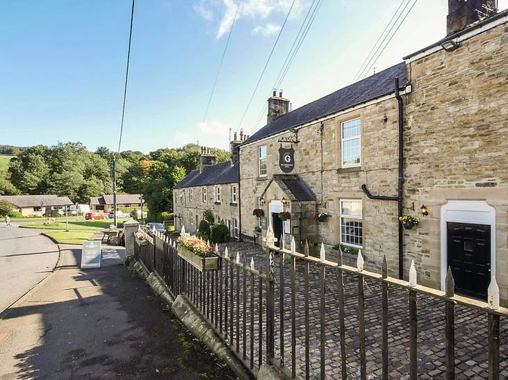


The Old Farmhouse & Grindon Cartshed
Converted with the utmost consideration, the 18th-century Grindon Farmhouse looks straight down…

Allendale Town
3.75 miles (6kms)
If you were dropped into East Allendale you could be forgiven for thinking you were in the northern part of the Yorkshire Dales. Like that area it’s rugged rather than beautiful, but it’s also peaceful and serene. Appropriately, Allen comes from the Celtic word aln, which means 'shining' or 'foaming'. The main centre, Allendale Town, is set on a hillside overlooking a bend in East Allen River and sheltered beneath the heather moors of Hexhamshire Common. It proclaims itself to be the true geographical centre of Britain, and co-ordinates inscribed onto the church tower’s sundial reinforce this.
On entering the large market square with its many large hotels and inns, it soon becomes obvious that this place has seen busier times. This was once a mining town, the region’s most prosperous, with good veins of lead and silver. In the halcyon days of the 18th century Allendale had a population of over 5,500 – four times what it is today. Allendale Town was lively, for the miners were hard-working men who filled every one of the inns. Even with the death of mining at the turn of the century, it stayed busy, with coaches bringing people from the industrial northeast for health and enjoyment.
Perhaps Allendale is most famous for its Baal Fire Festival, which takes place each New Year’s Eve. It’s said to be of Viking origin. At 11.30pm the pubs empty and a crowd gathers in the square. Suddenly the night sky is lit up by flaming tar barrels carried on the heads of a procession of 40 men dressed in fancy costumes. Known as guisers, they parade around the town streets accompanied by the Allendale Silver Band. Close to midnight the guisers hurl the burning contents of the barrels onto a bonfire, whose flames then explode high into the sky. The church bells chime in the New Year and Auld Lang Syne is sung before everybody returns to the pub for more celebrations.
There are many long walks from Allendale Town to the moors, but a good introduction explores the immediate environs of the valley itself. Passing the old inns you go down to the river, which is lined by fine stands of trees. In spring and early summer the fields and woods are full of wild flowers like bloody cranesbill, wild primrose, herb Robert and ragwort.
Later the walk climbs away, to high fields and old farms looking down on the rooftops of Allendale Town. The river, in some places hidden by trees, but in others shining among the valley meadows, meanders into the distance to those dark North Pennine moors that yawn across the western skies.
Leave the Market Place past the Allendale Inn and walk along the Whitfield road down to Mill Bridge.
Immediately beyond the bridge, turn left along a lane signed towards Wooley Scar. Where it swings right to a final cottage, walk through the gate ahead and follow the edge of a couple of fields above the river.
Cross a ladder stile at the far side and climb beside trees. Continue above a steep bank to enter a field. Keep by the left side, swinging within the corner to reach a ladder stile. Bear half right to a stile where fence and wall meet, and keep the same line to a gate in the distant boundary.
Stay by the right fence into the next field. Ignore a stile on the right and continue beside the scant hedge. Approaching trees, bear left to a waypost by a dead tree.
Through the boundary swing left, dropping below an old hedge to a gate in the bottom corner. A grass track leads down to a cottage. Bear off right before it, joining a stepped path into the valley. Over a bridge spanning Steel Burn, keep ahead into rough meadow. At the far side, disregard a bridge over the river and continue through successive pastures, passing right of a derelict farmhouse and eventually reaching a second river bridge below Hagg Wood.
Cross and climb a steep, winding track to the B6295 beside Studdondene. Go left to a sharp bend and bridge over Parkgates Burn.
Walk ahead over the lay-by into trees and immediately fork left (just before a duckboard) up to a stile. Cross to a second stile and bear left upfield to Low Scotch Hall on the skyline. Mount a ladder stile below the house and immediately turn right. Past the house, go left over a stile. Cross another and follow the fence across the hillside. Continue over two more fields towards the woods on Prospect Hill.
Climb a ladder stile, and up beside the wood. Entering another field, swing left past the farm. Keep ahead over a stile in the corner and accompany the left wall beside two more fields to a crossing track.
Beyond the track, bear right across another field, passing through a gate gap and on to a stile in the far left corner. Head half right downhill towards houses at the bottom, crossing an intervening wall stile. Go through a squeeze gap and walk out between the houses onto a street. Follow the walkway opposite back into town.
Good river paths and less distinct field paths, 21 stiles
Riverside and high pasture
Farming country, keep dogs on leads
AA Walker's Map 29 Hadrian's Wall
Ample parking in village centre
In village centre
Read our tips to look after yourself and the environment when following this walk.
If it’s history you’re after, there’s heaps of it in Northumberland. On Hadrian’s Wall you can imagine scarlet-cloaked Roman legionaries keeping watch for painted Pictish warriors while cursing the English weather and dreaming of home. Desolate battlefield sites and hulking fortresses such as Alnwick, Dunstanburgh, Bamburgh and Warkworth are reminders that this, until not so very long ago, was a contested border region. The ruins of Lindisfarne bear witness to the region’s early Christian history.
Northumberland also has some of Britain’s best beaches. On summer days, and even in winter, you’ll see surfers and other brave souls making the most of the coast. Inland, there are some great walks and bike rides in the dales of the Cheviot Hills and the Simonsides – just hilly enough to be interesting, without being brutally steep. There's dramatic scenery in the High Pennines, where waterfalls plunge into deep valleys, and there are swathes of heather-scented moorland. Northumberland National Park covers over 400 square miles of moorland and valleys with clear streams and pretty, stone-built villages. It’s just the place for wildlife watching too. You’ll find flocks of puffins, guillemots and other seabirds around the Farne Islands, and seals and dolphins offshore.
Discover more than 15,000 professionally rated places to stay, eat and visit from across the UK and Ireland.
Choose a place to stay safe in the knowledge that it has been expertly assessed by trained assessors.
Search by location or the type of place you're visiting to find your next ideal holiday experience.
Read our articles, city guides and recommended things to do for inspiration. We're here to help you explore the UK.


