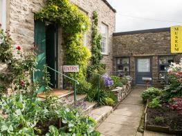


Arklehurst
In the tiny Yorkshire Dales village of Langthwaite, in Arkengarthdale, Arklehurst is a…

Arkengarthdale
10 miles (16.1kms)
The quiet villages of Arkle Town and Langthwaite are grey clusters of houses in the austere splendour of Arkengarthdale. One of the most northerly of the valleys in the Dales, it runs northwards from Swaledale into dark moorland, with the battle-scarred Stainmore beyond its head. This isolation and stillness is deceptive, however, for until the beginning of the 20th century the surrounding hills were mined for lead. The metal was first dug here in prehistoric times, but industrial mining of the great veins of lead really began in the 17th century. By 1628 there was a smelt mill beside the Slei Gill, which you will pass on the walk, and it is possible to pick out the evidence of some of the early miners' methods.
Booze (Norse for 'the house on the curved hillside') is now just a cluster of farm buildings, but was once a thriving mining community with more than 40 houses. Between Booze and Slei Gill you will pass the arched entrance to a level (a miners' tunnel) and behind it the remains of Tanner Rake Hush. This desolate valley is full of tumbled rock, left behind when the dammed stream at the top of the valley was allowed to rush down, exposing the lead veins. You'll pass the spoil heaps of Windegg Mines, before returning to the valley near Scar House, now a shooting lodge owned by the Duke of Norfolk but once belonging to the mine master.
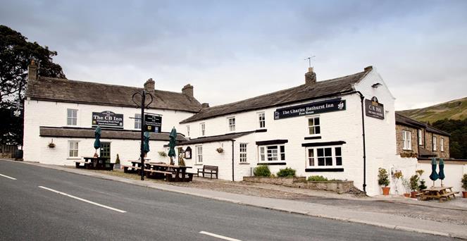
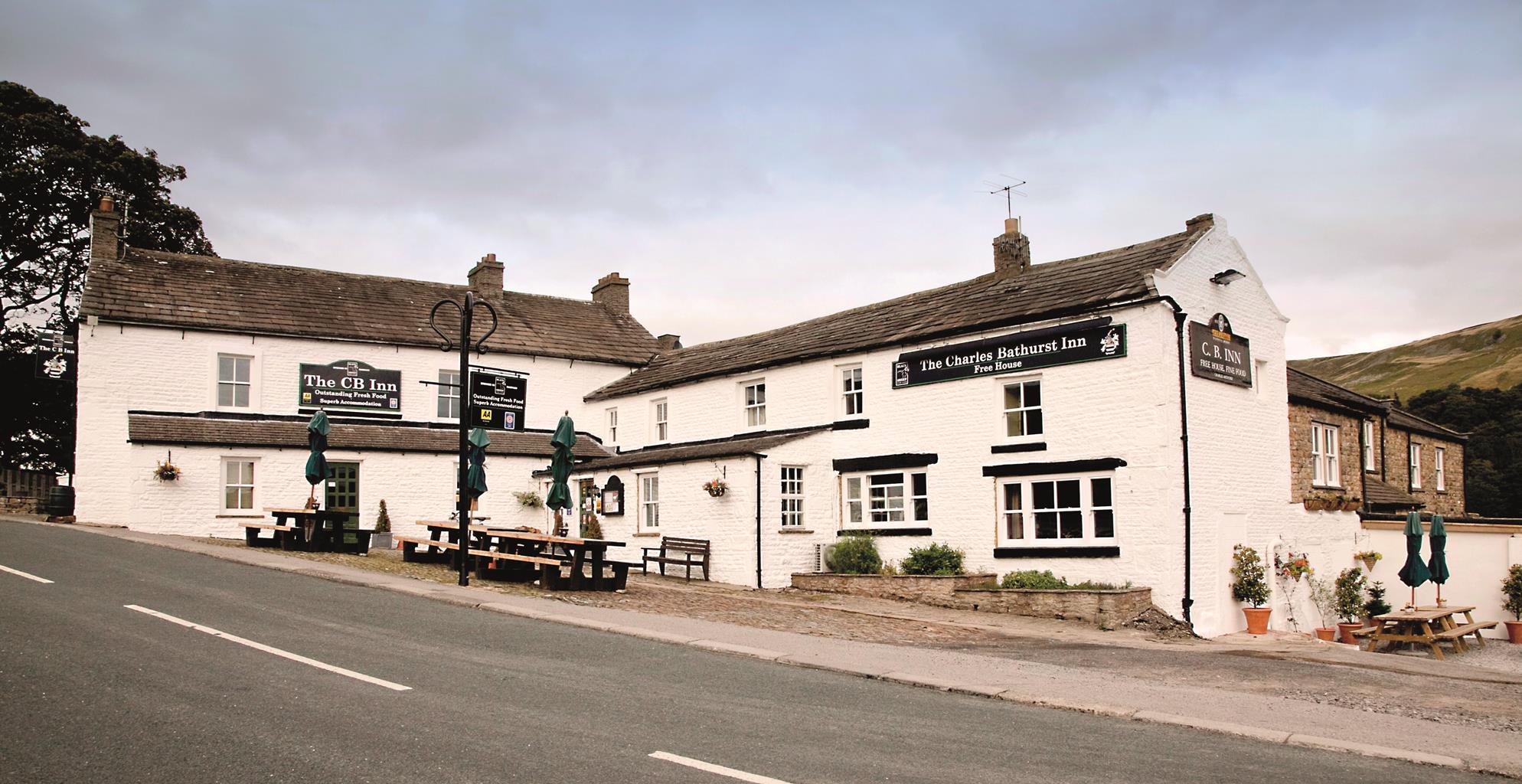
Near Eskeleth Bridge is the powder house, a small octagonal building, set safely by itself in a field. Built about 1804, it served the Octagon Smelt Mill, the remains of which can be traced near by. Just after you turn right along the road are the ruins of Langthwaite Smelt Mill. Lord of the Manor Charles Bathurst held the mining rights here for much of the 18th century. The CB Inn near the road junction is really the Charles Bathurst, in his honour.
Mining the west of the valley was more difficult than on the eastern side. This was an area known in the 19th century as the Hungry Hushes – the lead mined here was scarce and hard-won. The miners' tracks ascend the hill and eventually pass the junction of two long chimney flues.
The walk then returns via Turf Moor into Langthwaite – it needs a feat of the imagination to visualise its heyday, with a tight-knit community of hardened miners and their families.
Leave the car park, turn right, then right over the bridge into Langthwaite. Climb the narrow lane between cottages. The lane becomes a track. Ignore two left forks and continue to the hamlet of Booze. Go straight through the yard of Town Farm and follow a rutted track up and left to a gate.
Continue ahead on a green track slanting down through spoil heaps and past ruined Sleigill House to the stream. Walk up the valley, go through a gate and cross the stream near a limekiln.
Climb the steep bank, go through new tree-plantings and follow green paths through the heather. Pass a wooden hut and turn left on a broad track. Follow the main track through a slight but long valley, then bearing left over the moor and down to a T-junction with a wall just below. Where this falls back, go down right to a gate in the corner.
Follow the small gully downhill and past waymarks to a level track. Turn right and follow the track, traversing the hillside until it bends sharp left to meet a stony track. Turn left to a house then bear right, through the garden and down a slanting green track, eventually entering woodland.
Emerge alongside Scar House. Follow the drive downhill and over a bridge. Bear right on a walled track, then turn right through gateposts and walk to a road. Turn left, uphill, to a T-junction. Turn right and follow the road for 0.5 miles (800m). Opposite a barn, turn left on an obvious track.
Turn right at the far side of a gravelled area, cross a grassy area and slant uphill towards a prominent flat-topped spoil heap. Just before this, the track bends sharp left then winds uphill to reach a T-junction near the crest. Turn left and follow the clear track, along the ridge then bearing right down to a road.
Turn left. Pass above a farm (Bouldershaw), then turn right at a bridleway sign. Turn left just before the farmyard and go straight down a green track. At The Ghyll, join its access track but as it bends right bear left and down to a stile in the bottom right corner of the field. Go down to the road. Turn left back to the car park.
Mostly clear tracks, some heather moor, 4 stiles
Mining-scarred moorland, with evocative remains of industry
Off lead for much of walk, except where sheep are present
OS Explorer OL30 Yorkshire Dales - Northern & Central Areas
Pay-and-display car park at south end of Langthwaite village
None on route
Read our tips to look after yourself and the environment when following this walk.
North Yorkshire, with its two National Parks and two designated Areas of Outstanding Natural Beauty, is England’s largest county and one of the most rural. This is prime walking country, from the heather-clad heights of the North York Moors to the limestone country that is so typical of the Yorkshire Dales – a place of contrasts and discoveries, of history and legend.
The coastline offers its own treasures, from the fishing villages of Staithes and Robin Hood Bay to Scarborough, one time Regency spa and Victorian bathing resort. In the 1890s, the quaint but bustling town of Whitby provided inspiration for Bram Stoker, who set much of his novel, Dracula, in the town. Wizarding enthusiasts head to the village of Goathland, which is the setting for the Hogwarts Express stop at Hogsmeade station in the Harry Potter films.
York is a city of immense historical significance. It was capital of the British province under the Romans in AD 71, a Viking settlement in the 10th century, and in the Middle Ages its prosperity depended on the wool trade. Its city walls date from the 14th century and are among the finest in Europe. However, the gothic Minster, built between 1220 and 1470, is York’s crowning glory.
Discover more than 15,000 professionally rated places to stay, eat and visit from across the UK and Ireland.
Choose a place to stay safe in the knowledge that it has been expertly assessed by trained assessors.
Search by location or the type of place you're visiting to find your next ideal holiday experience.
Read our articles, city guides and recommended things to do for inspiration. We're here to help you explore the UK.