
Hopton Hall
Self-catering holiday cottages on the edge of the Peak District National Park that sleep between…

Across limestone pastures in the footsteps of lead miners.
Carsington Reservoir
6.3 miles (10.1kms)
‘He was as lean as a Skeleton, pale as a dead corpse, his hair and beard a deep black, his flesh lank, and, as we thought, something of the colour of lead itself.’ So wrote Daniel Defoe on seeing a lead miner, who had been living in a cave at Harboro Rocks. In times past Carsington and Brassington lived and breathed lead. Prior to the construction of Carsington Water archaeologists discovered a Romano-British settlement here, which could have been the longlost Ludutarum, the centre of the lead-mining industry in Roman times. As you walk out of Carsington into the world of the miner, you’re using the very tracks he would have used. But the lesions and pockmarks of the endless excavations are being slowly healed by time, and many wild flowers are beginning to proliferate in the meadows and on hillsides.
Weird-shaped limestone crags top the hill, then Brassington appears in the next valley with its Norman church tower rising above the grey rooftops of its 17th- and 18th-century houses. Brassington’s former post office used to be the tollhouse for the Loughborough turnpike. St James Church is largely Norman, though it was heavily restored in the late 19th century, including the north aisle, which was added in 1880. High on the inner walls of the Norman tower is a figure of a man with his hand on his heart. The carving is believed to be Saxon: the man, Brassington’s oldest resident.
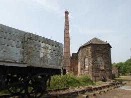
Climbing out of Brassington the route takes you over Hipley Hill, where there are more remnants of the mines, and more limestone outcrops. On the top you could have caught the train back, but the Cromford High Peak Railway closed in 1967, so you are left with a walk along its trackbed. It’s a pleasant walk though, through a wooded cutting, with meadow cranesbill and herb Robert thriving among trackside verges and crags. Harboro Rocks beckon from the left. Archaeologists have uncovered evidence that sabre-toothed tigers, black bears and hyenas once sought the shelter of nearby caves. They also discovered relics and artefacts from Roman and Iron Age dwellers.
For those with extra time, there’s an path winding between the popular climbing crags to the summit, which gives wide views across the White Peak and the lowlands of the East Midlands. There are perfect views of Carsington Water and its surrounds. Leaving the railway behind, there’s one last hill, Carsington Pasture, to descend before returning to the lake.
Take the ‘Carsington Water Circular Route’ path northwards. Passing two bird hide paths, it winds through scrub woods and rounds a finger of the lake before crossing the B5035 road. Continue up the far side, meeting a lane by Wash Farm then entering the village by The Miners Arms.
Head left through the village to a sharp bend left. Now go straight ahead along a narrow lane passing several cottages. Beyond a gate the lane becomes a fine green track beneath the limestone-studded slopes of Carsington Pasture.
The track swings left to a gate below some wind turbines; immediately beyond the gate take the narrower right fork off the main path. This climbs up grassy slopes with numerous other tracks criss-crossing the high rough pasture. Towards a small copse, go past a redundant stone squeeze stile, pass right of the copse and through a former gateway in a tumbledown wall. Now descend a green track into a little valley, crossing one more field to a green lane.
Cross over this, following a miners’ track up to some old workings. As the track bends sharp right, fork left on to a narrower track with Brassington soon in view ahead. Cross a stile then follow a wall on your left to the next stile. Turn left, then part-way down the next field, fork diagonally right across fields to a track at the edge of the village.
At Smithy Barn turn left on to Dragon Hill, then immediately right up a road to the Miners Arms pub. Turn right on to a side road directly opposite the pub, then sharp left up Red Lion Hill. Turn left again at the T-junction, continuing above the church. Opposite Browntop, fork right on to a footpath which climbs diagonally past more mining holes and spoil heaps.
Cross the head of a green lane then take the right of two trackless footpaths (Limestone Way). The path crosses under a line of wooden electricity pylons. In the third field, bear half-right above the small rock outcrops – the way is vague here. Now aim for the extensive buildings of Longcliffe Dale Farm, turning left at the road. Past the farm, a footpath on the right then cuts a corner to the High Peak Trail. This passes an electricity substation and a stables, bending right at the stables’ gates and down a short grassy track to the High Peak Trail.
Turn right along the trackbed of the High Peak Trail, passing Harboro Rocks.
Drawing level with two groups of wind turbines, turn right and across a small field on a footpath to Carsington. Cross a road, then follow the wall across Carsington Pasture. Approaching woodland, descend steeply to a gate by a cottage.
Turn left down a little stepped alley, which broadens to become Mining Lane. Fork left as it joins the road back to The Miners Arms. Now retrace your earlier route back to Sheepwash car park.
Hilly field paths, some hard to follow, and railway trackbed, many stiles
Limestone hills
Dogs on lead over farmland, under close control everywhere else; avoid long stretchy leads on High Peak Trail to avoid tripping other users
OS Explorer OL24 Peak District – White Peak Area
Sheepwash pay car park by Carsington Reservoir
None on route
Read our tips to look after yourself and the environment when following this walk.
The natural features of this central English county range from the modest heights of the Peak District National Park, where Kinder Scout stands at 2,088 ft (636 m), to the depths of its remarkable underground caverns, floodlit to reveal exquisite Blue John stone. Walkers and cyclists will enjoy the High Peak Trail which extends from the Derwent Valley to the limestone plateau near Buxton, and for many, the spectacular scenery is what draws them to the area.
The county is well endowed with stately homes – most notably Chatsworth, the palatial home of the Duke and Duchess of Devonshire, with its outstanding collections of paintings, statuary and art. Other gems include the well preserved medieval Haddon Hall, the Elizabethan Hardwick Hall, and Kedleston Hall, whose entrance front has been described as the grandest Palladian façade in Britain.
The spa town of Matlock is the county’s administrative centre and other major towns of interest include Derby and the old coal mining town of Chesterfield, with its crooked spire. Around the villages of Derbyshire, look out for the ancient tradition of well dressing, the decorating of springs and wells – the precious sources of life-sustaining water – with pictures formed from flowers.
Discover more than 15,000 professionally rated places to stay, eat and visit from across the UK and Ireland.
Choose a place to stay safe in the knowledge that it has been expertly assessed by trained assessors.
Search by location or the type of place you're visiting to find your next ideal holiday experience.
Read our articles, city guides and recommended things to do for inspiration. We're here to help you explore the UK.