

Ty Hotel, Milford Haven Waterfront
Launched in partnership with the Port of Milford Haven and Milford Waterfront, Ty Hotel is…

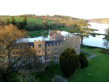
The waters of Milford Haven and the coastline that forms its entrance.
Milford Haven
9 miles (14.5kms)
The narrow finger of land that juts out between Freshwater West and Angle Bay forms the eastern wall of the mouth of Milford Haven. On the northern edge of the peninsula, the waters are passive, lapping against a coastline that’s gentle and sloping, but as you round the headland, a radical transformation takes place. Here, the cliffs stand tall and proud, defiantly resisting the full brunt of the considerable Atlantic swells. There are other differences too. While the views along the seaward coast are wild and unspoilt, the inner shores of the Haven reveal the smoking oil refinery chimneys that dominate the eastern skyline.
The narrow-necked shape of the peninsula lends itself to a challenging circular walk that shows both sides of the coin. The outward leg, as far as the sweeping sands of Freshwater West, is about as tough as coast path walking gets; constantly dipping and climbing on narrow, often quite exposed, paths. The return leg is a little more civilised, tracking easily around the curve of Angle Bay and following field edges back out on to the headland.
Milford Haven is the name of both a huge natural inlet, once described by Admiral Nelson as ‘the finest port in Christendom’, and the small town that nestles on its northern shores. Despite the obvious advantages of the sheltered waterways, the Haven saw only limited development until the 20th century. Although there is evidence of earlier settlements and shipping activity, the town, as it is now, and original dock, sprang up in the late 1700s to house a small whaling community that had fled from Nantucket, Massachusetts, during the American War of Independence. Despite interest from the military, which saw the potential for shipbuilding, lack of funding at the time prohibited serious expansion. Various enterprising ideas followed over the ensuing years, but by the end of the 19th century, the whaling had all but declined and the Navy had moved to nearby Pembroke Dock.
Large-scale fishing in the rich waters of the Pembrokeshire coast threw the port a lifeline in the early 1900s and then, as this too declined, mainly due to over-fishing and the related smaller catches, energy production took over as the area’s main industry. There were once three refineries and a power station at the head of the Haven. One of the refineries has now closed and the original oil-fired power station was also closed after public pressure against its plan to burn a controversial fuel type. A LNG (Liquified Natural Gas) and Pembroke B, a gas-fired power station were both opened in the early years of the 21st century and both are currently the largest such facilities of their type, in Europe.
Facing the sea, walk left out of the car park and pass between the Wavecrest café and the toilets to a waymarked gate. Follow the field edge, passing through further gates, and eventually leading out on to the coast, where a right fork drops to a ruined tower on a slender headland.
Continue back up from this, pass through further gates and then go down to a little footbridge. Climb up from this and pass Sheep Island on your right.
Continue along the coast, dropping steeply into a succession of valleys and climbing back up each time. As you reach the northern end of Freshwater West, keep your eye open for a footpath waymarker to the left.
Cross a stile and walk up the floor of the valley, swinging left to a stile at the top. Cross the next field, to a kissing gate and another field to a stile. Cross this and turn left on to the road and walk past a cluster of houses to a right-hand turn. Follow this all the way down to the coast and turn left on to the coast path to merge on to a drive.
Take the drive to a bridleway sign on the right. If the tide is low, you can cross the estuary here and continue along the bank of pebbles to the road on the other side. If it’s not, carry on along the drive to join a road that leads into Angle village and turn right by the church to follow a gravel track over a bridge and around to the right.
Continue around, pass the Old Point House Inn on your left and follow field edges to the gravel turning point above the lifeboat station on your right. Keep straight ahead and continue through a succession of fields into a wooded area.
You’ll join a broad track that runs around Chapel Bay cottages and fort. Keep straight ahead to follow the narrow path back above the coast. This eventually rounds the headland by Thorn Island.
As you descend into West Angle Bay, the path diverts briefly into a field to avoid a landslide. Continue downwards and bear right on to a drive that drops you back to the car park.
Coast path and easy tracks over agricultural land, short road section, many stiles
Rugged coastline, magnificent beach and sheltered harbour
Care needed on cliff tops and near livestock
OS Explorer OL36 South Pembrokeshire
Car park at West Angle Bay
West Angle Bay
Read our tips to look after yourself and the environment when following this walk.
Wales meets the Atlantic Ocean in spectacular fashion at Pembrokeshire. Unlike the West Country, Pembrokeshire can offer the coast without the crowds, and quaint fishing villages without those huge coach parks. Volcanic eruptions and earth movements have left a tortured rocky coastline of some 160 miles, whose beauty and drama have been recognised by National Park status.
Sometimes known as ‘Little England Beyond Wales’, the county has held a fascination for English visitors ever since the first Norman warlords forced their way in 800 years ago, leaving a string of 50 fine castles in their wake. The anonymous author of The Mabinogion, an 11th-century collection of Welsh folk legends, started it all. His description of the old Celtic kingdom of Dyfed (which encompasses Cardiganshire, Carmarthenshire and Pembrokeshire) as ‘the land of magic and enchantment’ was perhaps the earliest written attempt to sum up the outstanding natural beauty of this wonderful westernmost outpost of Wales. This is a county where you can take it easy on the sandy beaches, make sport out of those Atlantic waves, or discover the mysteries of St David’s or the ancient Preseli Hills.
Discover more than 15,000 professionally rated places to stay, eat and visit from across the UK and Ireland.
Choose a place to stay safe in the knowledge that it has been expertly assessed by trained assessors.
Search by location or the type of place you're visiting to find your next ideal holiday experience.
Read our articles, city guides and recommended things to do for inspiration. We're here to help you explore the UK.


