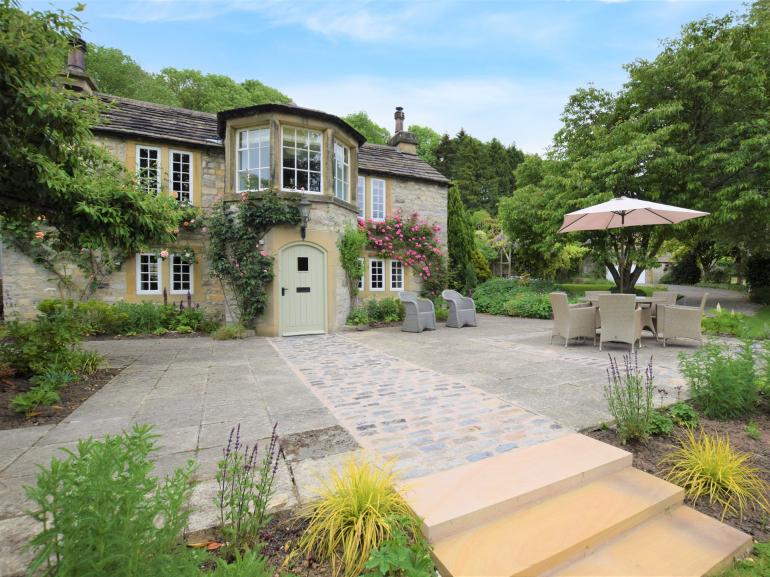
Rookery Cottage
This Grade II, 18th-century cottage is situated in the grounds of The Rookery, with its own…

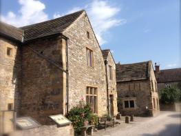
The well-preserved remains of Magpie Mine are testimony to centuries of underground toil and sacrifice.
Sheldon
9.5 miles (15.3kms)
The rocks and minerals of the Peak District have always been in demand, none more so than lead. For centuries men have toiled below the surface to extract the highly valued metal, so vital for roofing and other building uses, and in its heyday (the early 1700s) as many as 10,000 miners were busy on the ore fields of the Peak District. Although profits were certainly made, many business ventures ended in failure, and abandoned shafts, redundant chimneys and grassed-over spoil tips litter the White Peak landscape. The best surviving mining remains are to be found just outside the village of Sheldon, near Bakewell.
Magpie Mine was first worked in 1740, then more or less continuously for the next 200 years, and although now silent the buildings and even some of the machinery have been carefully preserved by the Peak District Mines Historical Society. The site, a scheduled ancient monument, shows the various stages of development, from the earliest stone buildings through to the dark, corrugated iron sheds and steel headgear that date from the last unsuccessful attempt to revive the mine in the 1950s. Magpie Mine is free to look around, but do beware sudden drops and don’t touch any of the old machinery. At weekends there’s often someone from the adjacent field centre on hand to answer questions or provide information.
Mining was not just a difficult business, it was also dangerous. There was a constant threat from rock falls and poisonous gases, as well as disputes between different miners. The hardest battle, though, was with water and the never-ending attempts to pump it out of the mines so that the ore could be worked. Ever more larger and powerful devices were used, including a huge Cornish pumping engine housed in the stone building that dominates the centre of the site. Next to it is a round Cornish chimney, unlike the squarer versions more typical of Derbyshire. Finally, in the late 1800s, a 1.25-mile (2km) underground drainage channel, known as a sough, was dug all the way to the Wye Valley near Ashford in the Water in a last-ditch attempt to rid the mine of water.
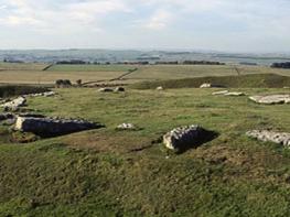
This long and varied walk also takes in a stretch of glorious woodland above the River Wye, plus the nature reserve of Deep Dale (not to be confused with the dale of the same name near Chelmorton). In May its slopes are overrun with up to a million cowslips, as well as other wild flowers like salad burnet, tormentil and mountain pansy.
Walk down Sheldon’s main street and out of the village. Just after Lower Farm go left for the higher of two footpaths that keeps up above the woods in the dale ahead. With the trees on your left, walk diagonally right down the slope towards Ashford in the Water. At the very bottom go hard left and through a gate.
Follow the popular riverside path, which ignores the meanders and soon hugs the bottom of Little and Great Shacklow woods. Beyond a path junction begin to climb. Eventually go through a gate at the far end and down a path out of the woods to reach a junction of tracks.
Turn left at the waymarker for Deep Dale and Monyash. Swing left into Deep Dale and follow the obvious path up the valley bottom. Towards the top go through a gate and continue in the same direction, with the wall now on your left. Go ahead at a path junction and at the very top pass through a gate for a farm track up to the road.
Turn right for 100yds (91m), then left at a signpost. Follow the path across a series of fields, swinging round to a westerly direction and aiming for the village of Flagg. Go over a lane and continue in the same direction through more fields. In the far left corner of the last one turn right onto a road, then left into Flagg.
Follow the road through the village, turning left on to Mycock Lane. At the second bend go straight on along the drive of Knotlow Farm. The signposted public footpath goes to the right of the farm, via camping fields, and then on to reach a path junction by an isolated barn. Go right, then left, for a walled track. Turn left just beyond Cross Lane Farm on a walled path that leads into Monyash.
Turn right along the road for the village centre, cafe and pub; otherwise go left and very soon right for the road to Sheldon. After 650yds (594m) turn left on a public footpath across fields in a northeasterly direction. Go through a belt of trees to reach a road. Turn right and, ignoring the Sheldon lane, go left just afterwards, at the bottom of a dip. Follow the path as it slants diagonally right up to Magpie Mine, which is now coming into sight.
Leave the site of the old mine by a stile on its northern boundary, then cross two fields on the well-walked path towards the rooftops of Sheldon. Go over the end of a green lane and ahead and through two more fields for a path that emerges at the top of the village.
Field paths and firm moorland tracks; many stiles
Open fields, woodland and narrow limestone dale
Lead required around livestock and in nature reserve
OS Explorer OL24 White Peak
Considerately in Sheldon village centre
None on route; nearest at White Lodge and Ashford in the Water
<p>Be careful of sudden drops and old machinery at mining site</p>
Read our tips to look after yourself and the environment when following this walk.
The natural features of this central English county range from the modest heights of the Peak District National Park, where Kinder Scout stands at 2,088 ft (636 m), to the depths of its remarkable underground caverns, floodlit to reveal exquisite Blue John stone. Walkers and cyclists will enjoy the High Peak Trail which extends from the Derwent Valley to the limestone plateau near Buxton, and for many, the spectacular scenery is what draws them to the area.
The county is well endowed with stately homes – most notably Chatsworth, the palatial home of the Duke and Duchess of Devonshire, with its outstanding collections of paintings, statuary and art. Other gems include the well preserved medieval Haddon Hall, the Elizabethan Hardwick Hall, and Kedleston Hall, whose entrance front has been described as the grandest Palladian façade in Britain.
The spa town of Matlock is the county’s administrative centre and other major towns of interest include Derby and the old coal mining town of Chesterfield, with its crooked spire. Around the villages of Derbyshire, look out for the ancient tradition of well dressing, the decorating of springs and wells – the precious sources of life-sustaining water – with pictures formed from flowers.
Discover more than 15,000 professionally rated places to stay, eat and visit from across the UK and Ireland.
Choose a place to stay safe in the knowledge that it has been expertly assessed by trained assessors.
Search by location or the type of place you're visiting to find your next ideal holiday experience.
Read our articles, city guides and recommended things to do for inspiration. We're here to help you explore the UK.