


Island View House
Island View House is a cosy, newly renovated 5 bedroom cottage that sleeps up to 10. WiFi, crisp…

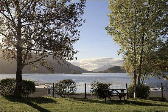
Two valley passes through the high mountains at the head of Glen Coe.
Glen Coe
8 miles (12.9kms)
This walk uses two through-routes on either side of Buachaille Etive Beag, the 'Small Herdsman of Etive'. The Gaelic word 'Lairig' means a valley pass through the mountains. We follow Lairig Gartain for the outward part of the journey, and Lairig Eilde for the return, with a final link along the old Glencoe road.
This land is owned by the National Trust for Scotland, and there hasn't been any deer stalking for 65 years. If you are really lucky, you might hear the mountain walls echoing with the roaring of the stags as you walk through Lairig Eilde ('Pass of the Deer'). It's an unforgettable sound – rather like a lion, but a little like a cow too.
For most of the year the hinds gather in small family groups with their calves of the last two years, while the stags go around in loose gangs. Deer dislike midges, so in summer they'll be on the high tops, though they may come down at night or in bad weather. In winter they'll be in the valley bottom or even at the roadside. The calves are born in early June; they are dappled to camouflage them on the forest floor, which is their natural home. Within a few days they're running with the herd. The grace and speed of a week-old deer calf across a peat bog is the envy of any hillwalker.
The hinds have no antlers. The stags lose theirs in early summer and grow new ones ready for the rut: the September mating season. Large, many branched antlers do not make a stag a better fighter, and are a serious drain on his system. They have probably evolved as display items, for intimidating other males and attracting females. A mighty roar may gain the stag the harem of a dozen hinds that he's after. If not, a quick clash of antlers will usually settle the matter. These displays are a way of determining which stag would have won without putting either to the risk of injury. However, the stag is sometimes prepared to fight for his wives and such fights can end in the death of one or even both males.
Red deer owe their widespread survival in Scotland to the men who preserved and nurtured them in order to hunt them every autumn. For ancient aristocrats and newly rich Victorian manufacturers, the sport of sneaking up on a stag with a rifle was exciting, virile and also impressively expensive. With no predators, deer must still be culled by shooting, even on NTS land where no sport stalking takes place. Such culling will be done at dawn, before walkers start disturbing the hill.
A signpost to Glen Etive, at the edge of the car park, marks the start of the path into Lairig Gartain. The path is clear and well built. It heads up-valley with the River Coupall down on the left. Gradually it draws closer to the river, but does not cross it. A large cairn marks the top of the path, which is slightly to the right of the lowest point of the pass.
The descending path is steeper, first down boggy grass, then stony and eroded to the right of the stream. After 0.5 miles (800m) the main path bears off right, and slants down the right-hand wall of the valley. Eventually it emerges on to the steep south ridge of Stob Dubh.
Here a path runs down to a gate in a deer fence just below, but there's no need to go any further downhill. Follow a path above the deer fence, descending to cross the Allt Lairig Eilde. (If the stream is too full to cross, you can head up to the right of the stream, hoping to find a safer crossing after about 0.25 miles (400m), where the stream runs more level either below or above a medium-sized waterfall.) Having crossed the stream, follow the fence up to pass its corner. Turn right up a wide path that rises out of Glen Etive.
The path ascends to the left of the stream, passing several waterfalls. eventually it crosses the stream, now very much smaller, then continues straight ahead, crossing the col well to the right of its lowest point. A large cairn marks the top of the path.
The new, descending stream is also, confusingly, the Allt Lairig Eilde. The path crosses it by a wide, shallow ford and goes down its left bank. (But if the previous stream was tricky, you should now stay to the right of this stream, rejoining the path where it recrosses.) After 1.25 miles (2km), the path recrosses, using large boulders as stepping-stones. It runs down to join the A82 near the cairn that marks the entry into Glen Coe.
Cross the road, and the river beyond, to join the old Glencoe road at an arched culvert. Turn right along the firm track, which soon rejoins the new road, then cross diagonally, on to a damp path. This runs briefly to the right of the new road, then recrosses. It soon rejoins the A82 opposite the beginning of the walk.
Rough, unmade paths, some boggy bits
Remote high valleys into heart of hills
Good, some streams to cross
OS Explorer 384 Glen Coe & Glen Etive
Large parking area on south side of A82
Glencoe NTS Visitor Centre
<p>Fords in Lairig Eilde can be impassable or dangerous after heavy rain</p>
Read our tips to look after yourself and the environment when following this walk.
Apart from the Orkneys and the Shetlands, Highland is Scotland’s northernmost county. Probably its most famous feature is the mysterious and evocative Loch Ness, allegedly home to an ancient monster that has embedded itself in the world’s modern mythology, and the region’s tourist industry. Monster or no, Loch Ness is beautiful and it contains more water than all the lakes and reservoirs in England and Wales put together. The loch is 24 miles long, one mile wide and 750 feet deep, making it one of the largest bodies of fresh water in Europe.
At the very tip of the Highlands is John o’ Groats, said to be named after a Dutchman, Jan de Groot, who lived here in the early 16th century and operated a ferry service across the stormy Pentland Firth to Orkney. In fact, the real northernmost point of the British mainland is Dunnet Head, whose great cliffs rise imposingly above the Pentland Firth some two miles further north than John o’ Groats.
The Isle of Skye is the largest and best known of the Inner Hebrides. Its name is Norse, meaning ‘isle of clouds’, and the southwestern part of the island has some of the heaviest rainfall on the whole of the British coast. Despite this, it’s the most visited of all the islands of the Inner Hebrides. It’s dominated from every view by the high peaks of the Cuillins, which were only conquered towards the end of the 19th century.
Discover more than 15,000 professionally rated places to stay, eat and visit from across the UK and Ireland.
Choose a place to stay safe in the knowledge that it has been expertly assessed by trained assessors.
Search by location or the type of place you're visiting to find your next ideal holiday experience.
Read our articles, city guides and recommended things to do for inspiration. We're here to help you explore the UK.