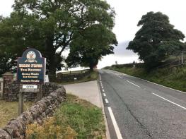


Troutsdale Farm
Surrounded by stunning Peak District countryside, Troutsdale Farm has two beautiful eco-barn…

Reservoir biodiversity provides drinking water for the Potteries and a valuable habitat for wildlife.
Tittesworth Reservoir
4.5 miles (7.2kms)
Tittesworth Water and dam were built in 1858 to collect water from the River Churnet and provide a reliable water supply to Leek’s thriving textile and cloth-dying industry. By 1963 work to increase its size had been completed, and local farmland was flooded to create a reservoir capable of supplying drinking water to Stoke-on-Trent and the surrounding areas. With a capacity of 6.5 billion gallons (29.5 billion litres), when full it can supply 10 million gallons (45.5 million litres) of water every day.
The land around the reservoir provides a habitat for a wide variety of wildlife, and many creatures can be seen in the course of this walk. Look out for brown hares in the fields near the car park. You can tell them from rabbits by their very long legs, black-tipped ears and a triangular black and light brown tail. Otters were once hunted almost to extinction by dogs, and although the sport is now illegal their numbers remain low, but look out for the tell-tale prints of their webbed feet and wavy line of tail prints in the sand and soft mud. Look also for holes in the banks along the River Churnet, where otters enter the reservoir. Although it’s a difficult little creature to spot, a hole may just be the entrance to a vole burrow and home to a water vole like Ratty from The Wind in the Willows.
Europe’s smallest bat, the pipistrelle, suffered a severe decline in numbers in the last decades of the 20th century due to loss of hunting habitats like hedges, ponds and grassland. Pond restoration near Churnet Bay is encouraging their return and they can best be seen here near dusk, flying at an incredible speed as they dive to gobble caddisflies, moths and gnats. Bird life around the reservoir is also abundant and there are two bird hides for visitors’ use. Look out for skylarks, small birds with a high-pitched continuous warble, that nest in the meadows around Tittesworth. The song thrush, another bird that has been in decline, also finds a home here, as does the linnet. Look for the male of the species in spring and summer when it has a bright blood-red breast and forehead. At various times of the year you might spot barnacle geese, great crested grebes, pied flycatchers, spectacular kingfishers, cormorants and even a rare osprey that has visited here.
Facing the entrance to the Visitor Centre cross the car park to your left and follow a path signed ‘Waymarked Walks’. Bend left at an early junction then pass the main car park and a play area. Ignore side paths on a twisty section to pass an engineered ‘log jam’ then cross two bridges. Fork right from the main trail to take the ‘Water’s edge path’. Ignore all side turns along this, bending left at a small headland and past some woodland. Now bend left into the woods and fork right at a track junction to rejoin the ‘Long Trail’ (unsigned).
Follow the Long Trail through the wood, crossing two small bridges. As the path leaves the wood fork right on to a grassy track, again signed ‘Water’s edge path’.
Continue along the bank of the reservoir, then re-enter the woodland and cross some duckboards. Cross a bridge by a picnic table, ascend some steps and turn right to rejoin the wide main track once more. Skirt the edge of a wood, keeping a fence on your left, then go downhill through a wood and along the reservoir bank before rising back into thin woodland.
Pass a 3km waymarker on a slight rise in the track, then cross a bridge. Rise steeply uphill on a graded track (replacing older steps), staying on the main path as a path joins from a field. Go downhill towards the dam wall on a graded path (again passing older steps) and take the footway across the dam wall. Climb up steps beside a woodland conservation area, then turn right on to a track, which soon bends left to a junction.
Bend right here, staying on the ‘long trail’. This keeps just right of fields, bending right and briefly downhill into undulating woodland and passing a 5km waymarker. Cross some metal-grilled boardwalks either side of a bridge, then head up over a small knoll of mixed woodland. This is followed by steps either side of a boardwalk bridge.
As you exit woodland you gain a pleasant view over Hen Cloud and The Roaches ahead. Stay on the stone path beside a wildflower meadow. Join the end of a tarmac road past the watersports centre, then cross over a junction by a metal barrier and open bird hide. The wide gravel path ahead leads past the Butterfly Beach, then out to the main road. Turn right along the grass verge then right on to a tarmac path running alongside the Visitor Centre driveway to return to the start.
Good well-made footpaths, forest tracks and roads
Reservoir and woodland
On lead at all times and under control
OS Explorer OL24 Peak District – White Peak Area
Tittesworth Water Visitor Centre (pay car park)
At Tittesworth Water Visitor Centre
Read our tips to look after yourself and the environment when following this walk.
It was Staffordshire that bore the brunt of the largest non-nuclear explosion of World War II, when a munitions dump at RAF Fauld went up in 1944. It was also the county’s regiment that once boasted within its ranks the most decorated NCO of World War I, in the person of William Coltman (1891-1974). Going back a little further, George Handel penned his world-famous masterpiece The Messiah on Staffordshire soil. During another chapter of Staffordshire history, the county was home to the first canals and the first factory in Britain, and it had front-row seats for the drama surrounding one of the most notorious murder trials of the 19th century, that of Doctor William Palmer.
In outline, Staffordshire looks not unlike the profile of a man giving Leicestershire a big kiss. The man’s forehead is arguably the best region for hillwalking, as it comprises a significant chunk of the Peak District. This area is characterised by lofty moors, deep dales and tremendous views of both. Further south are the six sprawling towns that make up Stoke-on-Trent, which historically have had such an impact on Staffordshire’s fortunes, not to mention its culture and countryside. This is pottery country, formerly at the forefront of the Industrial Revolution and the driving force behind a network of canals that still criss-cross the county.
Discover more than 15,000 professionally rated places to stay, eat and visit from across the UK and Ireland.
Choose a place to stay safe in the knowledge that it has been expertly assessed by trained assessors.
Search by location or the type of place you're visiting to find your next ideal holiday experience.
Read our articles, city guides and recommended things to do for inspiration. We're here to help you explore the UK.