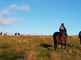


Swainby Country Park
A quiet and very peaceful site, Swainby Country Park is situated in the beautiful surroundings…

Swainby
6 miles (9.7kms)
The charming and peaceful village street of Swainby, divided by its treelined stream, gives few hints of its dramatic past. It owes its existence to tragedy, the coming of plague – the Black Death – in the 14th century, when the inhabitants of the original village, just up the hill at Whorlton, deserted their homes and moved here. There may already have been a few houses here as Swainby means ‘the village of the land workers’, and is recorded in the 13th century. In the 19th century Swainby was shocked out of its peaceful, rural existence by the opening of the ironstone mines in Scugdale. The village took on many of the aspects of an American frontier town.
As well as ironstone, jet was mined in the Swainby area in the 19th century, including on Whorl Hill, which you will walk around. Most of the jet pits were small, employing no more than a dozen men, but they could be very profitable, especially during the boom time for jet, encouraged by the example of Queen Victoria’s black mourning jewellery. Like coal, jet is fossilised wood. It comes in two types, hard and soft; hard jet was probably formed in sea water and soft jet in fresh water. It has been prized for more than 3,000 years, and was known to the Celts as Freya’s Tears. Because it is easy to work and takes a fine polish, jet workshops could turn out large quantities of jewellery relatively quickly. Although some jet objects are still made, especially in Whitby, the industry had virtually died out by the 1920s.
The path from Whorl Hill takes us into the deserted village of Whorlton. Little survived its abandonment after the Black Death except the church and the castle, both now partially ruined. On any but a sunny day, Holy Cross Church can be a disturbing place, with its avenue of yew trees leading to the arches of the nave, now open to the skies. The chancel is roofed, and a flap in the doorway allows you to look inside to see a fine early 14th century oak figure of a knight. It is probably Nicholas, Lord Maynell, who fought with Edward I in Wales and hunted in the woods here. The gatehouse of Maynell’s castle, just along the road, is the only substantial part left. It was built at the end of the 14th century, and was besieged 250 years later during the Civil War.
With the church on your left, walk down the village street to the right of the stream. Continue walking past a sign that says ‘Unsuitable for Buses and Coaches’ and go straight ahead uphill. As the road bends to the right, bear left up the track that lies ahead.
Go through a gate and turn left to join the waymarkers for the Cleveland Way. Walk through the woodland, turning left just after a seat, down to a gate. The footpath goes downhill to another gate into woodland. Turn left at the sign and cross the stream on the footbridge to reach a lane, with another footbridge, over Scugdale Beck.
Follow the lane past Hollin Hill Farm to a T-junction with a post box. Cross the lane and go through a Cleveland Way-signed gate. Walk up the path beside woodland to a gate (there’s a view of the valley from this ridge).
The path beyond bends and at a junction of paths, bear right to a gate and goes onto a paved track, climbing steeply in the wood. Go straight ahead at a crossing track to another gate, and continue to follow the paved path through a gate up to the heather moorland. After the first summit the path descends beyond a large and a small cairn into a dip. Where the paved path ends, take a narrow path off to the left, down through the heather.
After about 100yds (91m) you will reach a concrete post. Bear left and follow the narrow path down a ridge between gullies, descending to a signpost. Go straight on, eventually going over a spoil heap to reach a gate on your right.
Through the gate, go straight down the hill through woodland. At the bottom go ahead to cross a stile by a gate and go down the track. Just after the first house on the left, take a footpath over two stiles.
Walk up through the woodland onto a track. Turn left, and left again at another path, which soon becomes a track. At a T-junction, turn left again and follow the track downhill to a pair of kissing gates. Go straight ahead along the track, signed ‘Whorlton’.
Go through a metal handgate and follow the track along the hillside. After a kissing gate with steps beyond, turn left at the bottom and follow the field edge. Bear right to go over a stile by a gate and beside a paddock to another gateway onto a metalled lane. Turn right. Follow the lane past Whorlton Church and the castle back to Swainby village.
Tracks and moorland paths, lots of bracken, 4 stiles
Farmland and moorland, with some woodland
On short lead on moorland
OS Explorer OL26 North York Moors, Western Area
Roadside parking in Swainby village
In Swainby village
Read our tips to look after yourself and the environment when following this walk.
North Yorkshire, with its two National Parks and two designated Areas of Outstanding Natural Beauty, is England’s largest county and one of the most rural. This is prime walking country, from the heather-clad heights of the North York Moors to the limestone country that is so typical of the Yorkshire Dales – a place of contrasts and discoveries, of history and legend.
The coastline offers its own treasures, from the fishing villages of Staithes and Robin Hood Bay to Scarborough, one time Regency spa and Victorian bathing resort. In the 1890s, the quaint but bustling town of Whitby provided inspiration for Bram Stoker, who set much of his novel, Dracula, in the town. Wizarding enthusiasts head to the village of Goathland, which is the setting for the Hogwarts Express stop at Hogsmeade station in the Harry Potter films.
York is a city of immense historical significance. It was capital of the British province under the Romans in AD 71, a Viking settlement in the 10th century, and in the Middle Ages its prosperity depended on the wool trade. Its city walls date from the 14th century and are among the finest in Europe. However, the gothic Minster, built between 1220 and 1470, is York’s crowning glory.
Discover more than 15,000 professionally rated places to stay, eat and visit from across the UK and Ireland.
Choose a place to stay safe in the knowledge that it has been expertly assessed by trained assessors.
Search by location or the type of place you're visiting to find your next ideal holiday experience.
Read our articles, city guides and recommended things to do for inspiration. We're here to help you explore the UK.