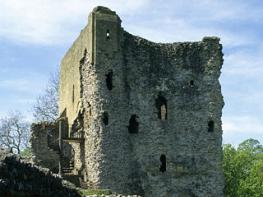
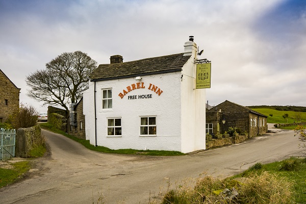

George's Cottage
Awaiting description.

Ladybower Reservoir
5 miles (8kms)
In the northeast corner of Derbyshire, the heather ridges and gritstone tors of Derwent Edge make one last stand before declining to the plains of Yorkshire. It’s always been a sparsely populated corner of the country with few references in the history books. Before World War II, Ashopton, which lay at the confluence of the rivers Derwent and Ashop, was a huddle of stonebuilt cottages, a small inn and a blacksmith’s shop. A little lane ambled from Ashopton northwards to its neighbouring village, Derwent, which enjoyed an even quieter location in the Upper Derwent Valley. But the building of a huge reservoir, the third in the region, shattered the locals’ lives. After the completion of its dam in 1943, Ladybower Reservoir gradually filled up, and by 1946 the water level had risen above the rooftops. The forced abandonment of a small north Derbyshire community to quench the thirst of the growing urban masses of the East Midlands may seem harsh today; but paradoxically the flooded, tree-lined valleys of the Upper Derwent are now considered one of the major beauty spots in the Peak District National Park.
Before you set off, gaze out at the huge concrete viaduct over the reservoir. Wherever you look there is water. Taking a shaded winding track up the next hill, the cottages you see here are all that remain of the village of Ashopton. Soon you’re through the woods and heading across open moor to the weathered gritstone tors that top the ridge. The rocks of Whinstone Lee Tor are set into a thick carpet of heather. Though the highest hills in the region lie to the north, this is one of the best viewpoints, as the ridge is at its narrowest here. In the west, Kinder Scout’s expansive flat top peeps over Crook Hill’s rocky crest.
After passing the Hurkling Stones, the route descends towards the lakeshore in search of Derwent village. The old gateposts of Derwent Hall still survive by the roadside. A notice board shows the position of the hall itself, along with the post office, school, church and some of the old cottages. After a dry spell the water level can sometimes fall sufficiently for you to see the crumbling walls of the village. One small bridge is almost intact, but the villagers dismantled the main twin-arched packhorse bridge for rebuilding beyond the reach of the rising water at Slippery Stones, higher up the valley. Leaving the old village behind you return by the shores of the reservoir. Nature has readjusted. The landscape, though more regimented now, is still beautiful; kestrels still scour the hillside for prey, and dippers frequent the streams as they always have done.
Cross the road to a service drive that swings right uphill past Ashopton’s remaining cottages before becoming an unsurfaced track.
At the top of the track, in a wide turning area, turn sharp left through a small gate. Climb on through trees, keeping left at a fork beside a wall. Passing through a gate, the track emerges from the forest below Lead Hill, where the Ladybower Reservoir comes into view.
Soon climbing again through bracken, the path initially remains beside the wall before later turning up towards the corner of a fence and wall. Swing right again up a stony path on to the ridge. At a junction of paths at the top go second left, uphill and along Derwent Edge.
The path gently gains height past the boulders of Whinstone Lee Tor and the Hurkling Stones. Broaching a slight crest, the view opens past the Wheel Stones to distant Back Tor. At a cross-path a little further on, go left, signed to Derwent. On reaching a crossing bridleway by a wall, go right and then left through a gate.
Carry on downhill to a pine plantation, passing through gates, then ford a stream flowing in Grindle Clough. After winding between a cluster of restored barns, the path, now paved, descends to join the track running along the east bank of Ladybower Reservoir.
When the water is low, it’s worth a detour (400yds (336m) along the track to the right, at the foot of Mill Brook Clough) to see the fascinating remains of Derwent village. Retrace your steps and continue along the well-graded track, by the shores of the reservoir. After rounding Grainfoot Clough the track passes beneath woodlands with Whinstone Lee Tor crowning the hilltop. The track meets the outward route at a gate above the Ashopton viaduct, opposite the lay-by on the A57 above the reservoir.
Well-defined moorland paths and a reservoir road, no stiles
High gritstone moorland
Keep on lead on access agreement land, can run free by reservoir shores
OS Explorer OL1 Peak District - Dark Peak Area
Marked lay-by east of Ashopton Viaduct (A57)
Upper Derwent visitor centre at Fairholmes car park
Read our tips to look after yourself and the environment when following this walk.
The natural features of this central English county range from the modest heights of the Peak District National Park, where Kinder Scout stands at 2,088 ft (636 m), to the depths of its remarkable underground caverns, floodlit to reveal exquisite Blue John stone. Walkers and cyclists will enjoy the High Peak Trail which extends from the Derwent Valley to the limestone plateau near Buxton, and for many, the spectacular scenery is what draws them to the area.
The county is well endowed with stately homes – most notably Chatsworth, the palatial home of the Duke and Duchess of Devonshire, with its outstanding collections of paintings, statuary and art. Other gems include the well preserved medieval Haddon Hall, the Elizabethan Hardwick Hall, and Kedleston Hall, whose entrance front has been described as the grandest Palladian façade in Britain.
The spa town of Matlock is the county’s administrative centre and other major towns of interest include Derby and the old coal mining town of Chesterfield, with its crooked spire. Around the villages of Derbyshire, look out for the ancient tradition of well dressing, the decorating of springs and wells – the precious sources of life-sustaining water – with pictures formed from flowers.
Discover more than 15,000 professionally rated places to stay, eat and visit from across the UK and Ireland.
Choose a place to stay safe in the knowledge that it has been expertly assessed by trained assessors.
Search by location or the type of place you're visiting to find your next ideal holiday experience.
Read our articles, city guides and recommended things to do for inspiration. We're here to help you explore the UK.