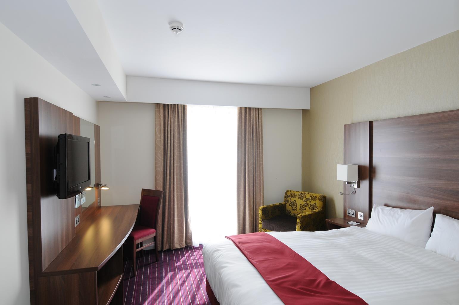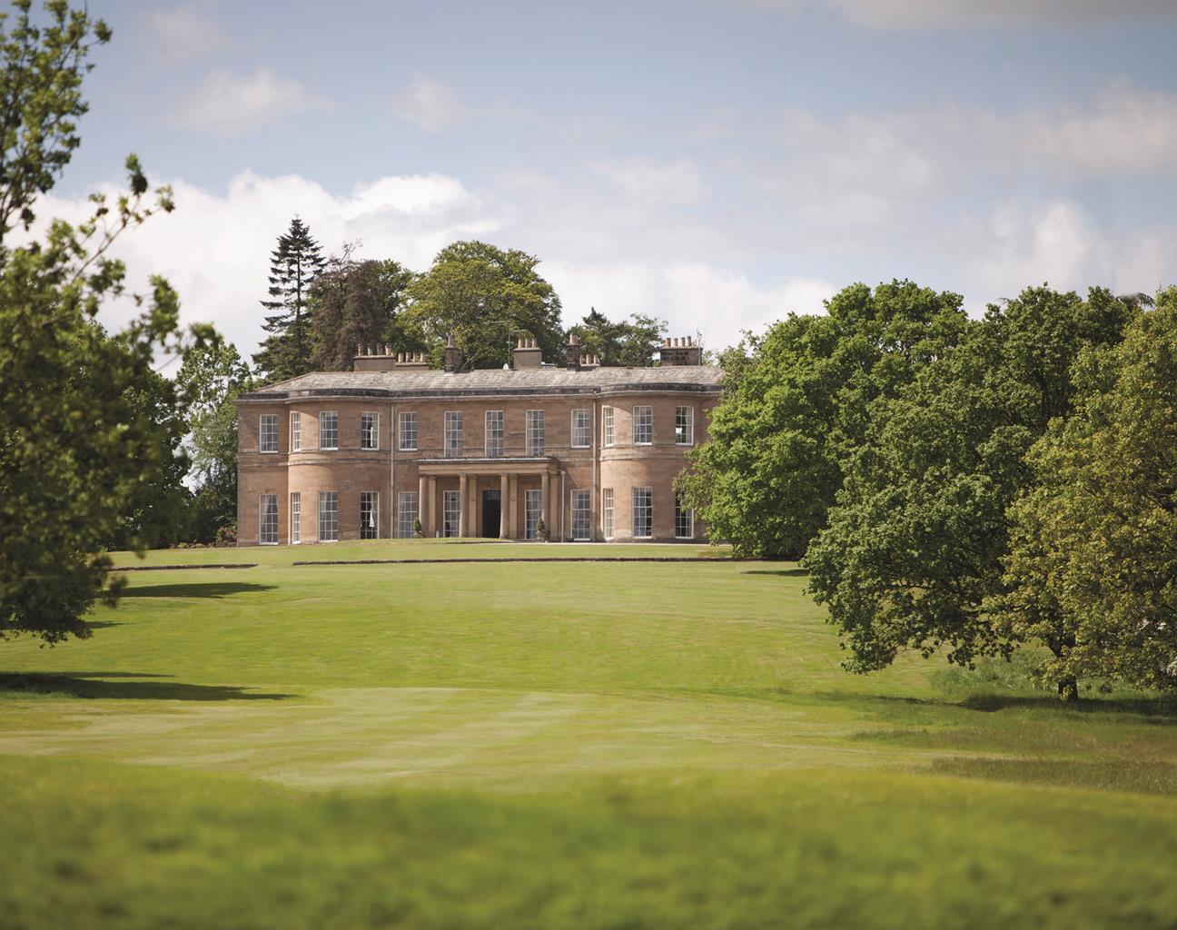
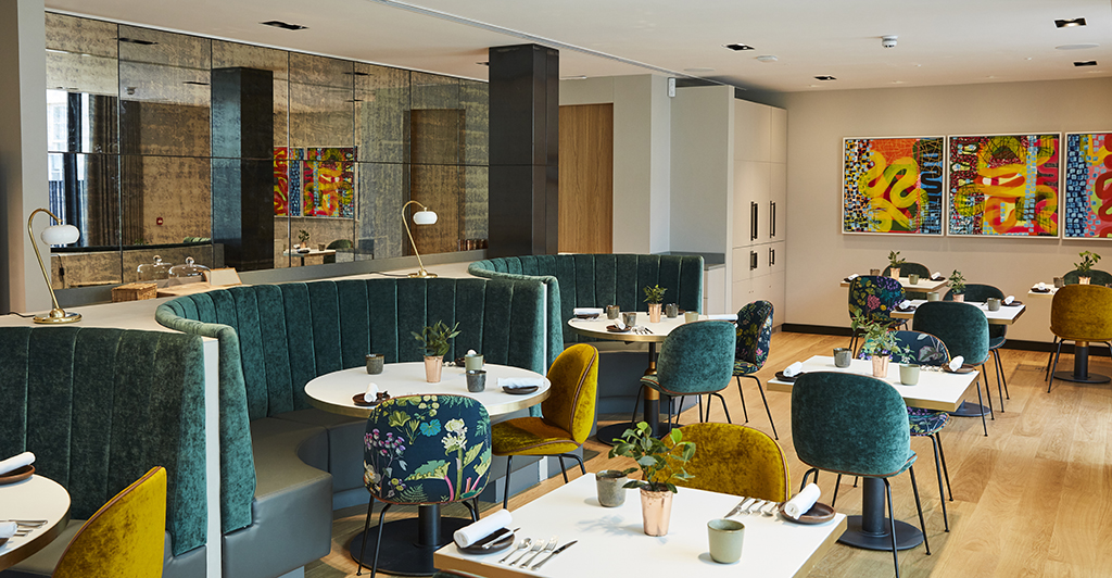


Wood Hall Hotel & Spa
A long sweeping drive leads to Wood Hall Hotel, a delightful Georgian house situated in 100…

A rolling landscape with echoes of a Roman past.
Bardsey
3 miles (4.8kms)
The Romans built a network of important roads across Yorkshire. They provided good transport links between their most important forts, such as Ilkley (probably their Olicana), Tadcaster (Calcaria) and York (Eboracum). And one of these roads, marked on old maps as Ryknield Street, passed close to the village of Bardsey, continuing west to a small Roman camp established at Adel. You walk a short stretch of the old Roman road when you take the track from Hetchell Wood, a local nature reserve.
Adjacent to these woods – and marked on the Ordnance Survey map as Pompocali – are a set of intriguing earthworks. Though rather overgrown, they still have the power to stir the imagination, not least because they are unencumbered by signs and information panels. A number of Roman finds have been unearthed here, including a quern for grinding corn and a stone altar dedicated to the god Apollo. And a couple of miles away (3.2km), at Dalton Parlours, the site of a large Roman villa has been discovered.
Once the Romans had abandoned this northern outpost of their empire, Bardsey became part of the kingdom of Elmet, and was later mentioned in the Domesday Book. By the 13th century, the village had been given to the monks of Kirkstall Abbey. After the Dissolution of Monasteries, in 1539, Bardsey came under the control of powerful local families – notably the Lords Bingley. The Parish Church of All Hallows, visited towards the end of this walk, is another antiquity – the core of the building is Anglo Saxon.
Above the church is a grassy mound, where a castle once stood. Pottery found on the site indicates it was occupied during the 12th and 13th centuries, and then abandoned. Some of the stonework from the castle was incorporated into the fabric of Bardsey Grange, whose most notable inhabitant was William Congreve. Born here in 1670, Congreve went on to write a number of Restoration comedies, such as The Way of the World.
So close to the city, yet retaining its own identity, Bardsey has expanded beyond its ancient centre to become a popular commuter village for people who work in Leeds. It joins that elite group of places that lay claim to having the country's oldest pub. The Bingley Arms has better claims than most; there is documentary evidence of brewers and innkeepers going back a thousand years. Bardsey is, in short, a historic little spot.
Begin from the junction of Church Lane with the A58 and head south along the main road. After 150yds (137m), take a path off left beside a gate into a wood. It rises to the overgrown embankment of the former Leeds–Wetherby Railway, which opened in 1876 and operated until 1964, when it fell victim to Dr. Beeching's cuts. Go right and almost immediately left through a gap. Soon emerging into a field, continue beside the perimeter. Passing into a second field keep with the boundary as it swings right down to more trees.
Pass through a kissing gate into Hetchell Wood Nature Reserve. Keep right where the path later forks, soon passing beneath Hetchell Crags, whose soft gritstone façade offers a challenge to local climbers. Leave the reserve through another kissing gate at a junction by a footbridge spanning Bardsey Beck. Turn left along a climbing track that was once part of a Roman road. Look for a bridleway signed off through a gate, a short distance along on the right.
Through the gate, a path leads away above the stream, skirting the Roman earthworks (Pompocali on the OS map). Beyond an overhanging rock, the path rises to a junction (to the left, you can wander back to investigate these intriguing mounds). The onward path, however, keeps to the right, joining a track that shortly leads past ruinous mill buildings. Carry on beneath an old railway bridge and across a stream. Wind around two sides of a paddock and then swing left along a drive coming from Moat Hall. Look for a stile breaking the right-hand wall, a few paces along on the right.
Take a field-edge path, with a hedge to the right (from here back to Bardsey you are walking the Leeds Country Way). Towards the far end of the field, your path turns right into a copse. Cross a beck on a little wooden footbridge and swing left through scrub above the stream. Shortly wind right to emerge into the corner of a field. Climb away beside the right-hand hedge, dropping beyond the crest of the hill to a junction. Go left here on a track that follows a broken wall to meet the A58 road.
Walk left for just 20yds (18m) and turn right into Wayside Mount, an unsurfaced access road that serves a collection of detached houses. Beyond the last house go through a gateway and follow the track ahead, a tall hedge on your left. When the track later swings left, leave and walk ahead, ignoring a stile to follow the field-edge downhill. Approaching the bottom, bear right across the field corner to find a path dropping into the trees below. Cross a stream and climb to a gate into the churchyard. Keep right of the church to meet a road.
Go right on Church Lane to return to the start point.
Good paths and tracks (though some, being bridleways, may be muddy)
Arable and woodland
Keep on lead by roads and in fields near livestock
OS Explorer 289 Leeds
Street parking off A58 at southern end of Bardsey
None on route
Read our tips to look after yourself and the environment when following this walk.
Everybody knows that Yorkshire has some special landscapes. The Dales and the Moors first spring to mind, but what about West Yorkshire? That’s Leeds and Bradford isn’t it? Back-to-back houses and blackened mills… Certainly if you had stood on any of the hills surrounding Hebden Bridge a hundred years ago, and gazed down into the valley, all you would have seen was the pall of smoke issuing from the chimneys of 33 textile mills. But thankfully, life changes very quickly in West Yorkshire. The textile trade went into terminal decline, the mills shut down forever and in a single generation Hebden Bridge became a place that people want to visit.
The surrounding countryside offers walking every bit as good as the more celebrated Yorkshire Dales; within minutes you can be tramping across the moors. And this close proximity of town and country is repeated all across West Yorkshire. There’s such diversity in the area that you can find yourself in quite unfamiliar surroundings, even close to places you may know very well. Take time to explore this rich county and you will be thrilled at what you find to shatter old myths and preconceptions.
Discover more than 15,000 professionally rated places to stay, eat and visit from across the UK and Ireland.
Choose a place to stay safe in the knowledge that it has been expertly assessed by trained assessors.
Search by location or the type of place you're visiting to find your next ideal holiday experience.
Read our articles, city guides and recommended things to do for inspiration. We're here to help you explore the UK.