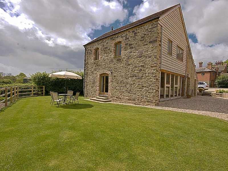

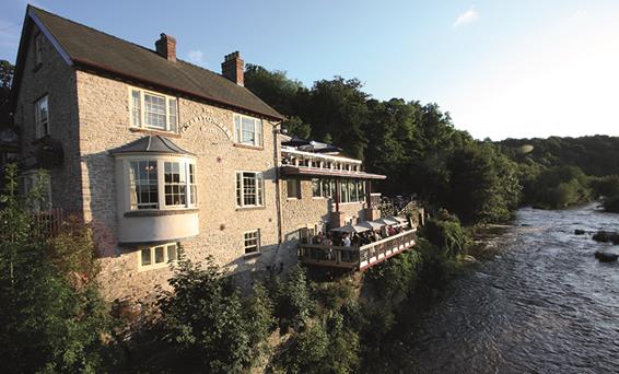

Acorn Lodge at Thomas House
Seeking peace, beautiful countryside and space to be yourself in comfort? Come to Acorn Lodge,…

Clee Hill
8.25 miles (13.3kms)
Locals say the view from Clee Hill is the finest in England and it's hard to disagree. After all, where else can you see from the Brecon Beacons to the Peak District, from Snowdonia to the Cotswolds? It's stunning. But before getting too carried away with the view, we need to sort out some names, which can be confusing in these parts. For instance, it's Cleehill village, but Clee Hill. However, strictly, Clee Hill is just the area that is currently being quarried, northeast of the village. The top is Titterstone Clee Hill. Not everybody calls it that - to many who live in sight of it, in Shropshire and neighbouring counties, it's just Clee Hill or The Clee.
And then there's Bedlam. The original Bedlam was the Hospital of St Mary of Bethlehem, a lunatic asylum (as they were called) in London. Few people know that Bedlam is also a Victorian quarrying settlement on Clee Hill. On old maps it's called by that name, and at Bitterley a road sign indicates Bedlam. Bedlam is also marked on the excellent map displayed at Cleehill picnic site. Unfold your modern OS map, however, and you'll look in vain for it. It may be apocryphal, but the story goes that Bedlam's residents don't like its name because of its associations, and would prefer to rename it Titterstone Village. Still, it's reassuring to note that somebody in Bedlam has a sense of humour, as you will see when you pass Hullabaloo House.
There are other intriguing names on and around Clee Hill: Sodom, for example, but perhaps it's best not to inquire too closely into that. Random, Crumpsbrook, Hopton Wafers, Cramer Gutter, Rugpits, Titrail, Lubberland, Angelbank, Applecake Hill, Cadbury, Pastycraft, Hackenchop, Hilluppencott, Hemm and Hoopits all have their own charm. Many names relate to wildlife, such as Kitesnest, Hawkwood, Magpie Hill, Brown Owls, Lapwing, Foxwood and even Wormsacre. Others relate to the industrial heritage of the area. The bridleway you join at Cleeton St Mary, for instance, is marked on old maps as Limers' Lane, though it's often referred to as the Random bridleway nowadays, because it passes Random.
Walk up the lane opposite the picnic area, towards the Kremlin Inn. After 100yds (91m), turn left and follow a broad track. Its middle section is classed as Open Access Land: follow it past mining ruins.
Meet the radar station access road by Hedgehog House and turn right. Walk to the end of Rouse Boughton Terrace and turn left, then go through a small gate on the right before a cattle grid. Follow the top edge of a thistly field. Continue along the edge of the next field and through a gate in the corner to meet the Shropshire Way, which goes to the right. Ignore it and go straight on, skirting a stream and gorse thickets and crossing a gate in a wire fence before returning to the left-hand hedge-line.
A green track develops, swinging right and down to cross Benson's Brook at a bridge. Follow the track up again, passing the abutments of a former tramway bridge (called Titterstone Incline on OS maps), before arriving at Bedlam.
Turn left into the hamlet, then fork right. Pass Hullabaloo House and climb a track to a cattle grid. Follow the track up to a farm then bear left up a smooth green track.
When you come to Bitterley Incline again, climb on to the embankment, joining the Shropshire Way. Follow it uphill. When you reach ruined quarry buildings, go right on a level path. Pass the last building, fork left and climb slightly. Go straight on, crossing the access road twice at a bend, then bear left up a steeper track. Skirt a large quarry to reach the radar station and trig point.
Some 100yds (91m) north of the trig pillar are the remains of an ancient cairn, the Giant's Chair. From this bear right, above steep scree slopes, then swing left on a clearer path and continue across bracken moorland to the red roofed farm of Callowgate.
Before reaching Callowgate, turn right where the bracken runs out. Follow sheep tracks to the edge of the moor and turn right again. Joining a lane at Cleeton Gate, turn right and walk to the village of Cleeton St Mary. Turn right, looping round the church and along a row of almshouses, then left on the Random bridleway, which runs along the moorland edge. Follow vague paths parallel to the fence, except where you need to cut a corner - it's obvious (and usually wet!) when you come to it.
When the fence makes a very sharp left turn, keep straight on to meet the radar station access road. Turn left to Rouse Boughton Terrace then retrace your steps to the start.
Good but rough, uneven and/or boggy in places
Moors and upland pasture with industrial remains
Good, but keep under close control near sheep and cattle
OS Explorer 203 Ludlow
Car park/picnic site/viewpoint on eastern edge of Cleehill
On A4117, 100yds (91m) west of car park
Read our tips to look after yourself and the environment when following this walk.
Perhaps nowhere else in England will you find a county so deeply rural and with so much variety as Shropshire. Choose a clear day, climb to the top of The Wrekin, and look down on that ‘land of lost content’ so wistfully evoked by A E Housman. Peer through your binoculars and trace the course of Britain’s longest river as the Severn sweeps through the county, from the Breidden Hills to Wyre Forest, slicing Shropshire in two. To the north is a patchwork of dairy fields, hedgerows, copses and crops, broken at intervals by rugged sandstone ridges such as Grinshill or Nesscliffe, and dissected by a complex network of canals.
Spilling over the border into neighbouring Cheshire and North Wales is the unique meres and mosses country, with serenely smooth lakes glinting silver, interspersed with russet-tinged expanses of alder-fringed peat bog, where only the cry of the curlew disturbs the silence. South of the Severn lies the Shropshire Hills AONB. It’s only when you walk Wenlock Edge that you fully discover what a magical place it is – glorious woods and unexpectedly steep slopes plunge to innumerable secret valleys, meadows, streams and farmhouses, all tucked away, invisible from the outside world.
Discover more than 15,000 professionally rated places to stay, eat and visit from across the UK and Ireland.
Choose a place to stay safe in the knowledge that it has been expertly assessed by trained assessors.
Search by location or the type of place you're visiting to find your next ideal holiday experience.
Read our articles, city guides and recommended things to do for inspiration. We're here to help you explore the UK.