


Woodside House
Woodside House is a quality 4 star self catering holiday home that can sleep 14 people. Located…

Ascend the former Norman hunting grounds of Beaurepaire then visit a fascinating mill complex in the town
Belper
5.6 miles (9kms)
Before Jedediah Strutt came to Belper, it was a mere backwater of Derbyshire, and according to Dr Davies, writing in 1811, was ‘backward in civility’ and considered as the insignificant residence of a few ‘uncivilised nailors’. The land around Belper was part of the Norman hunting grounds of Beaurepaire, which meant beautiful retreat. The land was first handed to Henri de Ferrières and the family ruled here until 1266, when Henry III handed it over to his son the Earl of Leicester, known as Edmund Crouchback.
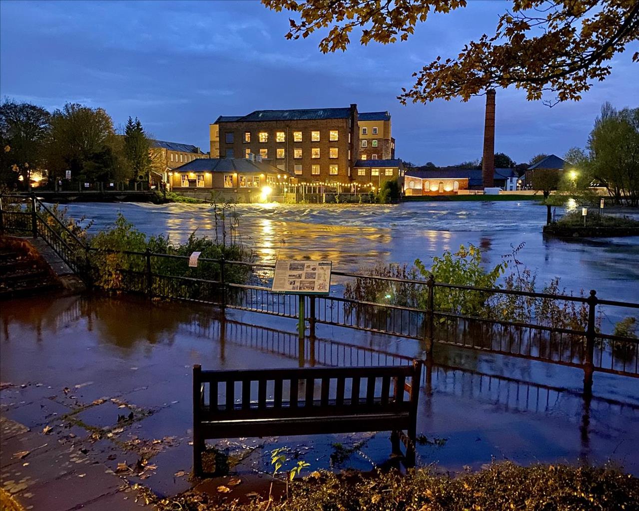
Jedediah Strutt had earlier partnered Richard Arkwright in the building of the world’s first water-powered cotton mill, sited upriver at Cromford. The success of that project prompted him to build the South Mill here at Belper. By 1786 he had built the timber-framed North Mill. Jedediah died in 1797, but his three sons, William, George and Joseph, built on his successes. In 30 years there were five mills in the town, though the original North Mill had to be replaced in 1803 after a damaging fire. The Strutts took an active interest in the welfare of their community, providing good housing for their workforce and schooling for the children. As you walk past the North Mill you can see a bridge connecting it with the mill across the road. Note the gun loopholes in it. They were to protect the mills from Luddites, but fortunately the trouble never materialised.
Most of the walk is rural, and you’re soon tramping through woods and across fields. The small lake you see is now a nature reserve, known for its wildfowl. Farm tracks that wouldn’t look out of place in a Gainsborough or Constable landscape take you up the hillside to Belper Lane End. At the top of the hill you reach Longwalls Lane, which was part of the Saxon Portway road. Archaeological finds show that the lane was in use, not only by the Romans, but by prehistoric man. In such times the ridges made safer routes than the swampy forests of the valleys, with their dangerous wild animals.
Exit the River Gardens car park by a pedestrian passageway near the public toilets. This leads past the back of the mills and the Derwent Valley Visitor Centre. Exit the driveway bearing right then over Belper Bridge. By The Talbot Hotel, turn right towards ‘Belper Lane End Alderwasley’.
Ignore the next two right forks (Wyver Lane and Belper Lane), but where the road swings sharply left, go straight ahead on The Scotches. At the end of this short lane, a stile leads to a path across a field. Follow this at the edge of several more fields before descending through woodland to Wyver Lane, near the wetlands nature reserve.
Turn left along the road. Take a track bearing left signed to Wyver Farm; this bends right through a long field then becomes a green lane. Pass straight through the yard of Wyver Farm then continue through fields to the road at Belper Lane End.
Turn right along the road, then right again at the Bull’s Head pub. Stay left with the main road towards Shottle, then turn left on to a farm track at Gorses Farm. Follow this uphill, continuing ahead when it becomes a narrow path by a barn.
Turn left along Longwalls Lane, which soon degenerates into a stony track. Any vehicle traffic is restricted beyond a sharp bend right of the main track. Continue ahead on a track which becomes rutted grass, then a narrower and rocky, tree-lined holloway. It becomes wider and open to traffic again at Starbuck House. Descend to a T-junction with the Ashbourne Road at Blackbrook.
Turn right along the road and pass Plains Lane. Take the next left on to a tarmac track. Cross a footbridge by a ford, then rise up the lane. Pass Lumb Farm and Windarra then take a footpath on the left. Past a gate, a path climbs diagonally across a field, then enters an area of delightful woodland (Lumb Grange). Turn left at a stile in a wall, aiming for some houses at the far end of a field. Take the right hand of two parallel tracks, past the houses to reach the road at Farnah Green.
Turn right along the road to walk past some houses. Shortly before The Bluebell pub, turn left on to a tarmac driveway to Chevin Mount. This becomes unsurfaced then bends sharp right. At a nearby bench, turn left down a fenced-in footpath, descending steeply and directly beside sloping fields to Chevin Road.
The continuing path is staggered 100yds (91m) to the left and follows a short driveway past Swiss Barn. Go through a walkers’ gate then go left on a well-marked footpath. This leads across fields and down to the River Derwent. Stay near the river, crossing a driveway track on a dog-leg left then right, then along wider tracks back to Belper Bridge and the outward route.
Good paths and tracks, could be muddy after periods of heavy rain, several stiles
Urban start and finish, but mostly rolling farm pastures
Dogs should be kept on lead through farmland, under close control elsewhere
OS Explorer 259 Derby
Belper River Gardens car park, off A6
At River Gardens car park
Read our tips to look after yourself and the environment when following this walk.
The natural features of this central English county range from the modest heights of the Peak District National Park, where Kinder Scout stands at 2,088 ft (636 m), to the depths of its remarkable underground caverns, floodlit to reveal exquisite Blue John stone. Walkers and cyclists will enjoy the High Peak Trail which extends from the Derwent Valley to the limestone plateau near Buxton, and for many, the spectacular scenery is what draws them to the area.
The county is well endowed with stately homes – most notably Chatsworth, the palatial home of the Duke and Duchess of Devonshire, with its outstanding collections of paintings, statuary and art. Other gems include the well preserved medieval Haddon Hall, the Elizabethan Hardwick Hall, and Kedleston Hall, whose entrance front has been described as the grandest Palladian façade in Britain.
The spa town of Matlock is the county’s administrative centre and other major towns of interest include Derby and the old coal mining town of Chesterfield, with its crooked spire. Around the villages of Derbyshire, look out for the ancient tradition of well dressing, the decorating of springs and wells – the precious sources of life-sustaining water – with pictures formed from flowers.
Discover more than 15,000 professionally rated places to stay, eat and visit from across the UK and Ireland.
Choose a place to stay safe in the knowledge that it has been expertly assessed by trained assessors.
Search by location or the type of place you're visiting to find your next ideal holiday experience.
Read our articles, city guides and recommended things to do for inspiration. We're here to help you explore the UK.