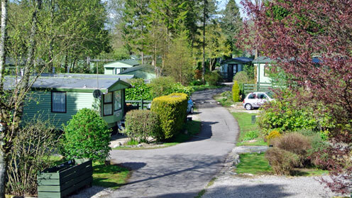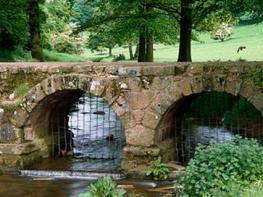
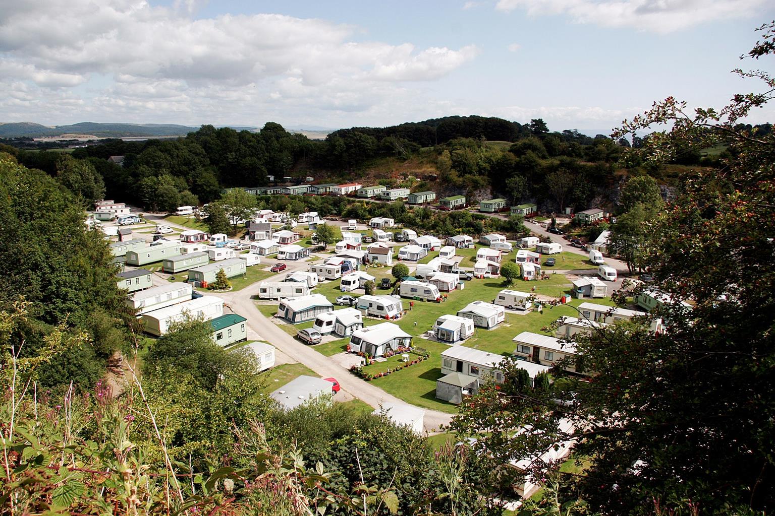
Bardsea Leisure Park
Bardsea Leisure Park is set in a former quarry, which creates a quiet and very sheltered site;…

A good outing on Birkrigg Common, strewn with ancient remains
Bardsea
8.4 miles (13.5kms)
Birkrigg Common is a wonderful open expanse of bracken, grass and low limestone scars, rising between the shores of Morecambe Bay and the gentle valley containing Urswick Tarn. Although only a lowly height, it offers splendid views encompassing the whole of Morecambe Bay and most of the Furness peninsula, with Black Combe and the Coniston fells prominently in view. Other Lakeland fell groups, the Yorkshire Dales and Bowland feature more distantly. A network of paths and tracks allow an intimate exploration of the countryside, which turns out to be remarkably varied and interesting.
The bedrock of Birkrigg Common is Carboniferous limestone. It outcrops only on the margins of the Lake District, most notably around Morecambe Bay and Kendal, but also around Shap and above Pooley Bridge. It was laid down in a shallow sea and once covered the whole of the Lake District, before the area was pushed up into a vast dome by earth movements. Subsequent erosion largely removed the limestone layer, exposing the volcanic core of the Lake District and leaving only a few outcrops of limestone around the fringes. Birkrigg Common is dry, as most limestone areas are. In the low-lying valley at Urswick, however, water has pooled to form the lovely little reed-fringed Urswick Tarn, which is a haven for waterfowl. Some groundwater contained in the limestone layer reaches the surface as freshwater springs out on the sands of Morecambe Bay.
The area around Birkrigg Common was always fairly dry and fertile, compared to the higher Lakeland fells, so it attracted the attention of early settlers. Little remains to be seen, though there is a small early Bronze-Age stone circle of limestone boulders on the seaward slopes. A standing stone at Great Urswick, known as the Priapus Stone and thought to be associated with fertility rites, lies at the base of a roadside wall. Several tumuli are dotted around the countryside and a rumpled series of low, grassy earthworks represent the remains of an ancient homestead site. Above Great Urswick, a low hill encircled by a limestone scar bears a hill-fort – probably dating from the Iron Age, in the centuries preceding the Roman conquest. It’s interesting to wander around and let your imagination run free at the ancient settlement sites. Very little is known about them, but there has been a continual human presence in the area for over 4,000 years.
Follow the shore along to Sea Wood. At the far end of the wood turn right and ascend near its edge to the road. Turn left up the road to a small layby, then right at a gate just above into upper Sea Wood.
Follow a path around the top edge of the wood, keeping left at any forks, then descend to leave the wood at a gate. Cross a road and follow a grassy path through bracken on Birkrigg Common. Fork left to a wall corner then keep left to a stone circle. Follow any grassy path to the high skyline; the trig point at 446ft (136m) affords fine views.
Pass a bench then bear right to meet a road. Cross and walk past a wall corner, then parallel to another road as the common tapers to a cattle grid. Continue along the road, then turn sharp right along a walled track.
Cross a stile at the end of the track and turn right. Pass the site of an ancient homestead, then keep left of a wall. Cross a stile at a gate, then bear left to find a path down a valley to a gate. Turn right before the gate and follow a hedgerow across a slope to a house. Pass through the garden to a road, then turn left to pass farm buildings at Holme Bank.
Turn right, following signpost to ‘Public Footpath Church Road’. Cross a ladder stile and footbridge, then bear slightly left to a village hall and road. Cross the road and turn right to pass a school. Just after the entrance, the Priapus Stone is incorporated into a wall on the left. Pass the parish church in Great Urswick.
Turn right at the Derby Arms pub. At the crest of a slight rise, turn left up a steep track signed ‘Footpath Red Lane’. Follow the track until there’s a gate across it. Bear left through a second gate and walk straight ahead, keeping right of a limestone edge, the site of an ancient fort.
Where the limestone edge ends, follow a wall down to another gate, then go straight on. Cross a stile on the right and, on the other side of a gateway, cross a stile on the left. Walk straight on and enter a short track to reach a road junction. Turn right, continue across a crossroads, and on to the next farm.
Turn right before the first house of the farm complex along a bridleway signposted ‘Bardsea Green’. Cross a stile by a gate and keep left to meet a road on Birkrigg Common. At a three-way signpost, follow the obvious path signed for Bardsea Green, initially parallel to the road, then parallel to a wall.
Keep left at a fork, then go through a gate and follow a track downhill to join a road. Keep left at a junction, up into Bardsea, then right at a T-junction, following the road down to the shore and back to the start.
Paths and tracks, some field paths may be muddy, many stiles
Low-lying, rolling limestone country, with coastal margin, woodland, open common and enclosed pastures
Under close control on roads and where there’s livestock grazing
OS Explorer OL6 & OL7 The English Lakes (SW) and (SE)
Any of the small car parks alongside the coast road just south of Bardsea
At start (community operated, donations invited)
Read our tips to look after yourself and the environment when following this walk.
Cumbria's rugged yet beautiful landscape is best known for the Lake District National Park that sits within its boundaries. It’s famous for Lake Windermere, England’s largest lake, and Derwent Water, ‘Queen of the English Lakes'. This beautiful countryside once inspired William Wordsworth and his home, Dove Cottage, in Grasmere is a popular museum. Another place of literary pilgrimage is Hill Top, home of Beatrix Potter, located near Windermere. Tom Kitten, Samuel Whiskers and Jemima Puddleduck were all created here.
Much of Cumbria is often overlooked in favour of the Lake Distirct. In the south, the Lune Valley remains as lovely as it was when Turner painted it. The coast is also a secret gem. With its wide cobbled streets, spacious green and views of the Solway Firth, Silloth is a fine Victorian seaside resort. Other towns along this coastline include Whitehaven, Workington and Maryport. Carlisle is well worth a look – once a Roman camp, its red-brick cathedral dates back to the early 12th century and its 11th-century castle was built by William Rufus.
Discover more than 15,000 professionally rated places to stay, eat and visit from across the UK and Ireland.
Choose a place to stay safe in the knowledge that it has been expertly assessed by trained assessors.
Search by location or the type of place you're visiting to find your next ideal holiday experience.
Read our articles, city guides and recommended things to do for inspiration. We're here to help you explore the UK.