Home>
Walks>
Board Hill and the 'Pots and Pans' peaks
Board Hill and the 'Pots and Pans' peaks
Recommended by
Our view
"Two small peaks above Dovestone Reservoir offer great views and some interesting hilltop features."
Walk directions
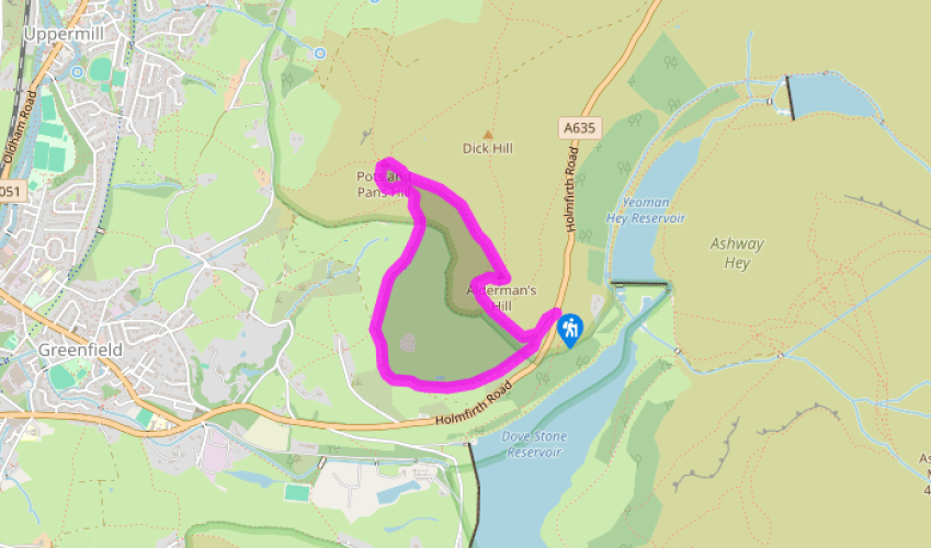
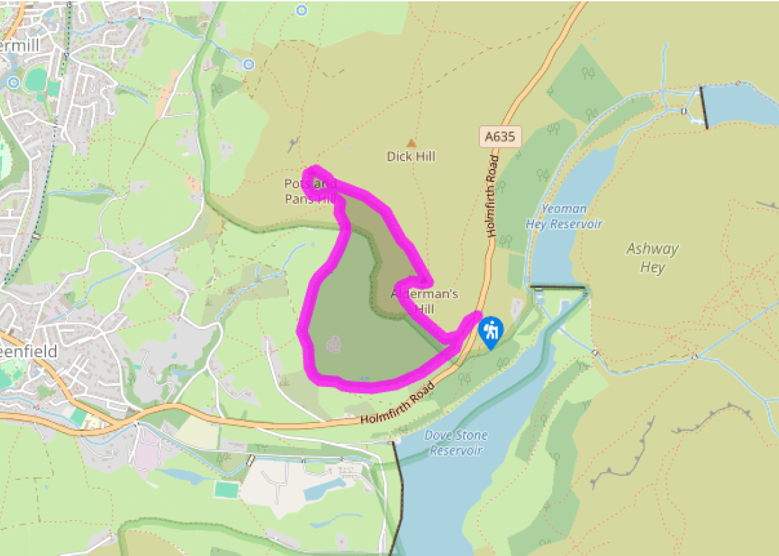
From the car park entrance cross the road and take the path through the gate opposite, waymarked ‘Oldham Way’. Follow the broad and grassy track ahead, which soon becomes a level walled route called Long Lane. Continue as it swings westwards around the hillside for 0.75 miles (1.2km).
At a junction of routes go right, over a stile by a gate, still following waymarks for the Oldham Way. Head up the obvious grassy track, aiming to the right of the hilltop obelisk. At the end of a short section enclosed by tumbledown walls you get to an old stile.
Go over this and out on to open moorland, following the clear path steeply uphill towards the top. Veer to the left of an old quarry and on to the memorial and rocky outcrops by the summit.
Head southeast from the obelisk on a path parallel to the metal railings, but not through a tempting gap in them. At the end of the railings follow the public footpath out across the undulating moorland, staying on the upper slopes all the way to the top of Alderman’s Hill. If you want a straightforward descent, return on the outward route.
After admiring the views of Dove Stone Reservoir from the top of the crags, turn right and walk along the high grassy edge on a clear path. Follow it down to the bottom of a slight dip.
The path now turns left and makes a long, steep descent of the rough but mainly grassy hillside. It joins a wall on the right and continues directly downhill towards the reservoir. Approaching the fence at the bottom, veer left on a faint path that drops down to cross a stile near the road. The car park is opposite.
Terrain
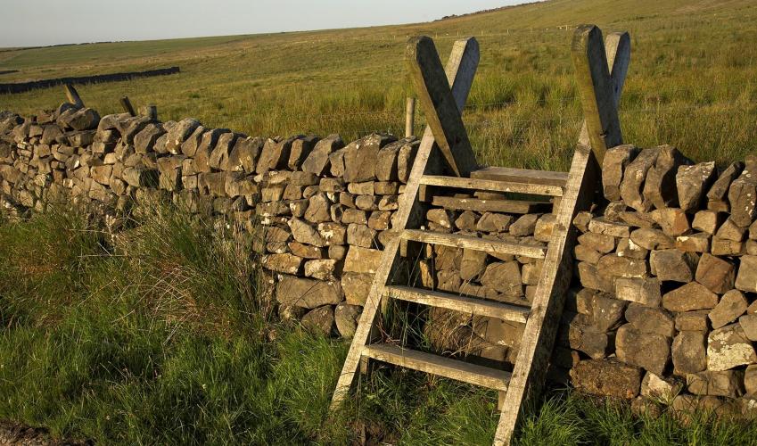
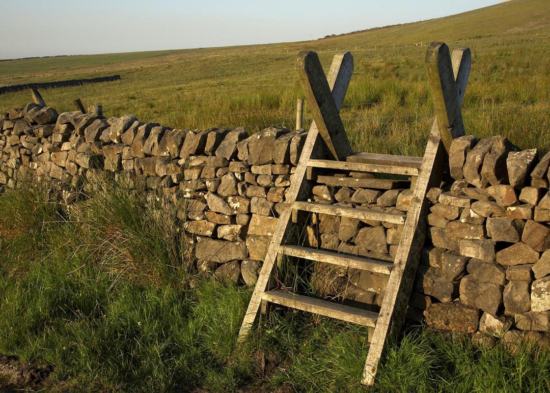
- Field and moorland paths; one long, steep grassy descent, likely to be slippery if wet; several stiles
Landscape
- Rugged moorland valley
Dog friendliness
- Livestock throughout, so on lead or under very close control
Parking
- Binn Green car park (pay-and-display, note closing times)
Toilets en route
- At car park
About the walk
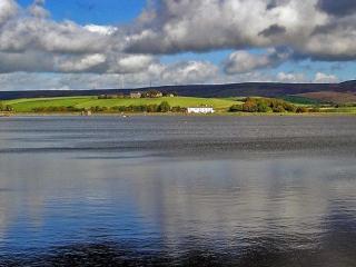
Dove Stone Reservoir, on the Peak District’s northwestern fringe above Oldham, is renowned for the dramatic moorland crags and rugged upland scenery that surrounds it. On the western edge of the valley are some lower tops that offer invigorating outings, wide vistas and some curious hilltop... decorations. Notable landmarks The first of the two objectives is shown as Board Hill on the Ordnance Survey map, although to many people it’s more affectionately known as ‘Pots and Pans’ after the shapely gritstone outcrop near the summit. To some, Pots and Pans looks like a human head with a hook nose and pointed chin. The top of the rock contains natural holes and cups, which probably explains its name. The other hilltop landmark that is visible for miles around is a tall stone obelisk, built in the last century to honour the local men who died in both World Wars. It was said to be sited so that it could be seen from the seven villages (Uppermill, Diggle, Dobcross, Greenfield, Lydgate, Springhead and Delph) that traditionally comprise Saddleworth. Every year a Remembrance service is held on this windy and exposed location, at 1,400ft (427m). Indeed, the views from this lofty position are spectacular. Immediately below is a string of small communities that seem to run into each other – Uppermill, Greenfield, Grasscroft and Mossley – then over to the west, and partly hidden by Shaw Hill with its transmitter mast, is Oldham. To the southwest is the distant blur of Manchester, with its high-rise buildings. Alderman's Hill It’s an easy moorland path across the rough but gently rising grassy slope to Alderman’s Hill, but as you reach the top you realise that the hill has a sterner side. Eastward-facing crags below the summit look sharply down to Dove Stone and Yeoman Hey reservoirs in the valley bottom far below, as well as across to the dark, rocky line of crags on the edge of Saddleworth Moor. The descent back to the car park is straight down the steep, grassy hillside along from the hilltop. It’s no problem if taken slowly, or you can zig-zag down the slope since this is access land – but for a more straightforward return retrace your steps via Long Lane.
"Two small peaks above Dovestone Reservoir offer great views and some interesting hilltop features."
Walk details
1hr 45min
Difficulty:
Hard
Gradient:
Moderate
Distance:
2.25 miles (3.6kms)
Ascent:
548ft (167m)
Walk directions
From the car park entrance cross the road and take the path through the gate opposite, waymarked ‘Oldham Way’. Follow the broad and grassy track ahead, which soon becomes a level walled route called Long Lane. Continue as it swings westwards around the hillside for 0.75 miles (1.2km).
1 of 6
At a junction of routes go right, over a stile by a gate, still following waymarks for the Oldham Way. Head up the obvious grassy track, aiming to the right of the hilltop obelisk. At the end of a short section enclosed by tumbledown walls you get to an old stile.
2 of 6
Go over this and out on to open moorland, following the clear path steeply uphill towards the top. Veer to the left of an old quarry and on to the memorial and rocky outcrops by the summit.
3 of 6
Head southeast from the obelisk on a path parallel to the metal railings, but not through a tempting gap in them. At the end of the railings follow the public footpath out across the undulating moorland, staying on the upper slopes all the way to the top of Alderman’s Hill. If you want a straightforward descent, return on the outward route.
4 of 6
After admiring the views of Dove Stone Reservoir from the top of the crags, turn right and walk along the high grassy edge on a clear path. Follow it down to the bottom of a slight dip.
5 of 6
The path now turns left and makes a long, steep descent of the rough but mainly grassy hillside. It joins a wall on the right and continues directly downhill towards the reservoir. Approaching the fence at the bottom, veer left on a faint path that drops down to cross a stile near the road. The car park is opposite.
Terrain
- Field and moorland paths; one long, steep grassy descent, likely to be slippery if wet; several stiles
Landscape
- Rugged moorland valley
Dog friendliness
- Livestock throughout, so on lead or under very close control
Parking
- Binn Green car park (pay-and-display, note closing times)
Toilets en route
- At car park
About the walk
Dove Stone Reservoir, on the Peak District’s northwestern fringe above Oldham, is renowned for the dramatic moorland crags and rugged upland scenery that surrounds it. On the western edge of the valley are some lower tops that offer invigorating outings, wide vistas and some curious hilltop... decorations. Notable landmarks The first of the two objectives is shown as Board Hill on the Ordnance Survey map, although to many people it’s more affectionately known as ‘Pots and Pans’ after the shapely gritstone outcrop near the summit. To some, Pots and Pans looks like a human head with a hook nose and pointed chin. The top of the rock contains natural holes and cups, which probably explains its name. The other hilltop landmark that is visible for miles around is a tall stone obelisk, built in the last century to honour the local men who died in both World Wars. It was said to be sited so that it could be seen from the seven villages (Uppermill, Diggle, Dobcross, Greenfield, Lydgate, Springhead and Delph) that traditionally comprise Saddleworth. Every year a Remembrance service is held on this windy and exposed location, at 1,400ft (427m). Indeed, the views from this lofty position are spectacular. Immediately below is a string of small communities that seem to run into each other – Uppermill, Greenfield, Grasscroft and Mossley – then over to the west, and partly hidden by Shaw Hill with its transmitter mast, is Oldham. To the southwest is the distant blur of Manchester, with its high-rise buildings. Alderman's Hill It’s an easy moorland path across the rough but gently rising grassy slope to Alderman’s Hill, but as you reach the top you realise that the hill has a sterner side. Eastward-facing crags below the summit look sharply down to Dove Stone and Yeoman Hey reservoirs in the valley bottom far below, as well as across to the dark, rocky line of crags on the edge of Saddleworth Moor. The descent back to the car park is straight down the steep, grassy hillside along from the hilltop. It’s no problem if taken slowly, or you can zig-zag down the slope since this is access land – but for a more straightforward return retrace your steps via Long Lane.