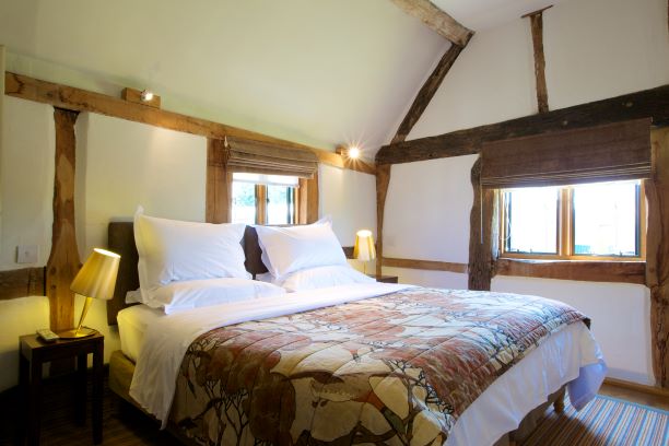
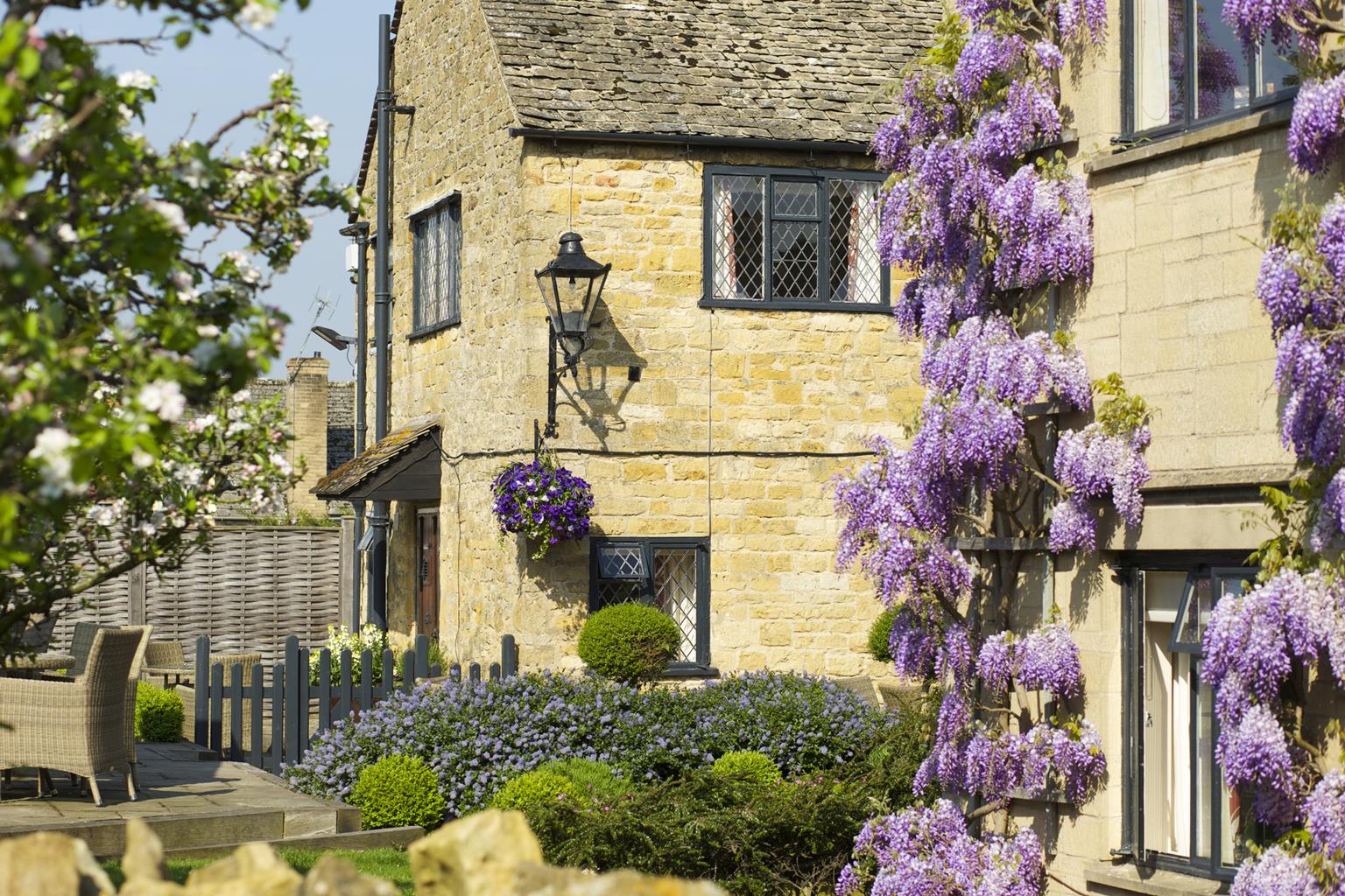
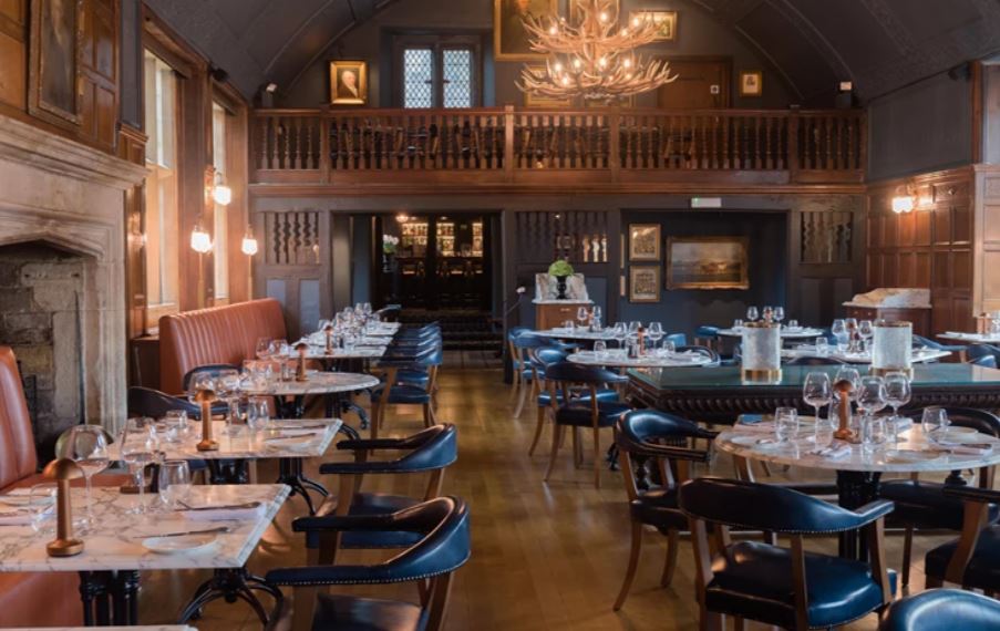


The Angel Inn and Posting House
Recently refurbished to provide contemporary quality, this pleasant Inn retains an element of…

Bredon Hill
7.5 miles (12.1kms)
Bredon Hill is a solitary outcrop of hard, yellowish limestone. The fort on its plateau summit enclosed 22 acres (8.9ha). Today the hill is one of English Nature’s National Nature Reserves.
As the name Pershore – ‘Pearshore’ – suggests, the area around nearby Pershore has long been synonymous with pears, and plums too. Although perry remains a popular drink, with some manufacturers of perry apparently planting new orchards, many traditional pear orchards have, like apple orchards, been wiped off the map, either for more lucrative forms of agricultural activity, or for house building. An interesting legacy is the presence of pear trees in local hedgerows.
The pear’s gene pool is being maintained by a national collection. As many as 120 varieties of perry pear have been recorded; about half of these have been traced in recent years. Specimens have been planted at the Three Counties Showground, near Malvern. In addition, the Worcestershire County Council’s Countryside Greenspace Team runs a fruit-tree scheme, like its counterpart in Herefordshire. Pear, along with other fruit trees such as cherry, apple and plum, is a popular wood for turning; also, the fine grain of pear wood makes it suitable for engraving when the favoured box wood is not available. In Worcester, look out for the city’s coat of arms – it bears three black pears. The story goes that when Queen Elizabeth I visited Worcester, the city’s 16th-century events manager arranged for a Worcester Black Pear tree to be placed along her route; this pleased Her Majesty, who pronounced that the city’s coat of arms ought to display these splendid fruits. Doubtless she didn’t actually taste one for the fruit is too tough to eat uncooked; it needs to be served in a pudding such as a crumble, or preserved in syrup. (The name is also inaccurate – the fruits are no more black than white grapes are white.) Nevertheless, to encourage some sense of heritage among its children, Worcestershire City Council has provided every one of the city’s schools with a Worcester Black Pear tree. On the top of Bredon Hill is Parson’s Folly. Named after Mr Parson, a resident of nearby Kemerton, it stands on the perimeter earthwork of Kemerton Camp, an Iron Age hill fort. The name of the village of Elmley Castle dates from the 11th century, when Robert le Despenser built a castle on an eastern outlier of Bredon Hill. It was later part of the estate of the Beauchamp family. The castle was again fortified in the 14th century, after interim decay. It is said that stones from this castle were used to build the old Pershore Bridge, adjacent to the present-day A44 road bridge. Today there is precious little to see of the castle itself (on private land).
Begin beside the telephone box, now a community book exchange in Great Comberton. Follow Church Street. Go through the churchyard; leave by an old iron kissing gate. At the road, go down the ‘11%’ gradient. In the dip find a metal gate. Ascend two fields (this bit is quite strenuous), with a stream on your left-hand side. In the third field, there is a (wobbly) signpost after 90yds (82m).
Turn right, initially beside trees. Soon a good farm track strikes across meadow. Ahead is a perfect Malvern Hills view. Follow waymarkers for the next 1.5 miles (2.4km), taking the gravel driveway beside Woollas Hall and skirting St Catherine’s Farm. Take a hard track, later tarmac, down into Bredon’s Norton. After the first few houses, you reach a junction.
Keep ahead for 100yds (91m) to another junction. Turn right if visiting St Giles’ Church; otherwise go ahead again, then round a left bend. Go into a field, to the right of two buildings – there’s a waymarker on a telegraph pole. Now follow an excellent track steadily upwards, through several gates, eventually swinging southeast, for at least 0.75 mile (1.2km). Less than 100yds (91m) beyond a single marker post reach a T-junction with ‘no right of way’ ahead.
Turn left, shortly veering right along a field-edge. Ascend for 600yds (549m), then turn right to walk all the way along the wooded escarpment ridge, before an open field leads to Parson’s Folly on the edge of Kemerton Camp. Follow the escarpment eastwards, keeping the wall on your left until you reach a small conifer plantation. Just past this, ignore a downward fork, instead following a wire fence for over 0.25 mile (400m), to a wood.
Don’t enter the wood; turn left, beside it. Within 150yds (137m), bend right to a junction. Turn left, facing away from the gate into wood, down a green hollow. At Doctor’s Wood veer left to cross an oddly level field, Even Hill (no contours on the map). Find a gate hidden in a dip at the edge of woodland to the right. Descend steeply through Cames Coomb, along a wide, well-trodden path. Briefly follow a level forestry road, then leave the trees, descending on a track for 400yds (366m) to a metal kissing gate on the right.
Walk a further 275yds (251m) on the good track to find a path on the left (ignoring the first signposted path to the left), initially between two hedges. When it ends, go straight ahead. Keep this general line – later a hard track – back into Great Comberton. Turn right to the telephone box.
Tracks, woodland paths, bridleways, minor lanes, many stiles
Farmland, woodland, panoramic views into Wales
Close control needed – cows, horses and lots of sheep
OS Explorer 190 Malvern Hills & Bredon Hill
Roadside parking, Great Comberton village
None on route
Read our tips to look after yourself and the environment when following this walk.
Worcestershire is a county of rolling hills, save for the flat Vale of Evesham in the east and the prominent spine of the Malverns in the west. Nearly all of the land is worked in some way; arable farming predominates – oilseed rape, cereals and potatoes – but there are concentrated areas of specific land uses, such as market gardening and plum growing.
Worcester is the county town, and home to Worcestershire County Cricket Club, which has what some regard as the most attractive grounds in the country, in a delightful setting with views of Worcester Cathedral. The Malverns, Great and Little, set on the slopes of the Malvern Hills, are renowned for their refinement. Great Malvern, terraced on its hillside site, came to prominence as a genteel spa for well-to-do Victorians, rivalling the likes of Bath, Buxton and Cheltenham with its glorious surroundings.
Sir Edward Elgar was a Worcester man, and his statue stands on the High Street, facing the cathedral. The cottage where he was born is now a museum and he is commemorated on the £20 note. Other notable Worcestershire figures include poet A E Housman, chocolate magnate George Cadbury; and Lea and Perrins, inventors of Worcestershire sauce.
Discover more than 15,000 professionally rated places to stay, eat and visit from across the UK and Ireland.
Choose a place to stay safe in the knowledge that it has been expertly assessed by trained assessors.
Search by location or the type of place you're visiting to find your next ideal holiday experience.
Read our articles, city guides and recommended things to do for inspiration. We're here to help you explore the UK.