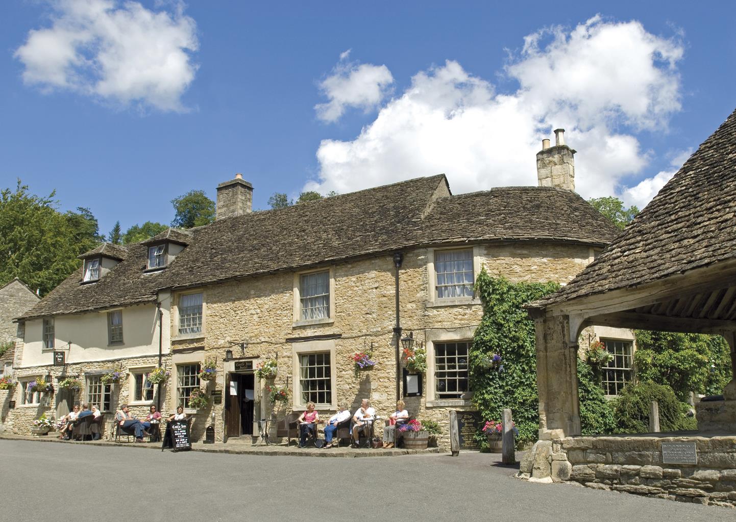
The Castle Inn
The Castle Inn is a beautiful Inn which dates back to the 12th Century and is at the heart of…

Through the wooded By Brook valley from a famous picture-book village.
Castle Combe
5.75 miles (9.2kms)
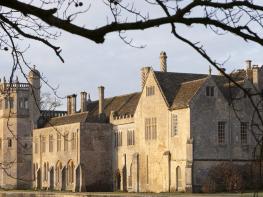
Since being voted ‘the prettiest village in England’ in 1962, there have been more visitors to Castle Combe, more photographs taken of it and more words written about it than any other village in the county. Nestling deep in a streamthreaded combe (valley), just a mile (1.6km) – and a world away – from the M4, it certainly has all the elements to make it a tourist’s dream. You’ll find 15th-century Cotswold stone cottages with steep gabled roofs surrounding a turreted church and stone-canopied market cross, a medieval manor house, a fast-flowing stream in the main street leading to an ancient packhorse bridge, and a perfectly picturesque river. Yet, as preservation is taken so seriously here, there is an atmosphere of unreality, where television aerials don’t exist, gardens are immaculately kept, and the inevitable commercialism is carefully concealed. However, it also has a fascinating history that’s well worth exploring, and the valleys and wooded hillsides that surround the village are favourite Wiltshire walking destinations. If you don’t like crowds, undertake this walk on a winter weekday.
The nearby castle that gave the village its name, of which little more than earthworks remain, began life as a Roman fort and was used by the Saxons before becoming a Norman castle in 1135 and the home of the de Dunstanville family. In the 13th and 14th centuries the village established itself as an important weaving centre as Sir John Fastolf, the lord of the manor, erected fulling mills along the By Brook and 50 cottages for his workers. With the growth of the cloth trade in Wiltshire, Castle Combe prospered greatly, becoming more like a town with a weekly market and an annual fair. The greatest tribute to the wealth of the weaving industry is reflected in St Andrew’s Church, which was enlarged during the 15th century, and has an impressive Perpendicular tower that was built in 1436.
Leave the car park via the steps and turn right. At the T-junction, turn right and follow the lane into Castle Combe. Keep left at the Market Cross, cross the By Brook and continue along the road. Take the waymarked path across the bridge on your left.
Pass through a kissing gate and follow the path uphill and then beside the right-hand fence above the valley (Macmillan Way). Beyond an open area, wind gently through woodland to a stone stile and gate. Cross a further stile and descend into the hamlet of Long Dean.
Where the lane bears left by Bybrook House, follow the track right to cross the river bridge. At a mill house, keep right and follow the sunken bridleway uphill to a gate. Shortly enter sloping pasture and follow the enclosed path around the top edge. Bear left through a kissing gate to follow a worn path through the field to a kissing gate that leads to a lane.
Turn left and descend to the A420 at Ford. Turn right along the pavement and shortly turn right again into Park Lane. (If you want to visit The White Hart Inn in Ford village, take the road ahead on your left, signed ‘Colerne’.) Climb the gravel track and take the footpath left through a gate.
Keep right through pasture and continue through trees to a water meadow in the valley bottom. Turn left, follow the path to a kissing gate and cross a stream. Steeply ascend the grassy slope ahead of you, bearing left beyond some trees towards a waymarker post. Follow the footpath along the top of the field to reach a stile and gate, then walk through the woodland until you come to a gate and the road.
Turn left at the immediate fork. Keep to the road for 0.5 miles (800m) and take the signposted bridleway right, on a sharp left-hand bend. Follow the track, then, just before a gate, keep right downhill on a sunken path to come to a footbridge over Broadmead Brook.
In 30yds (27m), go through the kissing gate on your right and follow the footpath close to the river. Go through another kissing gate and emerge opposite Nettleton Mill House. Go right to a hidden gate. Walk beside the stream and enter a golf course.
Turn right along the metalled track, cross the bridge and turn immediately right again. After 50yds (46m), bear left to follow a parallel path running below the golf course fairway. Walk beside a wall to reach a gate on your right. Drop down to a metalled drive and keep ahead back into Castle Combe. Turn left at the Market Cross and retrace your steps.
Field and woodland paths and tracks, metalled lanes, many stiles
Wooded river valley and village streets
Keep under control across pasture and golf course
OS Explorer 156 Chippenham & Bradford-on-Avon
Car park on Dunns Lane, just off B4039 at Upper Castle Combe
The Street in Castle Combe
Read our tips to look after yourself and the environment when following this walk.
Discover more than 15,000 professionally rated places to stay, eat and visit from across the UK and Ireland.
Choose a place to stay safe in the knowledge that it has been expertly assessed by trained assessors.
Search by location or the type of place you're visiting to find your next ideal holiday experience.
Read our articles, city guides and recommended things to do for inspiration. We're here to help you explore the UK.