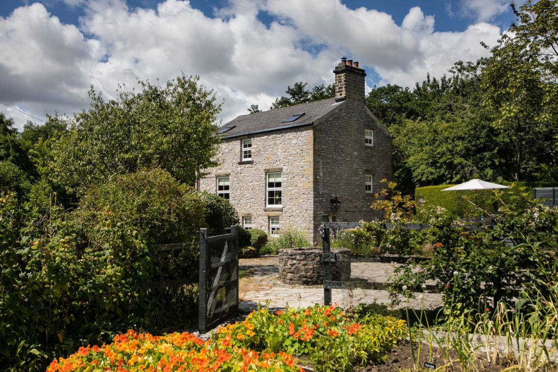

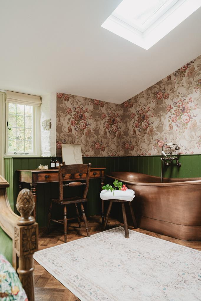
Lodge Cottage
A sprawling stone-built cottage with five bedrooms, copper bathtub, master suite, and hidden…

A glacial meltwater valley and Blue John Caverns
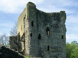
Castleton
5 miles (8kms)
Castleton is the last settlement before the Hope Valley narrows and squeezes into the rocky ravine of Winnats. It’s a bustling tourist town with a history evident back to Norman times, and a geology that has been responsible for many of its successes and most of its failures. At Castleton the shales and gritstone of the Dark Peak and the limestone plateaux of the White Peak meet. Here, countless generations of miners have dug their shafts and enlarged the natural caves that riddle the bedrock in search of precious ore. Here, too, they built an ambitious road that eventually succumbed to the landslides of Mam Tor, the ‘Shivering Mountain’. The castle keep is perched high upon an outcrop of limestone. It’s one of the earliest stone-built castles in the country, built shortly after the Norman Conquest by William Peveril, William the Conqueror’s illegitimate son.
The entrance to Cave Dale is narrow and striking. One minute you’re in the village square, the next you’ve turned the corner and entered an awesome limestone ravine. Geologists used to think Cave Dale was a collapsed cavern, but current thinking places it as a valley carved by glacial meltwater after the last Ice Age. A little limestone path takes you through the ravine, climbing past cave entrances and above a wide system of subterranean passages, including those of the nearby Peak Cavern. The valley shallows and the next stretch of the journey is over high green fields enclosed by dry-stone walls. Mam Tor, the Shivering Mountain, dominates the view ahead, and soon you look down on the crumbling tarmac of the ill-fated road, and the huge shale landslides that have plagued the valley for centuries.
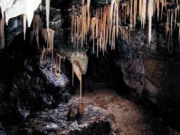
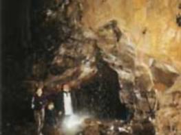
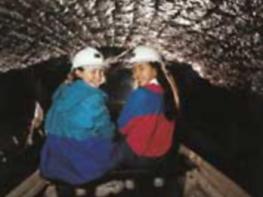
The first Castleton cavern of the day is the superb Blue John Cavern, high on the side of Mam Tor. It takes its name from the purple-blue fluorspar, unique to Castleton. The floodlights of the chambers show off the old river galleries with crystalline waterfalls, and aa fascinating array of stalagmites and stalactites. Beyond the Blue John Cavern a narrow path rakes across the steep limestone-studded slopes past Treak Cliff Cavern to the Speedwell Cavern, at the foot of the Winnats Pass. If you like boat trips, a visit to this cavern is a must. Here, lead miners excavated a level into the hill through which they built a subterranean canal, 547yds (500m) long. This took them 11 years, but low yields and high costs forced the early closure of the mine. The fascinating boat trip takes you down the canal to a landing stage just short of the ‘Bottomless Pit’, named because the spoil thrown in by miners made no impression on its depth.
The last stretch takes you across the National Trust’s Long Cliff Estate. Before retreating to Castleton, take one last look back up the valley, and across the limestone that was once a coral reef in a tropical lagoon.
From the car park turn left up the main street and then right to walk along Castle Street, passing the church on your way. Bend left then right with the road through Market Place leaving the small triangular green on your left and rising to the start of Pindale Road.
As the road bends left, turn off right between cottages into Cave Dale. Through a gate, the path enters the narrow limestone gorge, overlooked by the ruined keep of Peveril Castle perched on the cliffs above to the right. As you gain height, the gorge shallows and passes through a wall via a gateless gateway and a track joins from the right near a permissive access path.
Continue uphill to a gate in a dry-stone wall at plateau level, and follow the well-defined path across high pastureland. It passes through a gate in another wall before being joined by a path from the right at an oblique waymarked junction. Follow the waymarker diagonally left on a wide but fainter track over the crest of a rise, now heading for a gate in the far corner of the field. A shortwalled passage leads out to a broad track near the old Hazard Mine.
Turn right through a gate along a stony walled track, which shortly swings right and then runs straight for a mile (1.6km) past Rowter Farm to meet a road near Oxlow House. Cross to a gate on a dog-leg right across the road and follow a stony track past the rise of Windy Knoll, once quarried for its stone.
After a quarter of a mile (400m), just past the rise of Windy Knoll, turn right on a faint path back to the road. Go left and then fork right along the old Mam Tor Road, signed ‘Blue John Cavern’.
Turn in at the entrance to the cave and swing left in front of the ticket office to a gate. Follow a path to a second gate, from which the way drops around the shoulder of the hill and on towards Treak Cliff Cavern. Go left down the concrete steps by the ticket office, then right on a path with handrails.
Part-way down, bear right through a gap to follow a path across the hillside. Where the path forks beyond a stile, bear right to come out on the Winnats Pass road by Speedwell Cavern.
A path opposite takes the route on to the National Trust’s Long Cliff Estate. Keep beside the wall as it later curves left below Cow Low, shortly leaving the fields to join the end of a street. Walk down past cottages, cross Goosehill Bridge and turn left on a streamside path that leads out to the main road opposite the car park.
Limestone can be slippery when wet
Limestone ravines and high pastureland
Farmland; dogs should be kept on lead
OS Explorer OL1 Peak District - Dark Peak Area
Main Castleton pay car park by visitor centre
At car park. Free public toilets also available at Treak Cliff cavern when open
Read our tips to look after yourself and the environment when following this walk.
The natural features of this central English county range from the modest heights of the Peak District National Park, where Kinder Scout stands at 2,088 ft (636 m), to the depths of its remarkable underground caverns, floodlit to reveal exquisite Blue John stone. Walkers and cyclists will enjoy the High Peak Trail which extends from the Derwent Valley to the limestone plateau near Buxton, and for many, the spectacular scenery is what draws them to the area.
The county is well endowed with stately homes – most notably Chatsworth, the palatial home of the Duke and Duchess of Devonshire, with its outstanding collections of paintings, statuary and art. Other gems include the well preserved medieval Haddon Hall, the Elizabethan Hardwick Hall, and Kedleston Hall, whose entrance front has been described as the grandest Palladian façade in Britain.
The spa town of Matlock is the county’s administrative centre and other major towns of interest include Derby and the old coal mining town of Chesterfield, with its crooked spire. Around the villages of Derbyshire, look out for the ancient tradition of well dressing, the decorating of springs and wells – the precious sources of life-sustaining water – with pictures formed from flowers.
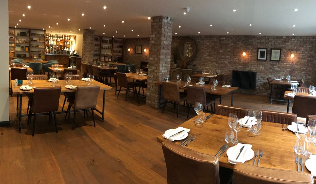
Discover more than 15,000 professionally rated places to stay, eat and visit from across the UK and Ireland.
Choose a place to stay safe in the knowledge that it has been expertly assessed by trained assessors.
Search by location or the type of place you're visiting to find your next ideal holiday experience.
Read our articles, city guides and recommended things to do for inspiration. We're here to help you explore the UK.