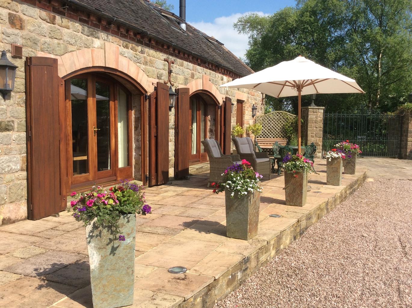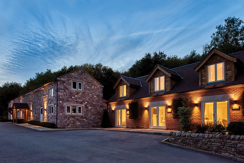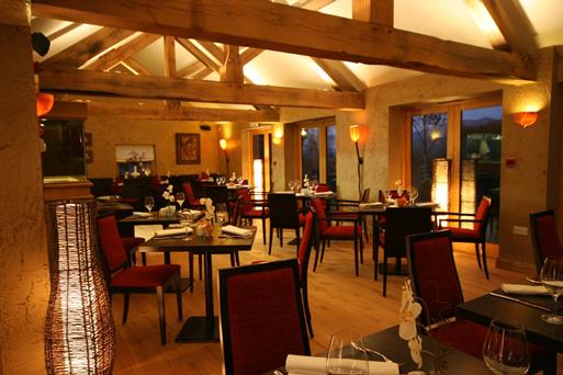


Cordwainer Cottage
You get the best of both worlds in the location of this stone built single storey self catering…

A short walk discovering the parts water and flint have played in the Staffordshire potteries.
Cheddleton
3.25 miles (5.3kms)
The walk starts at Deep Hayes Country Park, a recreational area which has been created around a disused reservoir. The reservoir itself was built in 1849 to compensate the River Churnet for the loss of water to several mills further downstream, while at the same time works were completed at nearby Wall Grange to pump 1.5 million gallons (6.8 million litres) of drinking water from Caena's Well. During the 1830s and 1840s thousands died in cholera epidemics because of poor water, so clean water was needed to serve the growing population of the booming Potteries region.
The reservoir at Deep Hayes was formed behind an earth dam 50ft (15m) high and 400ft (122m) long, which was built by hand. It continued to 'top up' the River Churnet until as recently as 1979, when problems with the dam's structure became too costly to repair. The water level was reduced, and three separate pools were made to create the country park you see today, complete with trails, toilets and visitor centre.
The highlight of the walk, though, is undoubtedly the flint mill on the Caldon Canal. Originally a corn mill dating as far back as the 13th century, it was strengthened for flint grinding in 1800. Flint is a hard, nearly pure form of silica; when ground down to a fine powder it's used to harden and whiten pottery (before flint was used, silica was added in the form of fine sand, but the sand was often iron-stained and impure).
The flint arrived by narrow boat. It was heated in kilns at 2,012°F (1,100°C) to make it more brittle, a process known as 'calcining'. The heated flint was then broken up and ground into fine powder by the water-powered, and later steam-driven, millstones. The slip, a mixture of water and fine flint powder, would be dried into blocks called 'cake' and taken to the wharf for dispatch to the potteries.
The mill continued to be worked well into the 20th century. During World War II, George Edwards & Son ground rutile (a black or reddish-brown mineral) for welding rods and, as late as the 1960s, ceramic stains were ground here for potteries overseas (in Saudi Arabia and Finland, for example). The mill finally stopped grinding flint in 1963, but it's open to visitors most weekends and bank holidays.
From the visitor centre in Deep Hayes Country Park go down to the bottom of the car park and cross the stream before following the shore of the reservoir along a wooded track. Go up some steps and left before the stile, continuing above the shoreline. After the second reservoir and at a fork of two obvious footpaths, go left down some steep steps and across the concrete stepping stones.
Once across the stream head right through a fence gap with a sign that says 'Keep dogs on leads'. After a short while this track runs alongside the small stream that fills the reservoirs. When you cross back over the stream, continue to follow it to the left through an aluminium kissing gate, then up some steps beyond a wooden gate ahead.
At a path junction (marked by a wooden signpost) head down steps left, back over the stream for the final time, before following the public footpath sign to Cheddleton. After crossing a stile, go right for 30yds (27m) before continuing up the wooded hill on steps. At the top of the wood cross the stile and head straight across the field, aiming left of the farm.
In the far corner of the field go along the muddy farm track to a gate. From here follow the obvious, waymarked path over a succession of stiles through a series of small fields to the left of the farm buildings.
Beyond a double stile and a plank footbridge, by a wooden public footpath sign, head straight across the field following the line of trees to your left. After the final tree veer right and cross the small stile over a dry-stone wall and drop downhill cross the next field to its far side. Just to the left of a clump of trees is a stile, followed in quick succession by another stile and a slot in the wall, bringing you out onto the road into Cheddleton almost opposite the tea rooms.
When you reach the end of this road, head left on the wide pavement of the A520 and, after 100yds (91m), turn left following signs to the flint mill. After exploring the mill museum, keep going along the canal tow path for about 1 mile (1.6km) until you reach a bridge (No. 39) over the canal. Cross over the bridge, before turning right, along the driveway, to return to the visitor centre.
Tow path, field and woodland paths (can be muddy), many stiles
Canal, reservoir, forest and farmland
On lead in country park, off lead along tow path
AA Leisure Map 7 Central Peak District
Deep Hayes Country Park visitor centre (closed at dusk)
Deep Hayes Country Park visitor centre
Read our tips to look after yourself and the environment when following this walk.
It was Staffordshire that bore the brunt of the largest non-nuclear explosion of World War II, when a munitions dump at RAF Fauld went up in 1944. It was also the county’s regiment that once boasted within its ranks the most decorated NCO of World War I, in the person of William Coltman (1891-1974). Going back a little further, George Handel penned his world-famous masterpiece The Messiah on Staffordshire soil. During another chapter of Staffordshire history, the county was home to the first canals and the first factory in Britain, and it had front-row seats for the drama surrounding one of the most notorious murder trials of the 19th century, that of Doctor William Palmer.
In outline, Staffordshire looks not unlike the profile of a man giving Leicestershire a big kiss. The man’s forehead is arguably the best region for hillwalking, as it comprises a significant chunk of the Peak District. This area is characterised by lofty moors, deep dales and tremendous views of both. Further south are the six sprawling towns that make up Stoke-on-Trent, which historically have had such an impact on Staffordshire’s fortunes, not to mention its culture and countryside. This is pottery country, formerly at the forefront of the Industrial Revolution and the driving force behind a network of canals that still criss-cross the county.
Discover more than 15,000 professionally rated places to stay, eat and visit from across the UK and Ireland.
Choose a place to stay safe in the knowledge that it has been expertly assessed by trained assessors.
Search by location or the type of place you're visiting to find your next ideal holiday experience.
Read our articles, city guides and recommended things to do for inspiration. We're here to help you explore the UK.