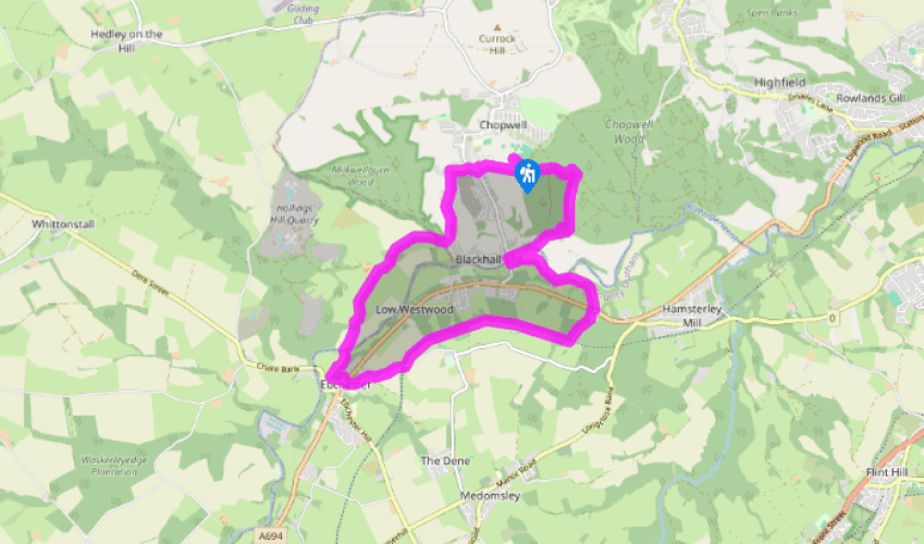
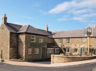
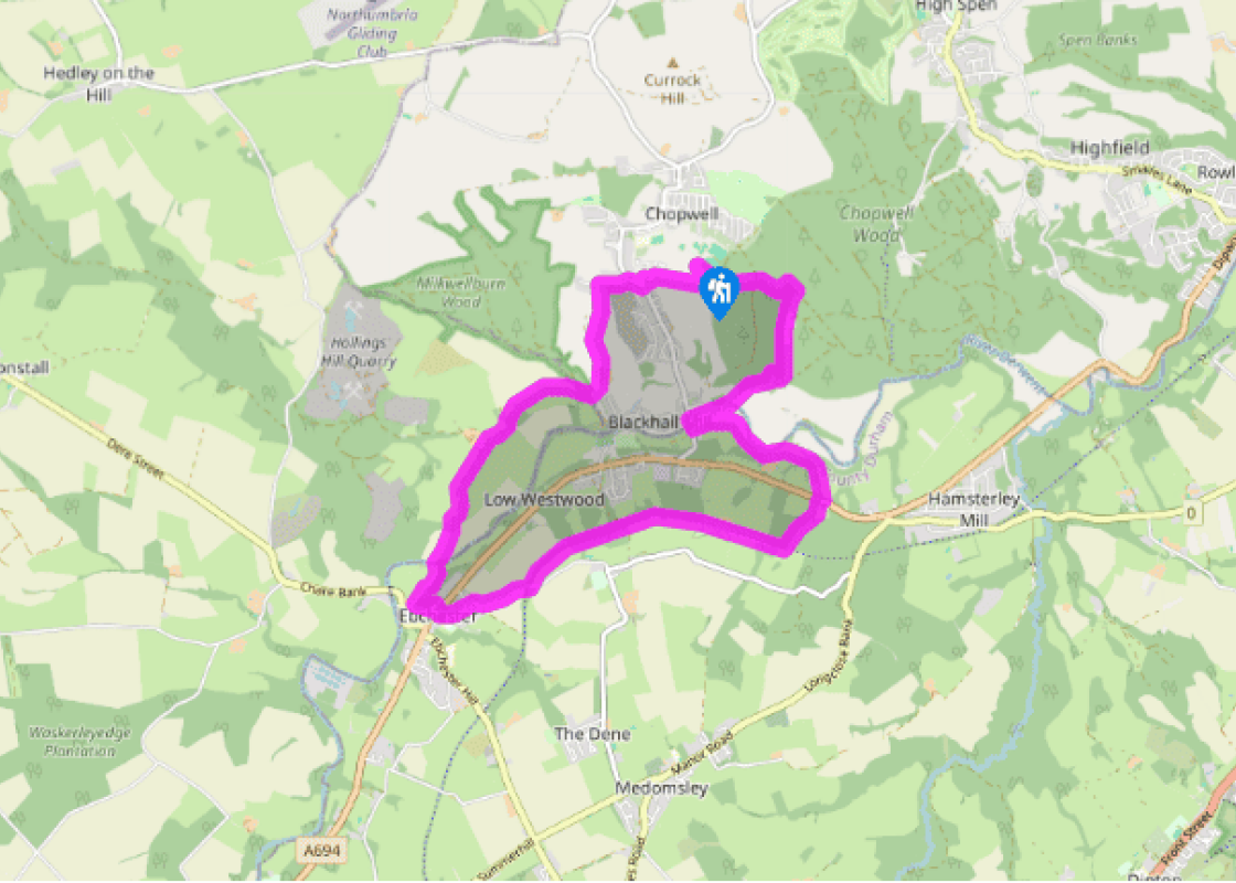
Return along the entrance drive of Chopwell Park. Just beyond the gate, turn left on a forest track and immediately fork right. After 200yds (183m), bear right at a junction (not sharp right), descending into a dell. Swing right over a footbridge and climb to a crossing. Take the first right, initially metalled and marked 'Forestry Commission Road'. Narrowing to a track beyond Carr House, it continues downhill beside a deepening gully. At a waymarker, branch right with the bridleway, winding down to a bridge. Head up to the next fork and keep left, falling to another split. Again keep left, exiting the forest between paddocks to join a farm track from Armondside. Follow it right to the road at Blackhall Mill.
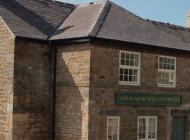
Cross the bridge and turn left along a track, bearing off right almost immediately on a contained footpath. Take care, river erosion has left the path occasionally narrow. Entering trees, swing left on a track curving uphill. Turn sharp left at the top, skirting Derwentcote Farm to continue above a high bank. Over a stile, bear right on a trod towards trees. Cross a couple of stiles and follow a track up past the Derwentcote Steel Furnace to the A694.
Cross right to a gate and stile from which a path rises left into a paddock. Walk up beside the right boundary to a stile. A clear path climbs away through woodland, eventually meeting the former Derwent Valley Railway. Follow it right for 1.25 miles (2km), crossing a track and eventually meeting a lane.
Head downhill to Ebchester, emerging onto the main road by the church. Go right and immediately left beside the post office to a small picnic green on the site of the Roman fort. A path leaves left, descending across a bank to a lane. Turn right, passing cottages to reach a footbridge across the River Derwent.
On the opposite bank, bear right and strike across a field to a gate and stile. A field track leads on to Broad Oak Farm. Continue forward through gates past the farm, soon crossing a stream. Keep ahead where the track then splits, cresting a rise. Through a gate, carry on by the left hedge. Beyond a kissing gate, the path shortly meets a junction of tracks at the edge of Milkwellburn Wood.
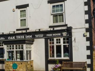
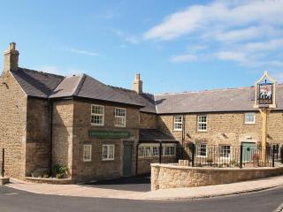
Go left and immediately fork right, climbing to Blackhall Farm. Continue through the yard along a grass track, leaving after some 300yds (274m) over a stile beside a gate on the right. Head out across a large paddock to the upper-right corner. Ignore the gate but look for a stile hidden in the hedge above. Walk up the field edge to a final stile, from which a narrow path leads beside houses onto a lane. Go right to the main road at Chopwell. Turn right and first left to follow the winding street back to the car park.
Coal mining created the village of Chopwell that we see today, with its red-brick buildings and no-nonsense atmosphere – and it was the miners who earned it the name ‘Little Moscow’ in the 1920s. The coal won from local mines was predominantly used for making coke to stoke the furnaces of the... Consett Iron Company. When coal production declined after the First World War, many miners were made redundant or put on short-time working. These conditions allowed Communist sympathisers to assume the running of the village. A miners’ strike from July 1925 to December 1926 led to accusations of a Communist takeover of the local Labour Party. A national newspaper declared that ‘the village is known far and wide as the reddest in England’. Streets were renamed after Marx, Engels and Lenin, and it is said that there were Communist Sunday schools in the village, as well as Das Kapital on the lectern of the local church. For a time the hammer and sickle flag flew over the town hall. The cradle of steel The area between Blackhall Mill and Derwentcote Ironworks was once the centre of the steel industry in Britain. Steel was made here initially to supply the sword manufacturers of Shotley Bridge, eastwards along the river. Derwentcote, the earliest steel-making furnace to have survived, was built around 1720 and worked until the 1870s. Another furnace at Blackhall Mill lasted until 1834, when a flood washed away its mill dam; the mill was demolished in the early 20th century. Derwentcote, now cared for by English Heritage, can be seen from the outside during the walk. Along the line Beyond Derwentcote the walk enters Byerside Wood and joins the old railway line that now forms the 12.5-mile (20.1km) footpath and cycle route of the Derwent Valley Country Park. This runs from Consett to Gateshead and connects with other former railway routes, including the Waskerley Way and the Consett and Sunderland Railway Path. In contrast to the industrial theme of much of the walk, the history of Ebchester stretches much further back in time. Here was the site of the Roman fort of Vindomora, strategically placed where the road we know as Dere Street, which ran from York to the Firth of Forth, crossed the Derwent. Constructed around AD 80, the original timber buildings were later replaced by stone and the fort was finally abandoned in AD 410. It is possible to see its ramparts north of the main road and in the village churchyard. There is a Roman altar in the church tower.
The metropolitan county of Tyne and Wear encompasses Newcastle-upon-Tyne, Gateshead, South Shields and Sunderland, as well as part of Hadrian’s Wall. The county is cut through by the two rivers after which it is named.
Return along the entrance drive of Chopwell Park. Just beyond the gate, turn left on a forest track and immediately fork right. After 200yds (183m), bear right at a junction (not sharp right), descending into a dell. Swing right over a footbridge and climb to a crossing. Take the first right, initially metalled and marked 'Forestry Commission Road'. Narrowing to a track beyond Carr House, it continues downhill beside a deepening gully. At a waymarker, branch right with the bridleway, winding down to a bridge. Head up to the next fork and keep left, falling to another split. Again keep left, exiting the forest between paddocks to join a farm track from Armondside. Follow it right to the road at Blackhall Mill.
1 of 6
Cross the bridge and turn left along a track, bearing off right almost immediately on a contained footpath. Take care, river erosion has left the path occasionally narrow. Entering trees, swing left on a track curving uphill. Turn sharp left at the top, skirting Derwentcote Farm to continue above a high bank. Over a stile, bear right on a trod towards trees. Cross a couple of stiles and follow a track up past the Derwentcote Steel Furnace to the A694.
2 of 6
Cross right to a gate and stile from which a path rises left into a paddock. Walk up beside the right boundary to a stile. A clear path climbs away through woodland, eventually meeting the former Derwent Valley Railway. Follow it right for 1.25 miles (2km), crossing a track and eventually meeting a lane.
3 of 6
Head downhill to Ebchester, emerging onto the main road by the church. Go right and immediately left beside the post office to a small picnic green on the site of the Roman fort. A path leaves left, descending across a bank to a lane. Turn right, passing cottages to reach a footbridge across the River Derwent.
4 of 6
On the opposite bank, bear right and strike across a field to a gate and stile. A field track leads on to Broad Oak Farm. Continue forward through gates past the farm, soon crossing a stream. Keep ahead where the track then splits, cresting a rise. Through a gate, carry on by the left hedge. Beyond a kissing gate, the path shortly meets a junction of tracks at the edge of Milkwellburn Wood.
5 of 6
Go left and immediately fork right, climbing to Blackhall Farm. Continue through the yard along a grass track, leaving after some 300yds (274m) over a stile beside a gate on the right. Head out across a large paddock to the upper-right corner. Ignore the gate but look for a stile hidden in the hedge above. Walk up the field edge to a final stile, from which a narrow path leads beside houses onto a lane. Go right to the main road at Chopwell. Turn right and first left to follow the winding street back to the car park.
Coal mining created the village of Chopwell that we see today, with its red-brick buildings and no-nonsense atmosphere – and it was the miners who earned it the name ‘Little Moscow’ in the 1920s. The coal won from local mines was predominantly used for making coke to stoke the furnaces of the... Consett Iron Company. When coal production declined after the First World War, many miners were made redundant or put on short-time working. These conditions allowed Communist sympathisers to assume the running of the village. A miners’ strike from July 1925 to December 1926 led to accusations of a Communist takeover of the local Labour Party. A national newspaper declared that ‘the village is known far and wide as the reddest in England’. Streets were renamed after Marx, Engels and Lenin, and it is said that there were Communist Sunday schools in the village, as well as Das Kapital on the lectern of the local church. For a time the hammer and sickle flag flew over the town hall. The cradle of steel The area between Blackhall Mill and Derwentcote Ironworks was once the centre of the steel industry in Britain. Steel was made here initially to supply the sword manufacturers of Shotley Bridge, eastwards along the river. Derwentcote, the earliest steel-making furnace to have survived, was built around 1720 and worked until the 1870s. Another furnace at Blackhall Mill lasted until 1834, when a flood washed away its mill dam; the mill was demolished in the early 20th century. Derwentcote, now cared for by English Heritage, can be seen from the outside during the walk. Along the line Beyond Derwentcote the walk enters Byerside Wood and joins the old railway line that now forms the 12.5-mile (20.1km) footpath and cycle route of the Derwent Valley Country Park. This runs from Consett to Gateshead and connects with other former railway routes, including the Waskerley Way and the Consett and Sunderland Railway Path. In contrast to the industrial theme of much of the walk, the history of Ebchester stretches much further back in time. Here was the site of the Roman fort of Vindomora, strategically placed where the road we know as Dere Street, which ran from York to the Firth of Forth, crossed the Derwent. Constructed around AD 80, the original timber buildings were later replaced by stone and the fort was finally abandoned in AD 410. It is possible to see its ramparts north of the main road and in the village churchyard. There is a Roman altar in the church tower.
The metropolitan county of Tyne and Wear encompasses Newcastle-upon-Tyne, Gateshead, South Shields and Sunderland, as well as part of Hadrian’s Wall. The county is cut through by the two rivers after which it is named.