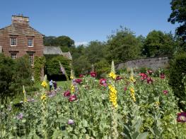
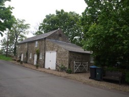
The Barn at Holwick
The converted Barn at Holnwick is in a quiet hamlet located within the beautiful North Pennines…

Cow Green
7.5 miles (12.1kms)
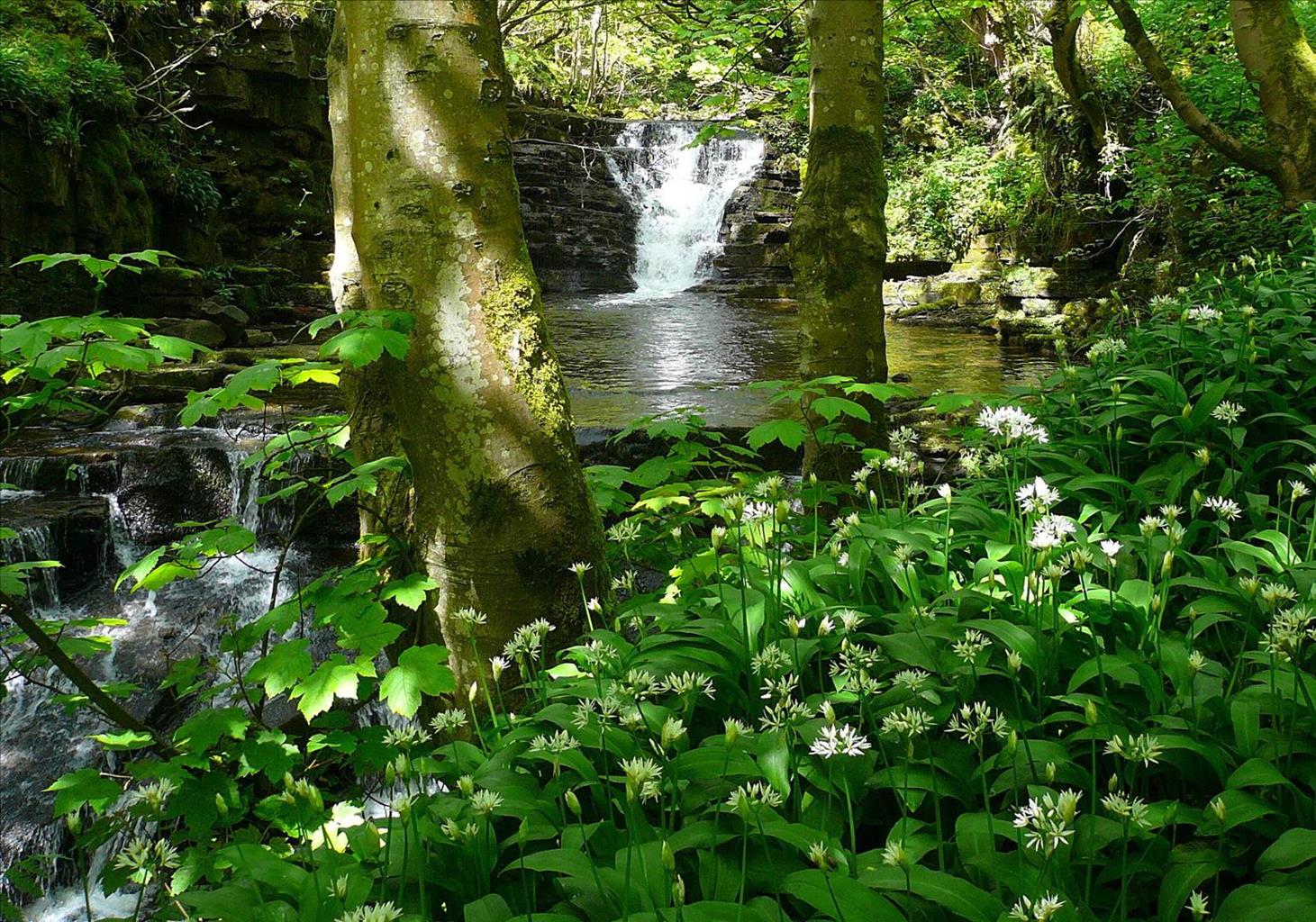
Cow Green was once a sleepy backwater of Upper Teesdale, a remote farming and lead-mining community. Here the Tees, barely down from its birthplace on the windswept expanses of Cross Fell, meandered in a wide heather and marsh basin. There were two famous views: the first, the Teesdale Wheel, where the Tees flowed in a huge circle, and the second, Cauldron Snout, lay just beyond, where the river thundered down dolerite cliffs in one of Britain’s most spectacular waterfalls.
It had long been known that the area was of great interest to botanists, and teams had often made pilgrimages here to see the unique collection of arctic alpine plants. In the 1950s and 60s there were rumours. Darlington needed more water and they had their eyes on Cow Green. Conservationists were up in arms. Letters were sent to The Times; scientists from all over the world protested that the site was just too valuable. Alfred Wainwright joined the protesters with the first edition of his little green Pennine Way Companion. He declared that to flood this land would be a desecration. A public enquiry was set up. Cow Green was chosen. Scientists and volunteers were allowed access to the site before flooding in order to remove specimens of the rare species and replant them above the proposed water line. By 1970 the dam had been built, the waters rose slowly, but surely, above the Teesdale Wheel until it was no more, and to the top of the concrete. Only Cauldron Snout survived.
What made Cow Green so special? It is believed to be the harsh climate and the presence of sugar limestone, a rock that has been baked by the intrusion of molten whin sill, the other predominant rock of the region. Behaving and looking like sand, its soils support a multitude of species including spring gentian, dog violet, thyme, harebell, shrubby cinquefoil, bird's-eye primrose and spring sandwort. The Teesdale violet only grows on Widdybank Fell, and tracts of juniper helped the survival of a large bird population.
The area is part of the Moor House-Upper Teesdale National Nature Reserve, which encompasses 18,285 acres (7,400ha) of the headwaters of the Tees. To begin, the route heads east over Widdybank Fell to join the Tees downriver. It’s a fascinating course, across the fields of lonely Widdy Bank Farm, through the meandering, ever tightening, valley of the Tees and between the jumbled rocks of Cronkley Fell and Falcon Clints. Each corner brings a new view, but each corner takes you further from civilisation, into a world of dark and dramatic heather hillscapes. The Tees is wide and shallow, and splashes over a bouldery bed, but the path is occasionally squeezed across rocky falls below Falcon Clints.
Then you come to Cauldron Snout. Cow Green Reservoir hasn’t stopped it foaming and it still thunders down those dolerite cliffs. An exciting path scrambles up by its side to the dam and continues above the eastern shore along a nature trail laid out by Natural England. Remember to pick up a booklet from the car park or Widdy Bank Farm for its interpretation.
From the car park walk back along the road across the desolate flank of Widdybank Fell, passing the old lead workings of Cow Rake Rigg. Crossing the watershed, the wide green sweep of Harwood Beck’s valley comes into view. Reaching the junction with the Harwood road, bear right, gently descending along the valley.
Approaching Harwood Beck, pass a stock barn and cross a side bridge and cattle grid before turning off right through a gate along a track to Widdy Bank Farm. Ahead the whin crags of Cronkley Scar rise above the opposite bank of the River Tees.
Go through the farmyard, cross a stile by a gate and joining the Pennine Way, head upstream on a grass track across rough grazing meadows beside the River Tees. Dwindling to a path the way continues over wet meadows below Widdy Bank, occasionally flagged or carried on duckboards over marshy sections.
Approaching Falcon Clints, the riverside apron narrows and the path clambers over rocks below the crags. Another meadow opens beyond, although the path stays at the foot of the clints before reaching more boulders.
Beyond, the valley opens once more and the path curves beneath the rocky scarp past the confluence of Maize Beck with the River Tees below Black Hill, which rises above the opposite bank. Turning the corner, the spectacle of Cauldron Snout is suddenly revealed, the water thundering and foaming through the narrow gorge over a series of giant steps. The path scrambles up beside them, its course revealed by rocks smoothed by the boots of countless Pennine wayfarers.
At the top of the falls you are confronted with the huge Cow Green dam. Ignore the footbridge taking the Pennine Way and turn right along a service drive rising beside the dam.
The track carries on above the eastern shores of the reservoir, passing the geological and plant-life features highlighted in the Natural England trail guide. Beyond a gate turn left and then subsequently right back to the car park.
Lane, track and riverside path, which is occasionally rugged, a short simple scramble beside the waterfall, 2 stiles
Moorland and rough pasture
Dogs should be kept on leads
OS Explorer OL31 North Pennines
Car park at Cow Green
Toilets open at car park during summer months
<p>Take care over rocky sections during wet or icy weather. </p>
Read our tips to look after yourself and the environment when following this walk.
County Durham reaches halfway across England, from the North Pennines in the west, to the sea in the east. Much of it is very sparsely inhabited, and is naturally beautiful; a mix of rolling hills, monumental valleys, lush farmland and unforgiving moors. It’s strong on industrial heritage as well, and remnants of the now all-but-vanished mining industry are everywhere.
The City of Durham has a magnificent Cathedral which can be traced back to the establishment of a church in the 10thcentury as the final resting place of the miraculous remains of Saint Cuthbert. The Cathedral, alongside the city’s Castle (an 11th-century structure that now houses University College), were created a UNESCO World Heritage Site in 1986. The area’s mining past is fully documented at the Durham Mining Museum; an amazing resource. Bishop Auckland is the other major settlement, and for centuries was run almost as an independent state by the powerful Bishops of Durham. These days it is still a bustling town with plenty of shops, historical interest and events like the annual food festival. The coastal town of Peterlee is unusual; it was set up as a new town to house Durham miners after WW2.
Discover more than 15,000 professionally rated places to stay, eat and visit from across the UK and Ireland.
Choose a place to stay safe in the knowledge that it has been expertly assessed by trained assessors.
Search by location or the type of place you're visiting to find your next ideal holiday experience.
Read our articles, city guides and recommended things to do for inspiration. We're here to help you explore the UK.