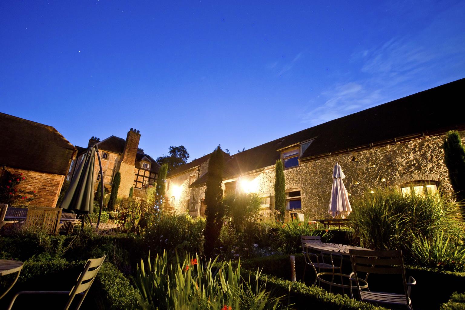


Folly View
Folly View is a comfortable two bedroomed, ground floor flat. It has it’s own garden with a…

Craven Arms
4.4 miles (7kms)
Craven Arms really does have hills on four sides: Hopesay Common and Wart Hill rise to the northwest, Callow Hill (the highest point of Wenlock Edge) to the northeast and View Edge to the southwest. Steepest of them all, and closest to the town, is Norton Camp. Given its commanding position, it’s no surprise to find there’s a hill-fort up there, just north of the highest point.
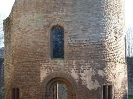
In fact, the Iron Age hill-fort at Norton Camp is one of the largest in Shropshire – the area within the ramparts being at least equal to Bury Ditches, for example – but it’s harder to appreciate as there’s no public access to the interior, which is used as farmland. The dense growth of trees on and around the ramparts also obscures any view of their structure, but you can at least appreciate the scale by walking around it. Technically, it’s a multivallate fort, with two complete ramparts, each with its associated ditch. Like Bury Ditches, it would have been a permanent settlement: the term ‘fort’ really doesn’t do it justice; ‘fortified village’ would be closer to the truth.
An ancient legend relates that long ago the land hereabouts belonged to two giants, probably brothers, one living on View Edge and one at Norton Camp. They kept their riches in a locked chest in the vaults below Stokesay Castle, but there was only one key, which they shared by throwing it back and forth between their respective hills. However, one day, one of them muffed his throw and the key fell into the castle moat. They tried for a long time to find it, and many others have tried since, but to no avail. So the chest is still there in the vaults, but no one can get in: for some unexplained reason it is also guarded by a huge raven. So they say.
It’s worth noting that one or two paths around Norton Camp can be rather overgrown in summer. Spring (for flowers) and autumn (for leaf colours) are often the best times for woodland walks anyway, but this would also be a good winter walk. There’s more chance to enjoy the distant views, and it's much easier to see the earthworks of the hill fort when the trees are bare.
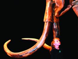
Walk past the left side of the Discovery Centre along a clear path into the Onny Meadows. Pass under wooden ‘mammoth tusks’ then, at a junction, turn left and shortly pass a community garden on your right. Join a tarmac lane, keeping straight ahead and then bearing right at a junction by a half-timbered house. At the end of the lane cross a footbridge over the River Onny.
Bear slightly right and pass right of two powerline poles. Just before the field corner turn right to cross a small footbridge then walk near the left edge of the next field, beside an old sunken track. Continue into a hedged track, which swings left around a farm and emerges into a lane.
Turn right. Pass the entrance to Norton’s Oak then turn left at a footpath sign. Follow the path climbing gently at first, then more steeply. As you enter Nortoncamp Wood, bear left just inside the edge, then bear right, climbing more steeply again on a sunken track. This bends right, still climbing, then back left as it levels out.
Keep ahead then bear right. The path is soon lined by rhododendron bushes. Keep straight ahead at a junction and shortly the path becomes a track. There are intermittent views on the left towards the Clee Hills, while on the right are the remains of the earthworks of Norton Camp.
The track arrives at a renovated house. Continue virtually straight ahead, between the house and a red-brick building. The track (sometimes overgrown) curves gradually rightward, still following the perimeter of the hillfort, until it reaches a signpost and stile.
Cross the stile and go left along a clear path close to an obvious craggy edge. Follow the path down the ridge then bear left to meet a track (Rotting Lane). Turn right and follow this downhill. Join a wider forest track and turn left; follow this track down, bending right to reach a T-junction.
Go right, passing the backs of houses, with the A49 below them. Continue along the track until it bends right and starts to climb again. Leave it here for a footpath down a field to a lane. Go left a few paces to the A49, cross, and turn right along the footway.
Cross a bridge over the Onny, then turn left (signs for Stokesay Castle). Very shortly turn right by a postbox on a tarmac path to a lay-by. Just beyond this, at a signpost, cross the A49 again to a waymarked path leading back to the Secret Hills Discovery Centre.
Good field and woodland paths, but those around Norton Camp may be overgrown in high summer, 5 stiles
Rolling fields and woodland
Good chance to run free in woodland
OS Explorer 217 The Long Mynd & Wenlock Edge
Secret Hills Discovery Centre on outskirts of Craven Arms
In Discovery Centre
Read our tips to look after yourself and the environment when following this walk.
Perhaps nowhere else in England will you find a county so deeply rural and with so much variety as Shropshire. Choose a clear day, climb to the top of The Wrekin, and look down on that ‘land of lost content’ so wistfully evoked by A E Housman. Peer through your binoculars and trace the course of Britain’s longest river as the Severn sweeps through the county, from the Breidden Hills to Wyre Forest, slicing Shropshire in two. To the north is a patchwork of dairy fields, hedgerows, copses and crops, broken at intervals by rugged sandstone ridges such as Grinshill or Nesscliffe, and dissected by a complex network of canals.
Spilling over the border into neighbouring Cheshire and North Wales is the unique meres and mosses country, with serenely smooth lakes glinting silver, interspersed with russet-tinged expanses of alder-fringed peat bog, where only the cry of the curlew disturbs the silence. South of the Severn lies the Shropshire Hills AONB. It’s only when you walk Wenlock Edge that you fully discover what a magical place it is – glorious woods and unexpectedly steep slopes plunge to innumerable secret valleys, meadows, streams and farmhouses, all tucked away, invisible from the outside world.
Discover more than 15,000 professionally rated places to stay, eat and visit from across the UK and Ireland.
Choose a place to stay safe in the knowledge that it has been expertly assessed by trained assessors.
Search by location or the type of place you're visiting to find your next ideal holiday experience.
Read our articles, city guides and recommended things to do for inspiration. We're here to help you explore the UK.