"How poor workmanship damned the lives of dozens."
Walk directions
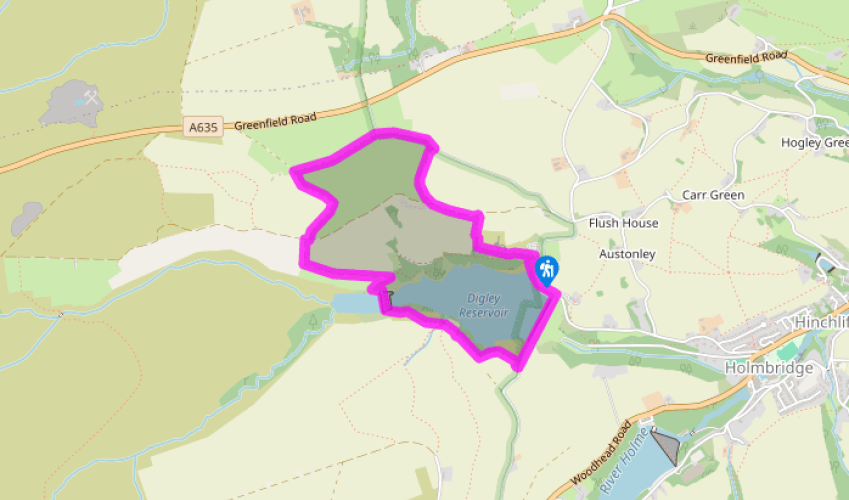
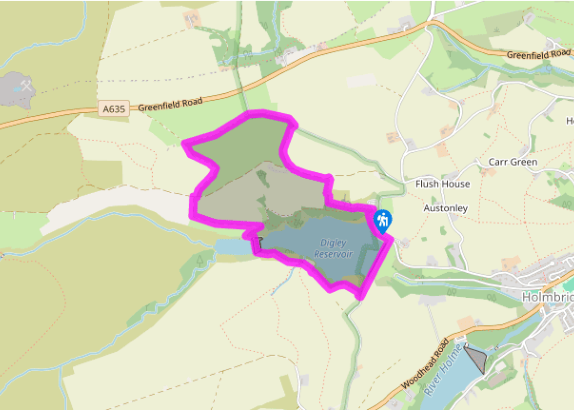
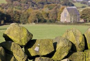
Take the ascending track to the side of the car park entrance. After 150yds (137m) take a path right, into an old quarried area. At a fork bear left, away from the quarry edge, soon swinging right up to a wooden stile by a bench. Ascend an enclosed path beyond to another stile. Cross that and continue for 20yds (18m), then turn left into a walled lane. The track forks after 250yds (229m); bear right, to a stile by a gate and into another walled lane. By an old quarry, 140yds (128m) later, the track becomes reedy but remains obvious and soon crosses a step stile into Acres Lane.
Turn left for 350yds (320m). When the road bends abruptly right, keep ahead over a stile by a metal gate and follow the lane beyond for 550yds (503m), down to a crossroads of tracks.
Turn left, into another walled lane, winding down to a wooden stile and into a staggered crossroads of tracks. Keep ahead, descending to a bench where a sharp turn right, off this track, has you zig-zagging down, passing through a metal gate, to cross the rebuilt wall of Bilberry Dam.
Bear left up a path that’s initially steep and bouldery, then sandy and well-defined. Pass through a redundant gate and swathes of bilberry and heather. Turn left through the next gate, onto a purpose-built path. Through a second gate, turn left beyond a small stream, off the waymarked path, and on to Yorkshire Water’s reservoir path. This contours easily across fields above the wooded reservoir edge. Beyond a third gate the path, now enclosed, heads through Digley South car park.
Turn left out of the car park, down Fieldhead Lane and across Digley Reservoir’s wall to turn left along Back Top Lane, past the eight-arched flow chamber of Digley Reservoir. About 150yds (137m) beyond that, step off the road through a wooden gate on your left, to return to the car park via a short flight of steps, away from traffic.
Terrain
- Good farm tracks and field paths; many stiles
Landscape
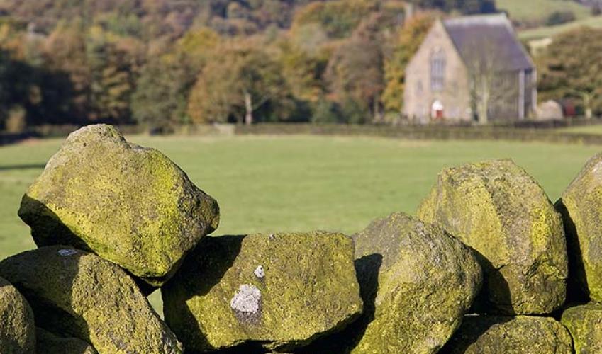
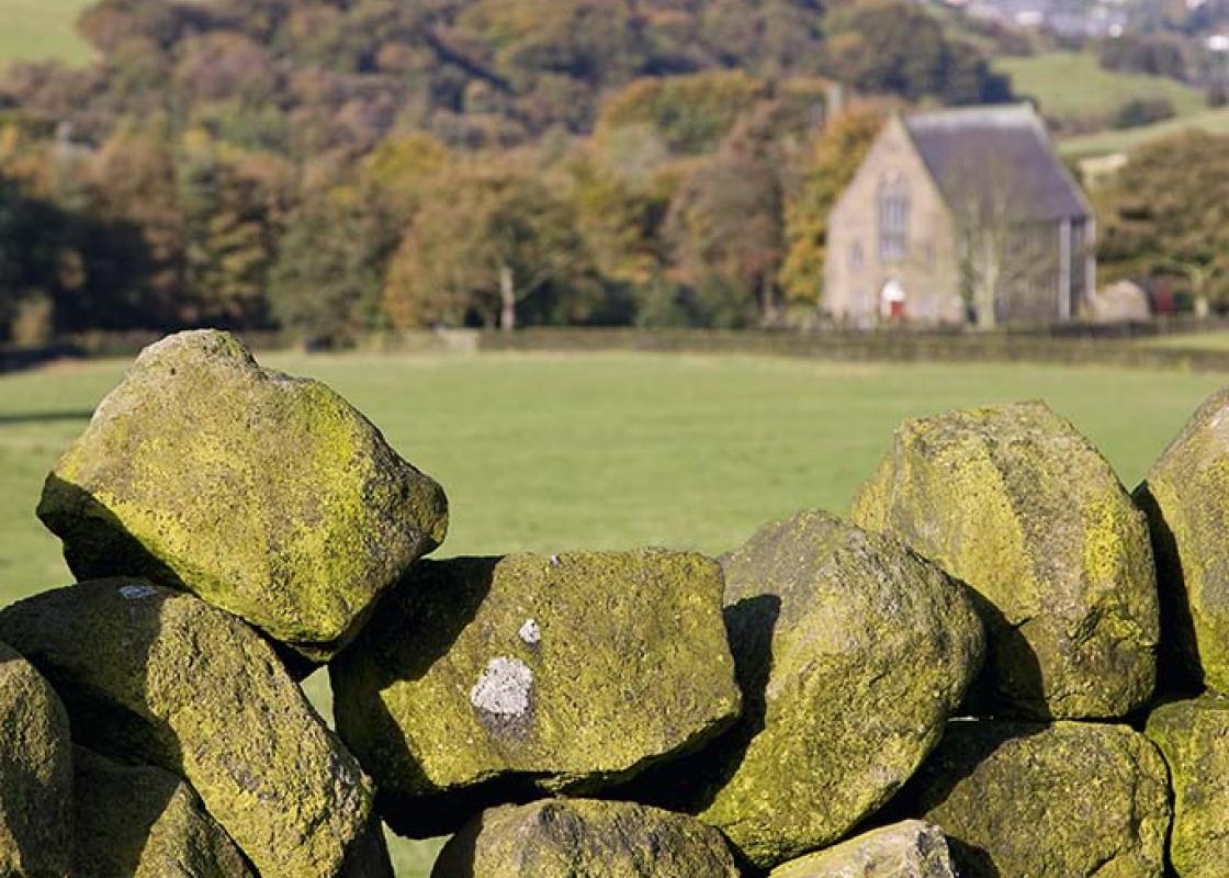
- Pastures, intakes and reservoir sides
Dog friendliness
- Dogs should be on lead near livestock
Parking
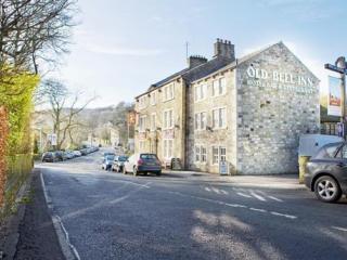
- Car park off Digley Royd Lane, near Holmbridge
Toilets en route
- None on route
About the walk
Digley Reservoir, which drains an area of some 14,000 acres (5,665ha) of moorland, is a relative newcomer as Pennine dams go, having been built in 1952. The reservoir it was built to supersede, however, earned a dark place in the history books, a century earlier. Bilberry Dam, which lies upstream... of Digley Reservoir, burst its embankment on 5 February 1852, causing one of the worst ever losses of life from a flood. Plans for Bilberry Dam were prepared in 1838 by engineer George Leather. Against his advice, the commissioners employed Messrs Sharp and Sons, of Dewsbury, who had submitted the lowest tender – £9,324 – to construct the dam. Leather wasn’t present when the embankment’s foundations were built but had misgivings about the work’s integrity. He frequently revisited the dam at his own expense after its completion in 1843, and was proven right: it leaked. His advice on repairs was, however, shrugged aside by the commissioners, on grounds of cost. In early February 1852, torrential rain saw water levels reach record heights. More than two inches (5cm) fell on the moors over 24 hours, and the reservoir had to cope with 633 million gallons (2,880 million litres) of water on top of its existing capacity. With one overspill channel blocked and the other overwhelmed, it became obvious to anxious observers that the dam was going to go, and alarms were raised. Shortly after midnight, a wall of water burst down Digley Clough and onwards into the towns and villages of the Holme Valley, wreaking destruction and terror: entire mills, dye houses, rows of cottages and bridges were swept away. Many people fled to higher ground but 81 people lost their lives, the UK’s fourth highest flood toll. In the Digley and Holme valleys, 7,000 people were put out of work. The disaster led to new laws dictating that only experienced and qualified engineers would be permitted to design dams. George Leather’s reputation was in tatters and his career ended. The commissioners, who had ignored his advice and allowed the mill to go into operation escaped prosecution, as they were effectively a government body. The inquest into the disaster however, noted they were ‘guilty of great and culpable negligence’.
"How poor workmanship damned the lives of dozens."
Walk details
1hr 5min
Difficulty:
Medium
Gradient:
Moderate
Distance:
2.5 miles (4.4kms)
Ascent:
465ft (142m)
Walk directions
Take the ascending track to the side of the car park entrance. After 150yds (137m) take a path right, into an old quarried area. At a fork bear left, away from the quarry edge, soon swinging right up to a wooden stile by a bench. Ascend an enclosed path beyond to another stile. Cross that and continue for 20yds (18m), then turn left into a walled lane. The track forks after 250yds (229m); bear right, to a stile by a gate and into another walled lane. By an old quarry, 140yds (128m) later, the track becomes reedy but remains obvious and soon crosses a step stile into Acres Lane.
1 of 5
Turn left for 350yds (320m). When the road bends abruptly right, keep ahead over a stile by a metal gate and follow the lane beyond for 550yds (503m), down to a crossroads of tracks.
2 of 5
Turn left, into another walled lane, winding down to a wooden stile and into a staggered crossroads of tracks. Keep ahead, descending to a bench where a sharp turn right, off this track, has you zig-zagging down, passing through a metal gate, to cross the rebuilt wall of Bilberry Dam.
3 of 5
Bear left up a path that’s initially steep and bouldery, then sandy and well-defined. Pass through a redundant gate and swathes of bilberry and heather. Turn left through the next gate, onto a purpose-built path. Through a second gate, turn left beyond a small stream, off the waymarked path, and on to Yorkshire Water’s reservoir path. This contours easily across fields above the wooded reservoir edge. Beyond a third gate the path, now enclosed, heads through Digley South car park.
4 of 5
Turn left out of the car park, down Fieldhead Lane and across Digley Reservoir’s wall to turn left along Back Top Lane, past the eight-arched flow chamber of Digley Reservoir. About 150yds (137m) beyond that, step off the road through a wooden gate on your left, to return to the car park via a short flight of steps, away from traffic.
Terrain
- Good farm tracks and field paths; many stiles
Landscape
- Pastures, intakes and reservoir sides
Dog friendliness
- Dogs should be on lead near livestock
Parking
- Car park off Digley Royd Lane, near Holmbridge
Toilets en route
- None on route
About the walk
Digley Reservoir, which drains an area of some 14,000 acres (5,665ha) of moorland, is a relative newcomer as Pennine dams go, having been built in 1952. The reservoir it was built to supersede, however, earned a dark place in the history books, a century earlier. Bilberry Dam, which lies upstream... of Digley Reservoir, burst its embankment on 5 February 1852, causing one of the worst ever losses of life from a flood. Plans for Bilberry Dam were prepared in 1838 by engineer George Leather. Against his advice, the commissioners employed Messrs Sharp and Sons, of Dewsbury, who had submitted the lowest tender – £9,324 – to construct the dam. Leather wasn’t present when the embankment’s foundations were built but had misgivings about the work’s integrity. He frequently revisited the dam at his own expense after its completion in 1843, and was proven right: it leaked. His advice on repairs was, however, shrugged aside by the commissioners, on grounds of cost. In early February 1852, torrential rain saw water levels reach record heights. More than two inches (5cm) fell on the moors over 24 hours, and the reservoir had to cope with 633 million gallons (2,880 million litres) of water on top of its existing capacity. With one overspill channel blocked and the other overwhelmed, it became obvious to anxious observers that the dam was going to go, and alarms were raised. Shortly after midnight, a wall of water burst down Digley Clough and onwards into the towns and villages of the Holme Valley, wreaking destruction and terror: entire mills, dye houses, rows of cottages and bridges were swept away. Many people fled to higher ground but 81 people lost their lives, the UK’s fourth highest flood toll. In the Digley and Holme valleys, 7,000 people were put out of work. The disaster led to new laws dictating that only experienced and qualified engineers would be permitted to design dams. George Leather’s reputation was in tatters and his career ended. The commissioners, who had ignored his advice and allowed the mill to go into operation escaped prosecution, as they were effectively a government body. The inquest into the disaster however, noted they were ‘guilty of great and culpable negligence’.