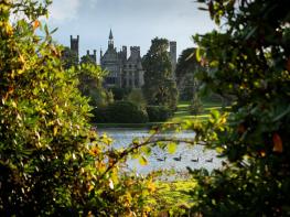


The Izaak Walton Hotel
Often it is claimed that a property is in an idyllic location; this could not be truer than for…

A lovely walk along the river Dove then over hilly fields near Stanshope.
Dovedale
5.4 miles (8.7kms)
There’s drama from the start as you follow the River Dove, travelling through a narrow gorge between Bunster Hill and the towering Thorpe Cloud. There are stepping stones to cross, then a limestone path climbs to a bold rocky outcrop above the river. Lovers’ Leap has a fine view across the dale to the Twelve Apostles. In keeping with the name, in 1761 an Irish dean and his lady companion, who were out horse-riding, fell off the rock. The dean died of his injuries, but the lady survived to tell the tale.
The Dove writhes round another corner. Above your head, fingers of limestone known as the Tissington Spires rise out from thick woodland cover. On the right there’s a splendid natural arch, which is just outside the entrance to the historic Reynard’s Cave. The dale’s limestone walls close in as boardwalk eases the way by the rushing river. As the valley opens out again two gigantic rock stacks face each other across the Dove. Pickering Tor has a small cave at its foot. A little footbridge allows you across to the other side to the foot of Ilam Rock. This 80ft (24m) leaning thumb of limestone has an overhang on the south side that’s popular with climbers. It also has a cave at the bottom, which is only 6ft (2m) at the entrance, but opens out to over 30ft (9m) inside. You will get a better view of them when you cross the little footbridge to the cave at the foot of the rocks. On this side you’re in Staffordshire and the paths are generally less populated. The continuing walk into Hall Dale heralds a less formal landscape. The dry dale climbs up the hillside past ancient woodland called Hurts Wood. Soon you’re walking down a quiet lane with Ilam and the Manifold Valley on your right and Bunster Hill on your left. A path takes you across the shoulder of the hill, across the ridge and furrow of a medieval field system, then back into the valley of the Dove.
Take the dead-end lane up the west bank of the River Dove. Cross the stepping stones then turn left along the wide footpath which wanders through the pretty wooded dale between steep-sided limestone crags.
The path climbs some steps up to Lovers’ Leap, then descends past Tissington Spires and Reynard’s Cave. The dale narrows over boardwalk and past a cave, before rising slightly over a short, polished limestone section.
The dale widens again. Leave the main track for a path to Stanshope, crossing the Ilam Rock footbridge and following a narrow woodland path on the far bank. Ignore a path junction (‘Ilam, steep ascent’) after 200yds (183m). Cross a stile then bend left into Hall Dale, following the dry valley bottom up out of the woods into a rugged limestone-cragged gorge.
As the gorge becomes shallower, you enter pastureland with the attractive village of Stanshope now on the skyline. Ignore a path to the left by a stile then take the next path left (at Point B). Cross one field heading due south then follow a wall as it bends to the right in the next. At a shady tree, at the start of the next field, veer diagonally left and uphill. Go straight ahead in the next field for 50yds (46m) then diagonally right across a third to a country lane.
Turn left to walk along the lovely quiet lane (Ilam-Moor Lane), enjoying magnificent views across the Manifold Valley down to the right and towards Bunster Hill ahead.
After roughly 800yds (732m) and immediately before a farm drive entrance (Ilamtops Farm) cross a stile. Head across the drive to a second stile, then veer gently right from the drive and fractionally downhill over grassy pasture to the top of Moor Plantation woodlands. Cross a stile into access land and continue descending across the next field.
The main route (too experienced walkers only) contours across the hillside over a challenging section and through a notch in the hillside before descending steeply to the edge of access land above pasture. Head left and follow the wall line, eventually emerging onto the Dovedale Lane opposite the gauging station. Turn right to return to the car park.
The alternative route: One field beyond the end of Moor Plantation woods, fork right and down into a shallow grassy valley. Cross a tall stile on to a farm track, then turn left at a junction by a house. The track runs above a lane, skirting beneath Bunster Hill. Head uphill along the edge of access land, bending right with the line of the wall to the Dovedale Lane and car park.
Good paths, lanes, fields, polished limestone, one rough rocky eroded section, some stiles including tall stile on alternative route
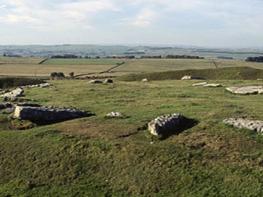
Partially wooded dales and high pastures, caves
Dogs should be kept on lead
OS Explorer OL24 Peak District – White Peak Area
Dovedale pay car park, between Ilam and Thorpe
At car park (small charge), Milldale
Seasonal flooding risk: a section on Bunster Hill contains an eroded rough rocky section of bare polished limestone that can be slippery in dry weather and treacherous in wet conditions and is not recommended for inexperienced walkers (please follow the alternative route)
Read our tips to look after yourself and the environment when following this walk.
It was Staffordshire that bore the brunt of the largest non-nuclear explosion of World War II, when a munitions dump at RAF Fauld went up in 1944. It was also the county’s regiment that once boasted within its ranks the most decorated NCO of World War I, in the person of William Coltman (1891-1974). Going back a little further, George Handel penned his world-famous masterpiece The Messiah on Staffordshire soil. During another chapter of Staffordshire history, the county was home to the first canals and the first factory in Britain, and it had front-row seats for the drama surrounding one of the most notorious murder trials of the 19th century, that of Doctor William Palmer.
In outline, Staffordshire looks not unlike the profile of a man giving Leicestershire a big kiss. The man’s forehead is arguably the best region for hillwalking, as it comprises a significant chunk of the Peak District. This area is characterised by lofty moors, deep dales and tremendous views of both. Further south are the six sprawling towns that make up Stoke-on-Trent, which historically have had such an impact on Staffordshire’s fortunes, not to mention its culture and countryside. This is pottery country, formerly at the forefront of the Industrial Revolution and the driving force behind a network of canals that still criss-cross the county.
Discover more than 15,000 professionally rated places to stay, eat and visit from across the UK and Ireland.
Choose a place to stay safe in the knowledge that it has been expertly assessed by trained assessors.
Search by location or the type of place you're visiting to find your next ideal holiday experience.
Read our articles, city guides and recommended things to do for inspiration. We're here to help you explore the UK.