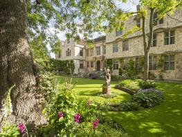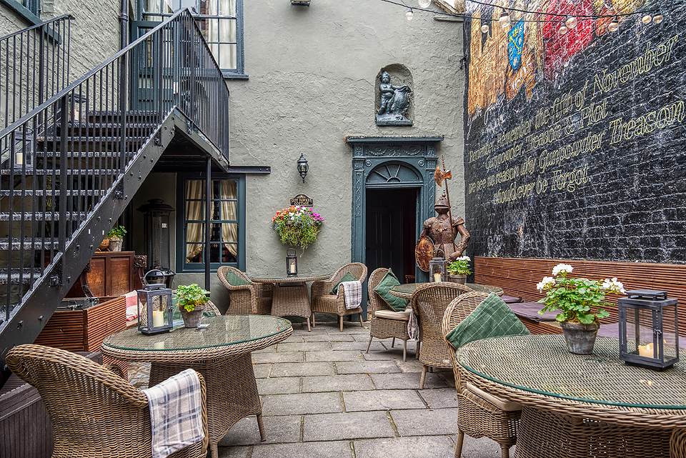

Heritage Escapes - The York Old Brewery
The York Old Brewery consists of three stunning city centre holiday apartments located adjacent…

Beginning with a quick tour of York’s historic city centre, the route heads out beside the River Ouse before swinging west on a Roman Road to Tadcaster
York
12.6 miles (20.3kms)
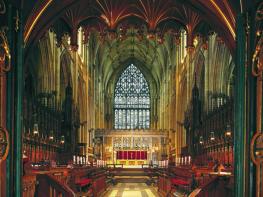
The Romans called York ‘Eboracum’, hence the Ebor Way, but as you will see on your route through York the name has been appropriated by plenty of enterprising businesses and local events since. The first part of the walk is along the medieval walls, which were originally Roman and are still remarkably intact. They encircle the old city and are almost three miles long, passing very close to The Minster on the northern side. A popular riverside path beside the Ouse leads out to the former Archbishops’ palace at Bishopthorpe, from where the Ebor Way swings abruptly west across to cross fields between villages on route to Tadcaster along the course of an old Roman Road. Progress is briefly interrupted by the busy A64 dual carriageway, negotiated by a bridge.
Monk Bar was one of the four main gateways into the city of York in medieval times. Go under the bar, turn left up the steps and left again to walk along the elevated walls. There are excellent views of the Minster and the Treasurer’s House as you walk to Bootham Bar and descend into Exhibition Square. Walk on past the Theatre Royal and turn right along Museum Street to cross Lendal Bridge. Immediately after crossing the river, turn right, back on to the walls, to walk to Micklegate Bar.
Continue on the city walls over Victoria Bar, an opening cut in the walls in 1838. When the opening was cut, a former gateway from medieval times was discovered. This part of the walk ends when you descend to the road below Baile Hill. This hill was the site of one of William the Conqueror’s early castles which defended the River Ouse. Turn right and cross over the busy road at the pedestrian crossing, and turn left down to the river beside Skeldergate Bridge.
The Ebor Way turns right along the western bank of the Ouse, past flats and then a camping and caravan park. On the opposite bank is the Minster Way, a 50-mile (80km) footpath linking York and Beverley Minsters. Continue along the riverbank, passing under the York bypass. As the path approaches Bishopthorpe, the palace comes into sight beside the river. At one time there was a custom whereby vessels passing the palace gave a salute, and a can full of ale was lowered to the deck for the crew. The palace was originally built in the 13th century by Walter de Grey, as a residence for the Archbishops of York. Shortly before Bishopthorpe, the path turns right to reach the road.
Turn left, passing the palace grounds near to the gatehouse. The gardens are occasionally open to the public. Turn right beyond the palace and walk through the village, passing three pubs, including one appropriately called The Ebor. At the junction, bear to the right of the school along Copmanthorpe Lane and at the end of the road continue straight on to a small footbridge at the far end.
Turn right, then left along the edge of the fields, following a line of telegraph poles. This leads to the main railway line. Warning of approaching trains is given by red and green lights beside the track. Cross the railway with care, turn left beside the line and take the third street on the right, Sawyers Crescent, then the second street on the left off Farmers Way; a short street that soon turns into a stoney path. After a gate, fork left, join a road, then eventually turn right past the shops to The Royal Oak on the corner. Turn right, then left along School Lane, then right on Manor Heath and finally left on Colton Lane to leave Copmanthorpe.
The Ebor Way now follows the course of an old Roman road. After about a mile (1.6km) the road turns sharp left. Continue more or less straight ahead, through a small gate and beside a hedge. At the far end you emerge at a road junction.
Turn sharply right and walk along the pavement of the road bridge across the A64 towards Bilbrough, following Ebor Way waymarks. On the far side head west along the A64 on the walkway set back from the busy road.
Just after the Little Chef restaurant, bear right down a lane. This eventually leads to a minor road on the outskirts of Tadcaster. Turn left, then right, to walk into the centre of the town.
Residential streets, riverside and field paths, quiet tracks (including former Roman Road)
City centre and then more rural
On lead on pavements; and dogs are not allowed on the city walls, so follow adjacent streets
Monk Bar, Foss Bank or Union Terrace pay-and-display car parks, York
York city centre (numerous locations) and Tadcaster town centre
<p>Children must be closely supervised on the high city walls, which have unguarded edges, and at the railway crossing at Copmanthorpe.</p>
Read our tips to look after yourself and the environment when following this walk.
Discover more than 15,000 professionally rated places to stay, eat and visit from across the UK and Ireland.
Choose a place to stay safe in the knowledge that it has been expertly assessed by trained assessors.
Search by location or the type of place you're visiting to find your next ideal holiday experience.
Read our articles, city guides and recommended things to do for inspiration. We're here to help you explore the UK.