Tarn House Holiday Park
Tarn House Holiday Park is a pet friendly park located just one mile from the centre of…

A steep climb leads up to a rocky summit with far-reaching views.
Embsay
3.25 miles (5.3kms)
Barden Moor is a broad swathe of heather moorland, largely managed for grouse and also valued as a water catchment area. As well as the small Embsay Reservoir there are two larger reservoirs on the moor. Owned by the Bolton Abbey Estate, the moor has been open for public access since 1968. Its fringe of gritstone crags is popular with rock-climbers, while its wide open spaces offer some tough but rewarding walks.
The climb to Embsay Crag, though steep in places, is one of the easiest ways to get a taste of this expanse. The Crag’s rocky summit is attractive in itself and offers a great view, not only over the southern flanks of the moor but extending far and wide. The rooftops of Skipton, the sweep of the Ribble Valley and the distinctive outline of Pendle Hill all compete for attention.
In the early stages of the Industrial Revolution there were six water-driven spinning and weaving mills in Embsay and Eastby. The development of the Leeds and Liverpool Canal encouraged a shift to larger mills in nearby Skipton, and this was reinforced by the arrival of railways.
Several mills remain, though mostly turned to other uses – for instance, one is now a large handicraft centre. The walk passes a millpond which was used to control the water supply to this and other mills in the village. Higher up the track to the reservoir you’ll also spot a mill chimney on the right: this was the Crown Spindle Mill.
Embsay Reservoir is more recent, being constructed in the early 20th century. It’s owned by Yorkshire Water, and there’s a straightforward, waymarked, one-mile (1.6km) circular walk around it. The reservoir is also home to Craven Sailing Club and is used for fly-fishing, being regularly stocked with both rainbow trout and brown trout.
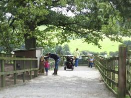
Go through a gate at the back of the car park, and bear left to a stile in the far corner of the field. Bear slightly right to a gate in a hedge, then walk along just above school grounds. Continue along the fence to a stile in a stone wall, and cross a track to a stile in a fence. Cross a field (look out for horses) to a stile.
Bear slightly right, go round the curve of a hedge and find another stile at the angle of two walls. Go straight ahead to a stile beside a gate, and ahead again to a stile and steps down to a lane, with a millpond on the far side. Turn right up the lane and follow it for about 700yds (640m), through a right-hand bend and then a left-hand bend, to pass the reservoir car park.
Soon the lane becomes a track. Follow it up to the level of the dam, past the sailing club and beside the reservoir, then up slightly to a gateway, where it emerges onto open moorland.
Go ahead a few paces. Then, as the track starts to curve left, turn right on a smaller track (bridleway sign). Follow this for 250yds (229m), then fork right to follow the reservoir wall near some trees. Dip down to cross a bridge, then follow the path, soon moving away from the wall again. There are blue-topped marker posts; these can disappear when the bracken is high, but the path itself is always clear. Embsay Crag rises steeply ahead.
Keep straight on up the main path as it climbs more steeply onto the upper slopes. (A less steep alternative goes left, to curve around to the top of the crag.) The final stretch is very steep. Finally emerge onto the summit.
Continue on the path, gradually descending and bearing right to meet a wall. Turn right through a gate by a signpost (footpath and bridleway to Eastby). Walk down a field, with a wall on your right, to go through a gate by the top of a wood then down the track along its left-hand side. Near Bondcroft Farm, a 4x4 specialist, meet a tarmac track at a gate and continue ahead on it.
Emerge onto a road. Turn left and walk with care (narrow verges), with houses on the left, for 250yds (229m). Shortly before the first house on the right, turn right onto a footpath signed to St Mary’s Church. This soon bears right to cross two fields. Meet the road near Embsay Church.
Cross, turn left and walk down the pavement to a gate and footpath sign by the entrance to a house. Cross the field diagonally to the far corner and go over a stile. Follow a path to a stile, then continue down the field to the gate back into the car park.
Fields, lanes and tracks leading to some steep rough paths on the heights; many stiles
Heather moors and gritstone crags above green pastures and villages
Dogs are not allowed in the access land on Barden Moor (between Points 4 and 7)
OS Explorer OL2 Yorkshire Dales, Southern & Western Areas
Free car park in Embsay, near Elm Tree Inn
None on route
<p>Parts of Barden Moor may be closed during the shooting season (August and September) or when there is high fire risk</p>
Read our tips to look after yourself and the environment when following this walk.
North Yorkshire, with its two National Parks and two designated Areas of Outstanding Natural Beauty, is England’s largest county and one of the most rural. This is prime walking country, from the heather-clad heights of the North York Moors to the limestone country that is so typical of the Yorkshire Dales – a place of contrasts and discoveries, of history and legend.
The coastline offers its own treasures, from the fishing villages of Staithes and Robin Hood Bay to Scarborough, one time Regency spa and Victorian bathing resort. In the 1890s, the quaint but bustling town of Whitby provided inspiration for Bram Stoker, who set much of his novel, Dracula, in the town. Wizarding enthusiasts head to the village of Goathland, which is the setting for the Hogwarts Express stop at Hogsmeade station in the Harry Potter films.
York is a city of immense historical significance. It was capital of the British province under the Romans in AD 71, a Viking settlement in the 10th century, and in the Middle Ages its prosperity depended on the wool trade. Its city walls date from the 14th century and are among the finest in Europe. However, the gothic Minster, built between 1220 and 1470, is York’s crowning glory.
Discover more than 15,000 professionally rated places to stay, eat and visit from across the UK and Ireland.
Choose a place to stay safe in the knowledge that it has been expertly assessed by trained assessors.
Search by location or the type of place you're visiting to find your next ideal holiday experience.
Read our articles, city guides and recommended things to do for inspiration. We're here to help you explore the UK.