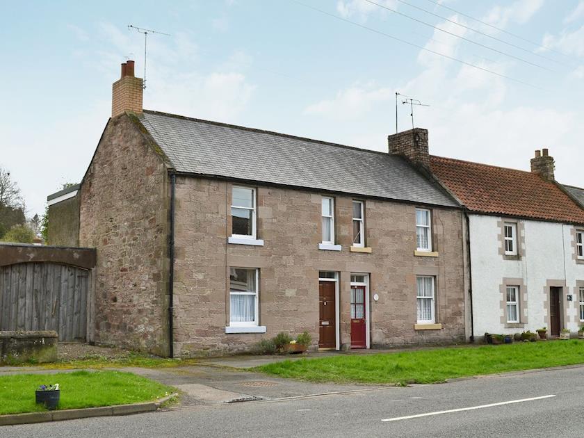


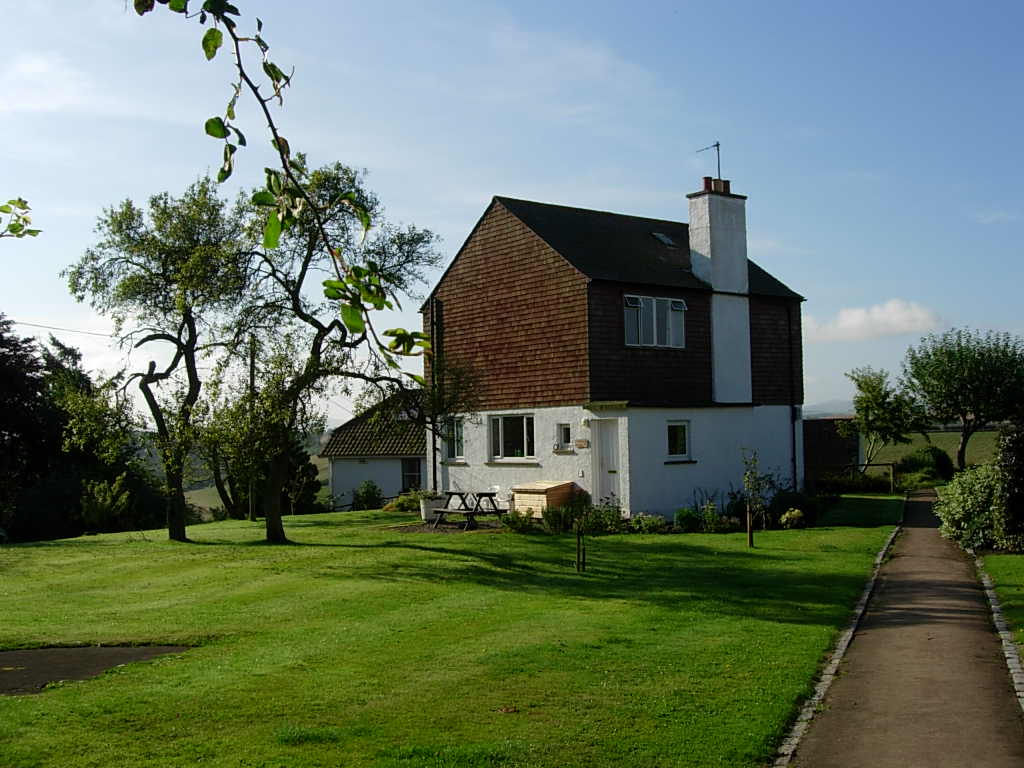
Orchard Cottage and Border View Cottage
This beautiful cottage, designed by Sir Basil Spence (architect of the rebuilt Coventry…

Etal
5.25 miles (8.4kms)
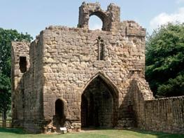
Although Etal and Ford are peacefully united under the ownership of the Joiceys, history reveals a bitter feud between the two families that originally held them. With the establishment of Norman rule in the North, the manors of Etal and Ford were granted sometime in the 12th century to the Manners and the Herons respectively. It seems that conflict arose out of a power struggle between them, which finally came to a head in 1428, when William Heron was killed in an affray at Etal Castle. His widow accused John Manners of maliciously killing her husband, and although John subsequently forked out a hefty compensation to Mrs Heron, the feud rumbled on for another 10 years.
The first manors would have been little more than stout wooden structures, surrounded by palisades as defence against intruders, with stone buildings appearing later only as means allowed. The Herons were the first to be granted a licence to crenellate, in 1341, and the Manners soon followed, building up their existing hall into the tower house that still stands at Etal's northwestern corner, and adding the enclosing walls and gatehouse a little later.
The two castles suffered many attacks from marauding bands, with Ford being largely destroyed in 1385. But it was not until 1513 that real trouble arrived, when a force of 30,000 Scots appeared with James IV at its head, after taking the castles at both Norham and Wark. The defence at Etal collapsed after a brief bombardment and the capitulation of Ford quickly followed.
For whatever reason, James seems not to have pressed home his advantage, for he lingered a few days at Ford, allowing the Earl of Surrey vital time to bring an army north. They met days later at Flodden and, although heavily outnumbered, the English routed the Scots, killing James along with many of his nobles. Etal, now back in English hands, was used to store the captured Scottish artillery that James had hauled south with his army.
As the century progressed, the area settled down and the need for stark fortifications became a thing of the past. Etal deteriorated and was finally abandoned as a home. The Carrs, its then owners, built a mansion to the east of the village in 1748, while Ford was remodelled shortly after as a grand country house. The two villages have developed very different characters, Ford portraying the best of early 19th-century town planning, while Etal gives the impression of a romantic pastoral age. Yet these pretty cottages are in fact newer than those at Ford. Although remodelled when the Carrs built their grand house, by the late 19th century, Etal's quaint thatched cottages had become totally insanitary, and when Lord Joicey bought the estate in 1907, he had them completely rebuilt.
Walk through the village to the main road and turn right towards Ford. Follow the road for 0.25 miles (400m) to the end of the pavement at a junction.
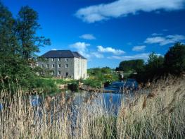
Cross to double gates opposite, from which a cycleway runs parallel to the road to Heatherslaw. Emerging beside a car park, walk out to a junction by Heatherslaw Station. Cross a bridge over the river and follow the ongoing lane past Heatherslaw Mill.
After the right-hand bend, just past Heatherslaw Farm, leave through a five-bar gate on the left, signed ‘Ford Bridge’. Bypass a shed to a second gate and then bear right towards another gate in the far corner of the field by the river. Continue above the Till to Ford Bridge and leave the bank onto a lane. Carefully cross and head left over the bridge to a junction.
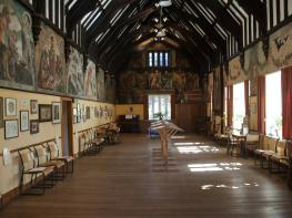
To the right, the main road winds up to Ford. Go past the entrances to the church and Ford Castle before turning off left into the village. At the bottom, opposite Lady Waterford Hall, turn right up to a junction in front of Jubilee Cottage.
Walk left, the lane winding past Horseshoe Cottage with its unusual doorway, and later, the former stable block, which now serves as estate offices.
As the lane then bends right, bear off left along a woodland path signed to Hay Farm. It leads down to a bridge over a small stream. Climb beyond to a gate and go left above the wood. Ignore the gate in the field corner and instead swing right, climbing to the top of the field. Leave through a gate on the left and walk out beside a neglected corner onto the end of a track by Hay Farm cottages.
Walk past the cottages and turn first right beside barns. At the end go right again, but leave after 20yds (18m) through a gate on the left by a sign to Heatherslaw and Letham Hill. Head to a powerline post and then swing right down the edge of a large field. Go through a gate at the bottom, drop to a footbridge and climb into another field. Swing left along the boundary to a junction in the corner.
Following a fingerpost to Letham Hill, turn right. A track develops towards the far end of the field, leading past a timber yard and farm buildings to emerge onto a lane opposite Letham Smithy. Go left to meet the main road and turn right, retracing your outward route to Etal.
Lanes, tracks and field paths; no stiles
Undulating farmland broken by small woods and copses
Stock fields and game coverts, so keep dogs on leads
OS Explorer 339 Kelso & Coldstream
Free car park by Etal Castle
At Etal Castle, Heatherslaw Mill and in Ford village
Read our tips to look after yourself and the environment when following this walk.
If it’s history you’re after, there’s heaps of it in Northumberland. On Hadrian’s Wall you can imagine scarlet-cloaked Roman legionaries keeping watch for painted Pictish warriors while cursing the English weather and dreaming of home. Desolate battlefield sites and hulking fortresses such as Alnwick, Dunstanburgh, Bamburgh and Warkworth are reminders that this, until not so very long ago, was a contested border region. The ruins of Lindisfarne bear witness to the region’s early Christian history.
Northumberland also has some of Britain’s best beaches. On summer days, and even in winter, you’ll see surfers and other brave souls making the most of the coast. Inland, there are some great walks and bike rides in the dales of the Cheviot Hills and the Simonsides – just hilly enough to be interesting, without being brutally steep. There's dramatic scenery in the High Pennines, where waterfalls plunge into deep valleys, and there are swathes of heather-scented moorland. Northumberland National Park covers over 400 square miles of moorland and valleys with clear streams and pretty, stone-built villages. It’s just the place for wildlife watching too. You’ll find flocks of puffins, guillemots and other seabirds around the Farne Islands, and seals and dolphins offshore.
Discover more than 15,000 professionally rated places to stay, eat and visit from across the UK and Ireland.
Choose a place to stay safe in the knowledge that it has been expertly assessed by trained assessors.
Search by location or the type of place you're visiting to find your next ideal holiday experience.
Read our articles, city guides and recommended things to do for inspiration. We're here to help you explore the UK.