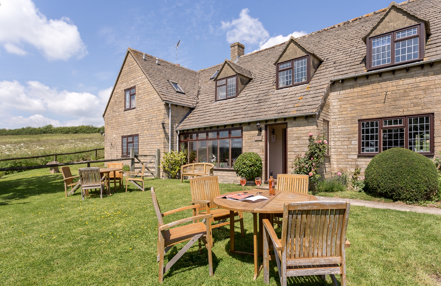


The Fox at Oddington
The Fox at Oddington is a delightful country inn that combines tradition with modern comforts.…

Embracing the legacies of Warren Hastings and the poet Edward Thomas.
Adlestrop
5 miles (8kms)
You may not know the name Warren Hastings but he played a prominent role in the British Empire. Born in the nearby village of Churchill in 1732, he spent much of his childhood in Daylesford, where his grandfather was rector. When debt forced the sale of the manor, Hastings was sent to London for a career in commerce. He joined the East India Company, which had become the de facto ruler of India, and by 1773 he was Governor-General of Bengal with the specific remit of cleaning up the corruption that was rife among the ruling classes. His methods were draconian but considered effective. Upon his return to England, he used his savings to repurchase Daylesford, where he died in 1818. The years before his death were bitter. A change in attitude to harsh colonialist methods meant that Hastings was impeached for corruption. The seven-year trial ruined him and his health, although he was eventually made Privy Councillor to George III.
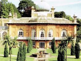
Daylesford House was rebuilt by Hastings to the design of the architect Samuel Cockerell, a colleague at the East India Company. The building is in a classical style with Moorish features. The parkland around Daylesford House was laid out in 1787 by the landscape gardener Humphrey Repton in the spacious style of the day, made popular by Lancelot ‘Capability’ Brown. The village grew out of a need for cottages for estate workers. Similarly, Daylesford church was rebuilt by Hastings in 1816 as a place of worship for the estate workers. By 1860 the congregation had outgrown the church, so it was redesigned to accommodate it. Inside there are monuments to the Hastings family, while Warren Hastings’ tomb lies outside the east window.
This small rural village has come to be associated the poem by the war poet, Edward Thomas (1878–1917). Called simply ‘Adlestrop’, the poem captures a single moment as a train halts briefly at the village’s station. Its haunting evocation of the drowsy silence of a hot summer day is all the more poignant when it is borne in mind that Thomas was killed by an exploding shell at Ronville near Arras in April 1917. Though trains still run on the line, the station was closed in 1964. The station sign now decorates a bus shelter, and the station bench has the poem inscribed upon it.
From the car park at the village hall turn left along the road. Pass a road on the right, the bus shelter bearing the Adlestrop sign, and some houses. Some 200yds (183m) after another road, turn right over a stile. Follow a woodland path to the left. Continue on this path until it meets a gate at a road.
Cross the road with care and turn left along the verge. Before a road on the right, and after West Lodge, turn right through a wooden gate onto a path in the Daylesford Estate. The path curves left to a post-and-rail fence. Turn right alongside it as it curves to the drive. Turn left onto the drive, flanked by poplar trees, and after 100 paces, turn left between post-and-rail fences.
Follow these to cross a bridge and follow a tree-lined avenue towards buildings. Traverse the farmyard and then turn right at Daylesford Hill Farm Cottage, passing the estate office.
Walk along the drive between paddocks, which soon begins following the estate wall. Pass the gardens office gate and, as the wall goes sharp right, stay on the drive to reach a road. Turn right at a gate.
Don’t go out onto the road but turn right and walk along a short fenced section beside a hedge to emerge opposite Daylesford Organic Farm. Turn right and walk along the road to Daylesford estate village. Opposite the drive to Daylesford House is a path leading to Daylesford church. After visiting the church, return to the road, turn right and retrace your steps. About 95 paces beyond the phone box, turn right through a kissing gate.
Cross this field to a gate. Turn right onto a track and cross a railway footbridge. Curve along the track to cross an iron lattice-sided footbridge over the stream. In 75yds (69m), turn right off the track through a kissing gate, and then left by the hedge to walk parallel to the track. At the end of the field turn left through a gate back onto the track, through another gate and then right, beyond the hedge. The path follows two sides of the field to a gate into a copse in the far corner.
At a track through the trees turn right and pass Oddington Church. Continue, now on tarmac, to a junction in the village, and turn right. Pass The Fox pub and go to another junction. Turn right and walk on the pavement. Where it ends, cross the road carefully to the pavement opposite.
Beyond the railway bridge, turn left along the Adlestrop road and turn immediately right through two kissing gates. Walk through Adlestrop Park, skirting to the right of the cricket pitch and head for a kissing gate to its right, which is in a tree gap.
Follow the track through a kissing gate and past Adlestrop’s St Mary Magdalene Church. At the next junction, turn left through the village until you reach the bus stop. Turn left here to return to the car park where you began your walk.
Track, field and road
Rolling fields, woodland and villages
Some livestock and one busy roadside
OS Explorer OL45 The Cotswolds
Village Hall car park in Adlestrop (donation requested)
None on route
Read our tips to look after yourself and the environment when following this walk.
Gloucestershire is home to a variety of landscapes. The Cotswolds, a region of gentle hills, valleys and gem-like villages, roll through the county. To their west is the Severn Plain, watered by Britain’s longest river, and characterised by orchards and farms marked out by hedgerows that blaze with mayflower in the spring, and beyond the Severn are the Forest of Dean and the Wye Valley.
Throughout the county you are never far away from the past. Neolithic burial chambers are widespread, and so too are the remains of Roman villas, many of which retain the fine mosaic work produced by Cirencester workshops. There are several examples of Saxon building, while in the Stroud valleys abandoned mills and canals are the mark left by the Industrial Revolution. Gloucestershire has always been known for its abbeys, but most of them have disappeared or lie in ruins. However, few counties can equal the churches that remain here. These are many and diverse, from the ‘wool’ churches in Chipping Campden and Northleach, to the cathedral at Gloucester, the abbey church at Tewkesbury or remote St Mary’s, standing alone near Dymock.
Discover more than 15,000 professionally rated places to stay, eat and visit from across the UK and Ireland.
Choose a place to stay safe in the knowledge that it has been expertly assessed by trained assessors.
Search by location or the type of place you're visiting to find your next ideal holiday experience.
Read our articles, city guides and recommended things to do for inspiration. We're here to help you explore the UK.