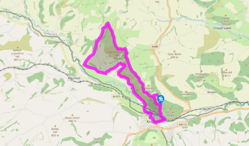
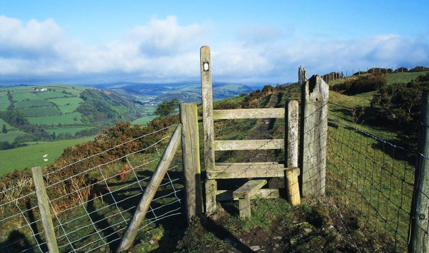
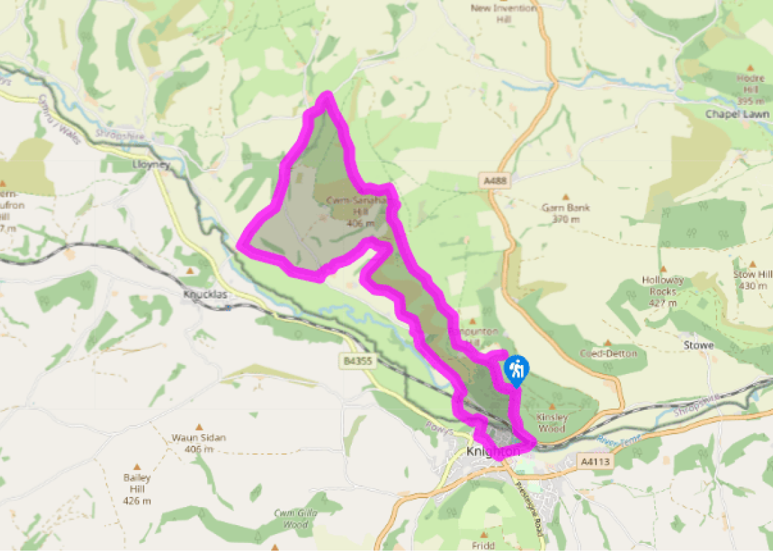
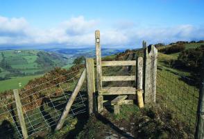
At the back of the car park, a gate leads into a meadow with a barn in it. Walk along the left-hand edge of this meadow. At the crest veer slightly away from the field-edge and descend through oak trees to a stile. Cross and join Offa’s Dyke Path (ODP).
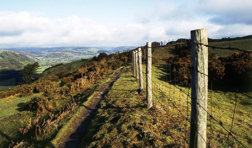
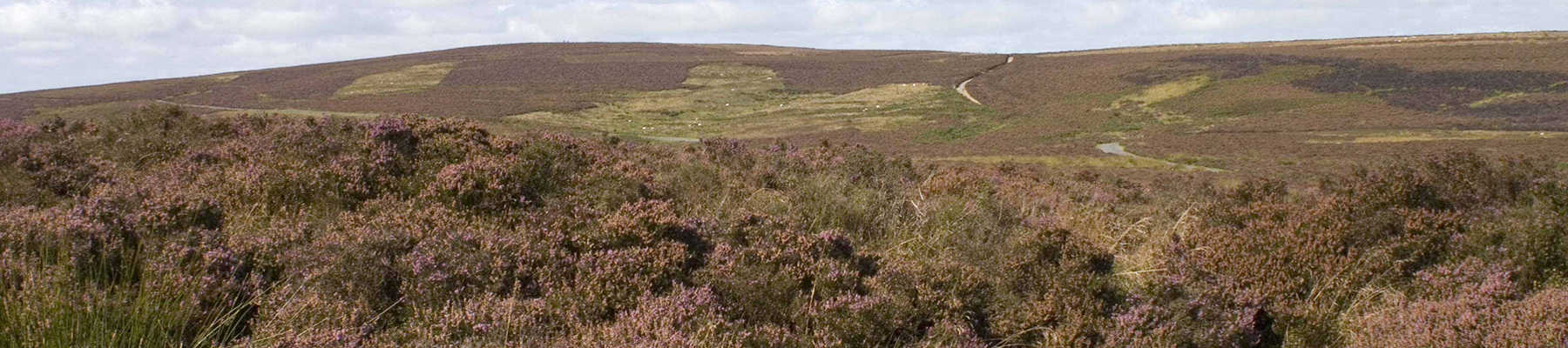
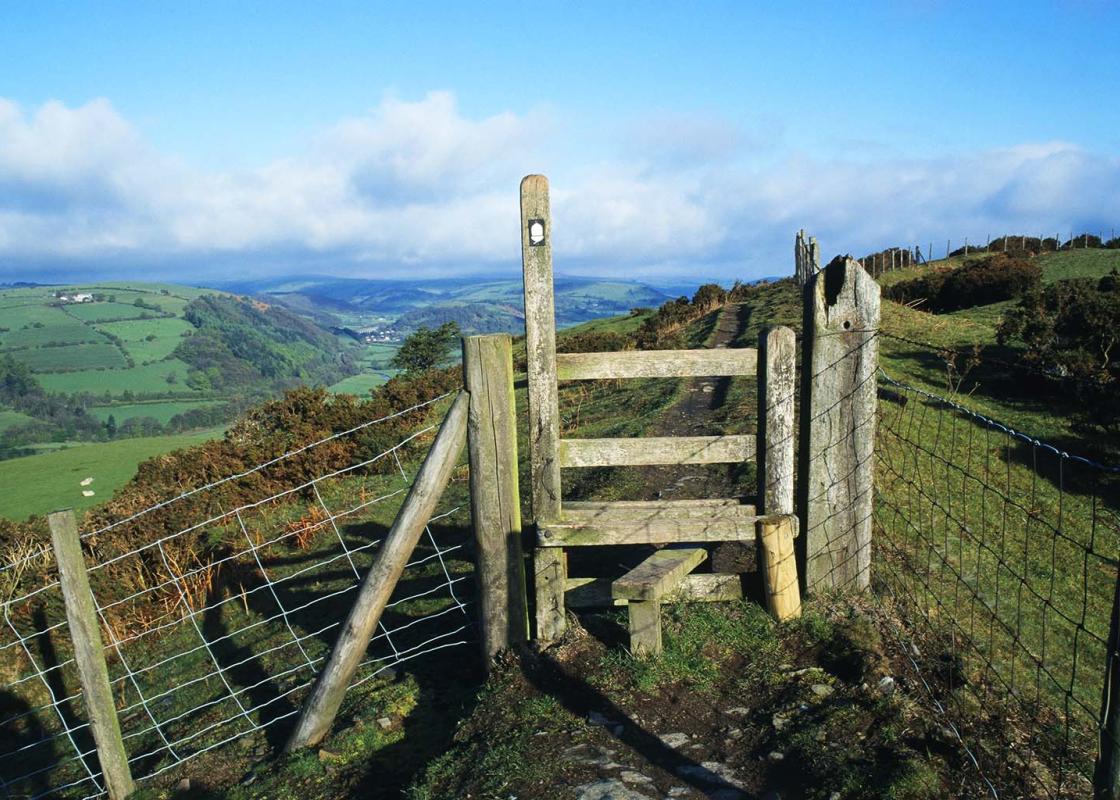
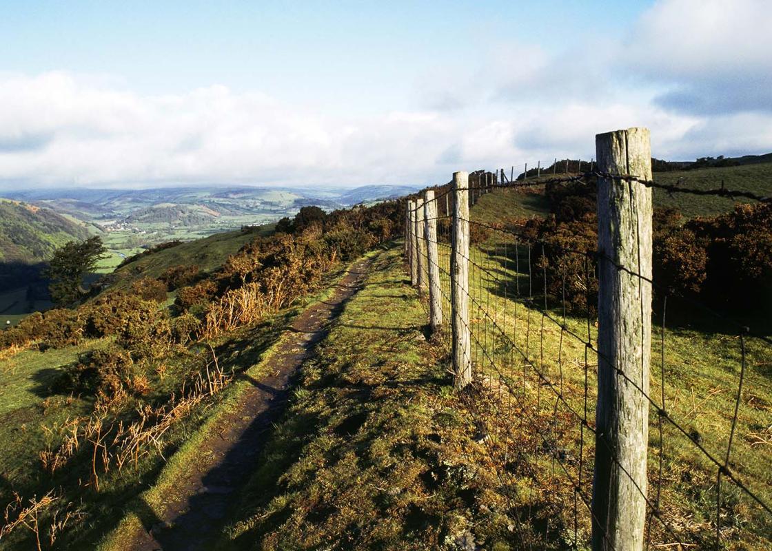
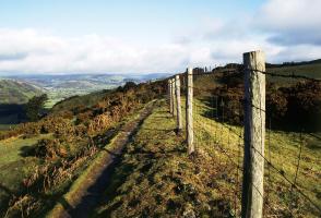
Turn right and follow the ODP for about 2.5 miles (4km). The path runs above steep slopes falling to the west, following the dyke all the way. After rounding a combe, it climbs to the top of Cwm-sanaham Hill (1,323ft/406m), then continues northwards, soon descending very steeply to a white house, Brynorgan.
Meeting a road, leave the ODP, turning left, then left again at Selley Cross. After 0.5 miles (800m) or so, just beyond The Workhouse, go through the next gate on the right. Follow a vague path along a field, then turn right, climbing steeply by a line of trees to a stile. Follow waymarks across several fields, to meet a lane at Monaughty Poeth.
Turn left for 0.75 miles (1.2km) to a junction at Skyborry Green. Turn left again, then immediately right, joining a bridleway that climbs to The Brynny. Turn right behind the house. Don’t join the obvious track just above but follow a narrow footpath along the hedge. Take the lower option at all unwaymarked junctions. After three stiles in quick succession, join a track and descend to the road at Nether Skyborry.
Turn left for 0.5 mile (800m), then right on to the ODP just before Panpunton Farm. The path crosses the railway and the River Teme, then follows the Teme towards Knighton, soon crossing the border and turning right to the Offa’s Dyke Centre.
Leaving the centre, turn left through Knighton, then left again on Station Road. After passing the station, turn left on Kinsley Road. Join the first path (steps) on the right into Kinsley Wood, opposite Gillow. Fork left after a few paces, then embark on a grindingly steep climb. The gradient eases a little before the path emerges from the trees to continue past picnic tables and across a forest road. Keep straight on to the top of the ridge, then turn left at a crossroads to walk across the summit. The path descends to a track. Turn right to return to the start.
Terrain
- Excellent on ridge, undefined across fields, many stiles
Landscape
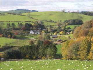
- Steep hills overlooking the broad Teme Valley
Dog friendliness
- Can run free in Kinsley Wood, but sheep present elsewhere
Parking
- Informal car parking in Kinsley Wood, accessed by forest road from A488 (or park in Knighton, Bowling Green Lane car park or at Offa’s Dyke Centre)
Toilets en route
- In Knighton, near Bowling Green Lane car park and Offa’s Dyke Centre
Knighton straddles the border, nine toes in Radnorshire and one in Shropshire. Its Welsh name is Tref-y-clawdd, which translates as ‘town on the dyke’, a reference to its position on the great earthwork known as Offa’s Dyke. Offa was ruler of the English kingdom of Mercia between ad 757 and 796,... and the eponymous dyke is the longest archaeological monument in Britain, an impressive structure consisting mainly of a bank, with a ditch on the Welsh side. Nobody is certain why Offa ordered its construction. It used to be thought it was an agreed frontier, a way of defining the border or maybe even regulating trade. It’s now thought that a period of instability, with constant cross-border raiding, led to Offa’s decision to secure his frontier with a defensive boundary. It was formerly believed to have run all the way from Treuddyn (north of Wrexham) to Chepstow, but current thinking is that it may have been shorter than that. Recent work in Gloucestershire has suggested that the earthwork in the lower Wye Valley, previously accepted as part of Offa’s Dyke, actually dates from a different period. The Shropshire earthwork is certainly part of Offa’s Dyke, however. Most of the best-preserved sections are in Shropshire, particularly on remote Llanfair Hill, a little to the north of this walk, which is also the dyke’s highest point (1,410ft/430m). To date, nearly 200 archaeological digs have been carried out on the dyke system. As far as its purpose is concerned, the only thing that has been concluded with any reasonable certainty is that it was built in such a way as to defend Mercia from the raiding Welsh. It was probably not simply an agreed frontier or a boundary marker. But, then again, if it was defensive, why have no traces of fortifications or palisading been discovered? Clearly, there is still much to learn. Offa’s Dyke National Trail, opened in 1971, is a splendid walk that runs for 177 miles (285km) from Prestatyn to Chepstow, following the earthwork for 30 miles (48km). The dyke has survived for 1,300 years, but has never been under such pressure as it is today. It’s damaged by agriculture, undermined by rabbits, threatened by development and now eroded by walkers. So walk alongside it where the route has been realigned, rather than on top. The paths are now managed by the Offa’s Dyke Path National Trail Officer (NTO) who liaises with local councils and the Offa’s Dyke Association to deal with any problems that arise anywhere along the Trail.
Perhaps nowhere else in England will you find a county so deeply rural and with so much variety as Shropshire. Choose a clear day, climb to the top of The Wrekin, and look down on that ‘land of lost content’ so wistfully evoked by A E Housman.
At the back of the car park, a gate leads into a meadow with a barn in it. Walk along the left-hand edge of this meadow. At the crest veer slightly away from the field-edge and descend through oak trees to a stile. Cross and join Offa’s Dyke Path (ODP).
1 of 6
Turn right and follow the ODP for about 2.5 miles (4km). The path runs above steep slopes falling to the west, following the dyke all the way. After rounding a combe, it climbs to the top of Cwm-sanaham Hill (1,323ft/406m), then continues northwards, soon descending very steeply to a white house, Brynorgan.
2 of 6
Meeting a road, leave the ODP, turning left, then left again at Selley Cross. After 0.5 miles (800m) or so, just beyond The Workhouse, go through the next gate on the right. Follow a vague path along a field, then turn right, climbing steeply by a line of trees to a stile. Follow waymarks across several fields, to meet a lane at Monaughty Poeth.
3 of 6
Turn left for 0.75 miles (1.2km) to a junction at Skyborry Green. Turn left again, then immediately right, joining a bridleway that climbs to The Brynny. Turn right behind the house. Don’t join the obvious track just above but follow a narrow footpath along the hedge. Take the lower option at all unwaymarked junctions. After three stiles in quick succession, join a track and descend to the road at Nether Skyborry.
4 of 6
Turn left for 0.5 mile (800m), then right on to the ODP just before Panpunton Farm. The path crosses the railway and the River Teme, then follows the Teme towards Knighton, soon crossing the border and turning right to the Offa’s Dyke Centre.
5 of 6
Leaving the centre, turn left through Knighton, then left again on Station Road. After passing the station, turn left on Kinsley Road. Join the first path (steps) on the right into Kinsley Wood, opposite Gillow. Fork left after a few paces, then embark on a grindingly steep climb. The gradient eases a little before the path emerges from the trees to continue past picnic tables and across a forest road. Keep straight on to the top of the ridge, then turn left at a crossroads to walk across the summit. The path descends to a track. Turn right to return to the start.
Terrain
- Excellent on ridge, undefined across fields, many stiles
Landscape
- Steep hills overlooking the broad Teme Valley
Dog friendliness
- Can run free in Kinsley Wood, but sheep present elsewhere
Parking
- Informal car parking in Kinsley Wood, accessed by forest road from A488 (or park in Knighton, Bowling Green Lane car park or at Offa’s Dyke Centre)
Toilets en route
- In Knighton, near Bowling Green Lane car park and Offa’s Dyke Centre
Knighton straddles the border, nine toes in Radnorshire and one in Shropshire. Its Welsh name is Tref-y-clawdd, which translates as ‘town on the dyke’, a reference to its position on the great earthwork known as Offa’s Dyke. Offa was ruler of the English kingdom of Mercia between ad 757 and 796,... and the eponymous dyke is the longest archaeological monument in Britain, an impressive structure consisting mainly of a bank, with a ditch on the Welsh side. Nobody is certain why Offa ordered its construction. It used to be thought it was an agreed frontier, a way of defining the border or maybe even regulating trade. It’s now thought that a period of instability, with constant cross-border raiding, led to Offa’s decision to secure his frontier with a defensive boundary. It was formerly believed to have run all the way from Treuddyn (north of Wrexham) to Chepstow, but current thinking is that it may have been shorter than that. Recent work in Gloucestershire has suggested that the earthwork in the lower Wye Valley, previously accepted as part of Offa’s Dyke, actually dates from a different period. The Shropshire earthwork is certainly part of Offa’s Dyke, however. Most of the best-preserved sections are in Shropshire, particularly on remote Llanfair Hill, a little to the north of this walk, which is also the dyke’s highest point (1,410ft/430m). To date, nearly 200 archaeological digs have been carried out on the dyke system. As far as its purpose is concerned, the only thing that has been concluded with any reasonable certainty is that it was built in such a way as to defend Mercia from the raiding Welsh. It was probably not simply an agreed frontier or a boundary marker. But, then again, if it was defensive, why have no traces of fortifications or palisading been discovered? Clearly, there is still much to learn. Offa’s Dyke National Trail, opened in 1971, is a splendid walk that runs for 177 miles (285km) from Prestatyn to Chepstow, following the earthwork for 30 miles (48km). The dyke has survived for 1,300 years, but has never been under such pressure as it is today. It’s damaged by agriculture, undermined by rabbits, threatened by development and now eroded by walkers. So walk alongside it where the route has been realigned, rather than on top. The paths are now managed by the Offa’s Dyke Path National Trail Officer (NTO) who liaises with local councils and the Offa’s Dyke Association to deal with any problems that arise anywhere along the Trail.
Perhaps nowhere else in England will you find a county so deeply rural and with so much variety as Shropshire. Choose a clear day, climb to the top of The Wrekin, and look down on that ‘land of lost content’ so wistfully evoked by A E Housman.