
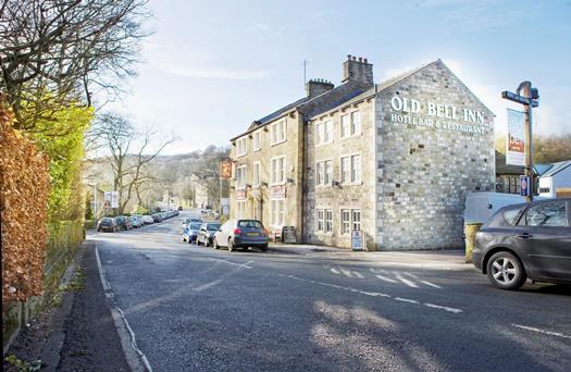

The Fleece Countryside Inn
A sympathetically restored 18th-century inn in a superb location with stunning views over the…

A bracing ramble on old moorland tracks, with extensive views all the way.
Rishworth Moor
7.5 miles (12.1kms)
Beginning in the upper reaches of the Ryburn Valley, the walk sets out across the dam of Baitings Reservoir, built in 1956 to supply Wakefield. Climbing Rishworth Moor onto Blackwood Edge, the view opens across the neighbouring valley to the M62 Motorway as it rises from Scammonden across the flank of Moss Moor to cross the Pennine watershed beneath Windy Hill just south of Blackstone Edge. One of the most talked-about features of the motorway is the division of east- and west-bound carriageways around Stott Hall Farm. Urban myths tell that this was because of the then farmer's stubbornness to sell out in the face of development. As always, the truth is less sensational, the hillside geology is just too unstable to support adjacent carriageways. As you stride out across Rishworth Moor, probably sighting few other walkers, you can pity the motorists in their little metal boxes. Or, if the weather is turning nasty, you may feel a twinge of envy instead. On the second half of the walk you get excellent views of the Ryburn Valley and beyond, including Blackstone Edge, Pendle Hill and distant windfarms.
The South Pennine hills, straddling the Yorkshire/Lancashire boundary and watershed, have long been a great obstacle to travel. A fascinating paved road climbs steeply up Blackstone Edge; opinions are divided as to whether it is Roman or a medieval packhorse track. But no one was in any doubt that this was difficult terrain. The redoubtable traveller, Celia Fiennes, coming this way in 1698, described this route as '...a dismal high precipice, steep in ascent'. Daniel Defoe came the same way in August 1724, during a blizzard that was unseasonal even for the Pennines.
A succession of turnpike roads were built in the 18th and early 19th centuries. Yet it was as recently as the 1970s, with the building of the M62 motorway, that trans-Pennine travel became routine. Surveyors did some of their initial work using ponies: the easiest mode of transport in this inhospitable landscape. As drivers now cruise effortlessly across the empty moors, it's easy to forget what a feat of engineering it was to build 'the motorway in the clouds'. At an altitude of 1,220ft (372m), the M62 is the highest motorway in the country, and this Pennine section offers some dramatic features.
When built, Scammonden Bridge was the largest single-span bridge in Europe and carries the B6114 across the motorway.Less obvious to motorway users is the Scammonden Dam just to the east. It is the only reservoir embankment in Britain to carry a motorway and the lake it created flooded a dozen farms in the Deanhead Valley. Having taken five years to build, the motorway was opened to traffic in 1970. It may be easier to travel across the Pennines these days, but nature has a way of reminding us not to take things for granted. When it was opened the M62 was called, somewhat optimistically, 'the motorway that never closes'. In fact, the weather up here is notoriously unpredictable, and few years pass without the traffic seizing up in winter's icy grip.
Take the path across the dam, a track beyond climbing past a farm to a lane. Turn left and walk for 0.5 miles (800m). Some 50yds (46m) after swinging over a bridge, leave through a waymarked gate in the right-hand wall.
Follow a tumbledown wall uphill towards Blackwood Farm. Entering between outbuildings, walk beyond the farmhouse to a gate at the top of the yard. Walk up the next field to a gate and continue steeply uphill, following the wall on your left. Look for views of the Ryburn Valley as you approach the crest of the hill. You will come to a ladder stile, next to a gate in the wall.
Don't cross, but strike off right over rough moorland; the path is distinct but narrow. Occasional yellow-topped markers confirm the route, which runs roughly parallel to the M62, aiming to the right of a tall mast on the far side of the motorway. After a mile (1.6km), the path begins a gentle descent, giving good views down to Green Withens Reservoir ahead. Keep forward above the head of a gully then over a plank bridge as the path falls across the hill to a bridge spanning a reservoir catchment channel.
Cross and walk right, following this watercourse towards the reservoir. Ignore the next two bridges across, but at the third, which is about 300yds (274m) before the reservoir embankment and waymarked 'Blackstone Edge and Baitings', revert to the northern bank. Bear slightly left to follow a path uphill – soon quite steeply – before it levels and swings left around Flint Hill. It later curves right to crest the watershed into the Upper Ryburn Valley where there is a junction of paths by a water channel.
Go right here (a sign indicates Baitings Reservoir), continuing to skirt the hill on a good, level path. After a mile (1.6km), watch for a fork marked by a wooden post and bear left, gradually descending towards Baitings Reservoir. When you come to a wall corner, keep straight ahead, following the wall on your left. A developing track leads out to the lane. Go left and take the second right, reversing your outward steps to the car park.
Moorland paths; may be boggy after rain
Open moorland
Keep on lead near livestock
OS Explorer OL21 South Pennines
Car beside A58 at Baitings Reservoir
None on route
Read our tips to look after yourself and the environment when following this walk.
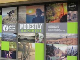
Everybody knows that Yorkshire has some special landscapes. The Dales and the Moors first spring to mind, but what about West Yorkshire? That’s Leeds and Bradford isn’t it? Back-to-back houses and blackened mills… Certainly if you had stood on any of the hills surrounding Hebden Bridge a hundred years ago, and gazed down into the valley, all you would have seen was the pall of smoke issuing from the chimneys of 33 textile mills. But thankfully, life changes very quickly in West Yorkshire. The textile trade went into terminal decline, the mills shut down forever and in a single generation Hebden Bridge became a place that people want to visit.
The surrounding countryside offers walking every bit as good as the more celebrated Yorkshire Dales; within minutes you can be tramping across the moors. And this close proximity of town and country is repeated all across West Yorkshire. There’s such diversity in the area that you can find yourself in quite unfamiliar surroundings, even close to places you may know very well. Take time to explore this rich county and you will be thrilled at what you find to shatter old myths and preconceptions.
Discover more than 15,000 professionally rated places to stay, eat and visit from across the UK and Ireland.
Choose a place to stay safe in the knowledge that it has been expertly assessed by trained assessors.
Search by location or the type of place you're visiting to find your next ideal holiday experience.
Read our articles, city guides and recommended things to do for inspiration. We're here to help you explore the UK.