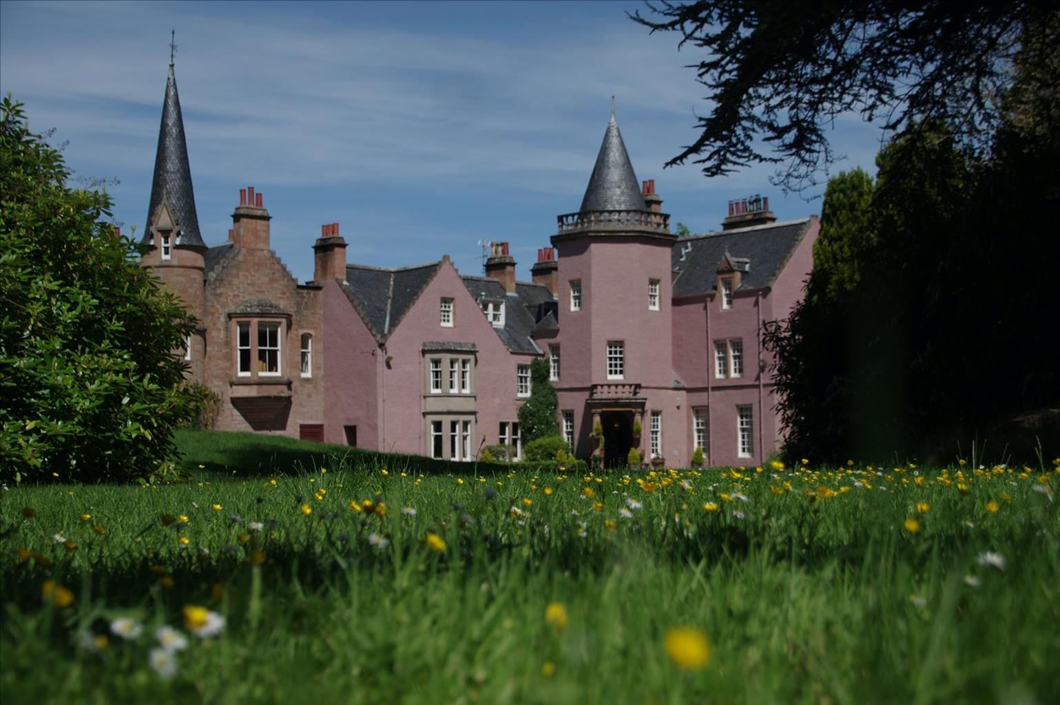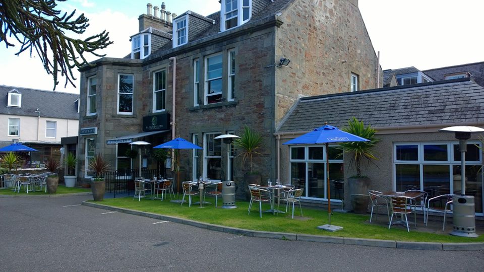
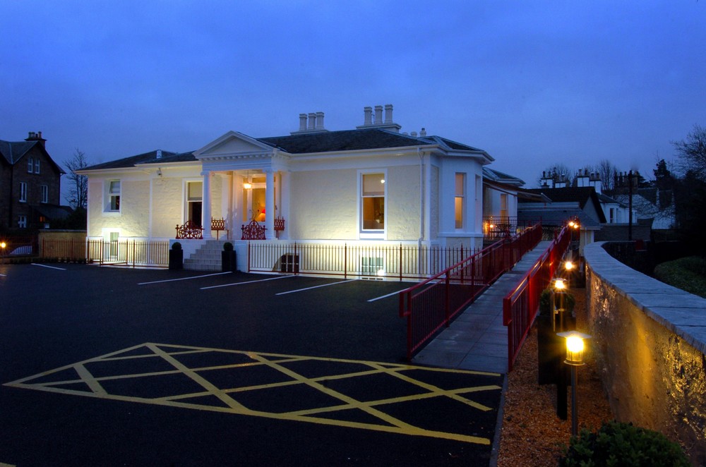

Loch Ness Lodge
Loch Ness Lodge enjoys a prominent position overlooking the loch of the same name, and all of…

Overlooking Loch Ness and past the home of a different monster, the Beast of Boleskine
Loch Ness
4.25 miles (6.8kms)
With so many fine sights in Scotland, it's a shame that such large numbers of people take the trouble to see one that doesn't exist. The first encounter with the Loch Ness monster was back in the 6th century AD, when St Columba was crossing the River Ness. One of his companions was attacked by a water beast. When the saint ordered it to go away, it did. The onlookers, pagan barbarians whose friend had already been eaten, promptly converted to Christianity. The account was set down 100 years later by Adomnan, an abbot of Iona. It sounds suspiciously like an earlier incident from the life of a different holy man, St Martin of Tours, and also like a story about how Christianity took over a site where human sacrifice had been offered to a river god.
Later confirmation came during the Lisbon earthquake of 1755. A shock wave, freakishly magnified along Loch Ness, sent breakers crashing against the shore at Fort Augustus – clearly Columba's monster was still down there disturbing the water.
Authentic sightings of a rather different monster did, however, take place in the early 1900s. Finding it fashionable to be Scottish, Alexander Crowley changed his name to Aleister and bought the nearby hall to become the Laird of Boleskine. In his time, he was known as 'The Beast of Boleskine', the 'wickedest man alive'. He identified himself with the Great Beast described in the final book of the Bible, the seven-headed monster that was to battle with the angels at the end of time.
In pursuit of his precept 'do what thou wilt shall be the whole of the law', he debauched minor film stars, when given the opportunity, betrayed his friends and became an alcoholic and heroin addict. At Boleskine, as he studied his magical books, the sky darkened at midday so candles had to be lit, and the lodge keeper went mad.
We might take the darkening of the sky as a normal Scottish summer raincloud, but we can still see the rowan trees his neighbours planted to protect themselves from his dangerous magical influence.
Apart from seducing his neighbours and brightening the Invernessshire scene with various exotic mistresses, Crowley contributed to local life by prankishly reporting to the Society for the Suppression of Vice the problem of prostitution in Foyers (the 'problem', from his point of view, was that there wasn't any). He also made an impassioned plea against the plan to enclose the Falls of Foyers in hydro-electric water pipes.
From the car park follow yellow waymarkers uphill near a stream. After 100yds (91m), a path on the right is signed 'Loch Ness Viewpoint'. After a bench, the path contours briefly then turns up left, to a higher viewpoint. It then turns back sharply left and descends on earth steps through a little crag to a forest road. Turn right for 200yds (183m).
Turn up left up a path which has a low, heavily mossed wall alongside as it bends up to a higher forest road. Turn right and walk for about 150yds (137m) until you reach a sharp left-hand bend. Turn off right here, on a small footpath with blue markers. It passes through an area of small self-seeded trees, then goes steeply up to the left underneath mature trees. At the top, bear left along a little ridge, gently downhill to a fine viewpoint.
Return for 100yds (91m) and bear left down the other side of the ridge. The path now descends steeply until it reaches a forest road. A sign indicates Lochan Torr an Tuill, nearby on the right, with a picnic table.
Return along the forest road, past where you joined it. It climbs gently and then descends to the sharp right bend where you turned off earlier – the waymarker says 'to Car Park' on the side now facing you. After 150yds (137m), turn left down the path with the low mossed wall to the forest road below (Point 2). Turn left, past a red/green waymarker. The track kinks left past a quarry.
Where the main track bends right, downhill, keep ahead on a green track with a red/green waymarker. It emerges from the trees at a signpost. Follow this down to the right towards Easter Boleskine house and down to the main road (B852).
Turn right for 50yds (46m). Below the left edge of the road is a tarred track. Turn down a faint path between the trees to cross this track, with a blue waymarker leading into a clearer path beyond. This passes down to the right of electricity transformers. At the foot of the slope, the main path bears right with a blue waymarker. It runs above the loch shore, passes below Lower Birchwood House, and joins its gravel access path. At a tarmac turning circle, the overgrown Inverfarigaig Pier on the left would be a good place to spot the monster from (just supposing she existed). The tarred lane ahead leads up to the B852, with the car park just above on the right.
Waymarked paths and tracks
Hillside of mixed woodland
Keep on lead for short stretch past Easter Boleskine
OS Explorer 416 Inverness, Loch Ness & Culloden
Farigaig Forestry Commission car park
At start
Read our tips to look after yourself and the environment when following this walk.
Apart from the Orkneys and the Shetlands, Highland is Scotland’s northernmost county. Probably its most famous feature is the mysterious and evocative Loch Ness, allegedly home to an ancient monster that has embedded itself in the world’s modern mythology, and the region’s tourist industry. Monster or no, Loch Ness is beautiful and it contains more water than all the lakes and reservoirs in England and Wales put together. The loch is 24 miles long, one mile wide and 750 feet deep, making it one of the largest bodies of fresh water in Europe.
At the very tip of the Highlands is John o’ Groats, said to be named after a Dutchman, Jan de Groot, who lived here in the early 16th century and operated a ferry service across the stormy Pentland Firth to Orkney. In fact, the real northernmost point of the British mainland is Dunnet Head, whose great cliffs rise imposingly above the Pentland Firth some two miles further north than John o’ Groats.
The Isle of Skye is the largest and best known of the Inner Hebrides. Its name is Norse, meaning ‘isle of clouds’, and the southwestern part of the island has some of the heaviest rainfall on the whole of the British coast. Despite this, it’s the most visited of all the islands of the Inner Hebrides. It’s dominated from every view by the high peaks of the Cuillins, which were only conquered towards the end of the 19th century.
Discover more than 15,000 professionally rated places to stay, eat and visit from across the UK and Ireland.
Choose a place to stay safe in the knowledge that it has been expertly assessed by trained assessors.
Search by location or the type of place you're visiting to find your next ideal holiday experience.
Read our articles, city guides and recommended things to do for inspiration. We're here to help you explore the UK.