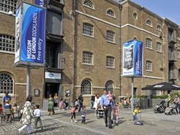


Queen Mary University of London
Stay QM is Queen Mary University of London’s accommodation option for those looking for a…

Three Mills
6 miles (9.7kms)
In the mid-19th century the banks of the River Lea were lined with flourishing industries. Because it was then deemed to be outside the City of London with its pollution regulations, the water and surrounding air quality were dangerously poor. Now this area is a clean, peaceful haven for both walkers and wildlife, with views of the Olympic Park looming in the background.
In the 14th century Edward III instigated a policy to encourage commercial expansion, which led to the manufacture of gunpowder, paper, soap, flour and porcelain along the Lea. These were vibrant times, but it wasn't until the 1700s that work was carried out on the meandering river to construct straight channels and build locks so that freight could be transported more easily. Some parts of east London were more significant than others in the development of the chemical industry. West Ham, for example, was just outside the jurisdiction of the Metropolitan Buildings Act of 1844 that protected the City from anti-social trades such as oil-burning and varnish making. Industry developed in Bromley-by-Bow because there was lots of cheap land and no building restrictions.
As the Industrial Revolution progressed in the 19th century, the River Lea became an enormous health hazard. The factories along its banks produced a great deal of waste - the river was, in effect, used as a dumping ground for chemical and pharmaceutical waste. Looking at the scene before you today, it's not easy to picture a skyline of mass industrialism. Warehouses, cranes and gas works were here, against a backdrop of smoggy, smelly air. But, together with the noise of the powerful machinery, this would have been a way of life for many workers. For more than half of the 20th century barges still brought raw materials to the factories from London Docks, taking away the finished goods. Today, however, you're more likely to see a heron than a vessel on this stretch of the river.
From the Tesco supermarket car park in Three Mill Lane take the footpath to the left of an iron bridge. Continue walking ahead with the river to your right-hand side and you will shortly see the formidable volume of traffic coming into view, going across the Bow Flyover.
On arrival at the blue gates veer right, pass under the low bridges, follow the path uphill and go right over the bridge. Turn left and continue along the tow path with the river now to your left. The old Bryant & May match factory is ahead to your left. The path swings right, away from the traffic. Ignore the Greenway sign on the right and pass under two pipes that are part of the Victorian sewer. Cross a footbridge and continue along the River Lea, past the Old Ford Lock.
Just before the next bridge ahead, the Hertford Union Canal emerges and joins at a right angle on the left. Cross the bridge and turn left down a slope to join this canal along a gravel path. Pass Bottom Lock, Middle Lock and, further on, Top Lock. Once past the cottages of Top Lock, you will see Victoria Park on the right. Continue along this long, straight, paved path until you pass under Three Colts Bridge, a metal barrier, two further bridges and another metal barrier.
Cross a footbridge at this T-junction of the waterways to pick up the southern section of the 1820 Regent's Canal, which was used by horse-drawn barges to haul coal through London. Continue along the canal, now to your right, towards the blinking light of Canary Wharf. Pass under a railway bridge then pass Mile End Lock, two more bridges and Jonson Lock. After another bridge you pass a red-brick chimney, a sewer ventilation shaft, walk under a railway bridge and continue past Salmon Lane Lock. After walking under Commercial Road Bridge (A13), turn left and follow the steps to the road.
Turn right along Commercial Road and look out for where you turn right down steps after crossing a bridge over the canal. Turn right and follow the tow path of the canal, the Limehouse Cut, with the water on your left. Keep going along the tow path until, after some distance, passing under several bridges.
On arrival at Bow Locks walk over the concrete footbridge and under two bridges. Continue ahead towards the Mill House. Turn left over the bridge to return back to the start.
Gravel, tarmac and tow paths
Mainly canalside industry and housing
No particular problem
OS Explorer 162 Greenwich & Gravesend; 173 London North
None locally (Tesco car park maximum 2-hour stay)
At car park
Read our tips to look after yourself and the environment when following this walk.
Greater London is one of the world’s largest urban areas; 33 boroughs stretching north to Enfield, south to Croydon, east to Havering, west to Hillingdon and with central London at the heart of it all.
Greater London was officially created in 1965, but the boroughs themselves all have their own histories going back much further. Greenwich is home to the Prime Meridian, which all clocks on earth take their time from, while Hounslow contains Heathrow Airport, one of the busiest airports in the world. Greater London contains a multitude of parks and green spaces, from the six Royal Parks (including Richmond Park, Green Park, Hyde Park and Regent’s Park) and other huge open spaces like Hampstead Heath and Clapham Common; to smaller community spaces like Clissold Park in Stoke Newington and Burgess Park in Southwark.
The centre of London has its quiet spaces too, like Coram’s Field by Great Ormond Street, and Camley Street Natural Park, a stone’s throw from King’s Cross and St Pancras. One of the city’s most impressive features is the London Underground. Beginning in 1863 as the Metropolitan Railway, it took commuters into The City from the suburbs of Middlesex. It was the first underground railway in the world, and now consists of 11 lines, 270 stations, and 250 miles (402km) of track. It’s estimated that nearly five million journeys are taken every day, and there are nearly one and a half billion riders each year. At peak times, there are more than 543 trains whizzing around the Capital.
Discover more than 15,000 professionally rated places to stay, eat and visit from across the UK and Ireland.
Choose a place to stay safe in the knowledge that it has been expertly assessed by trained assessors.
Search by location or the type of place you're visiting to find your next ideal holiday experience.
Read our articles, city guides and recommended things to do for inspiration. We're here to help you explore the UK.