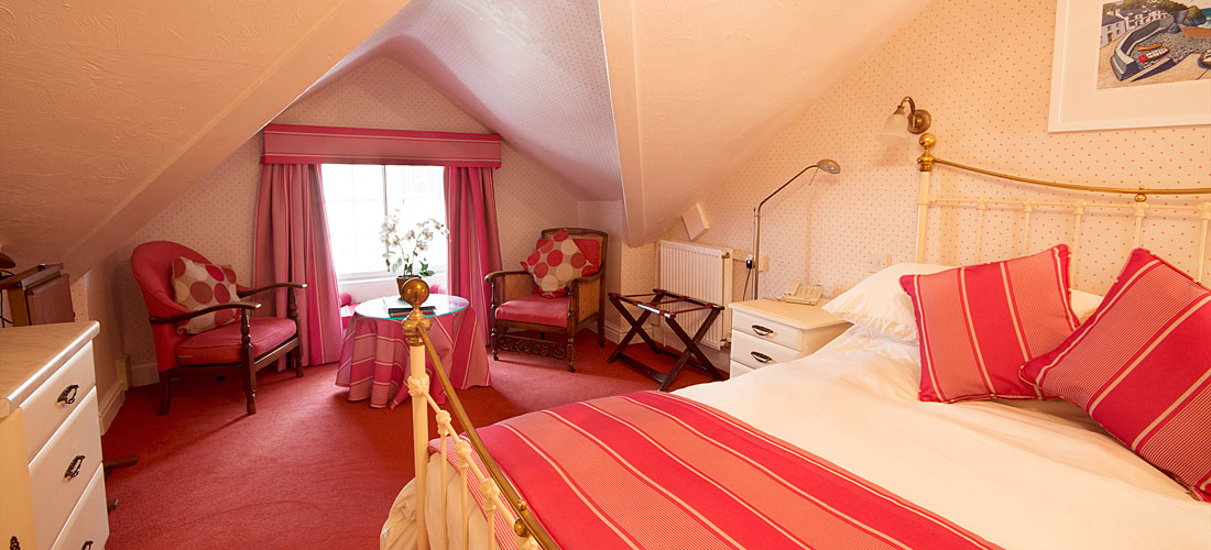

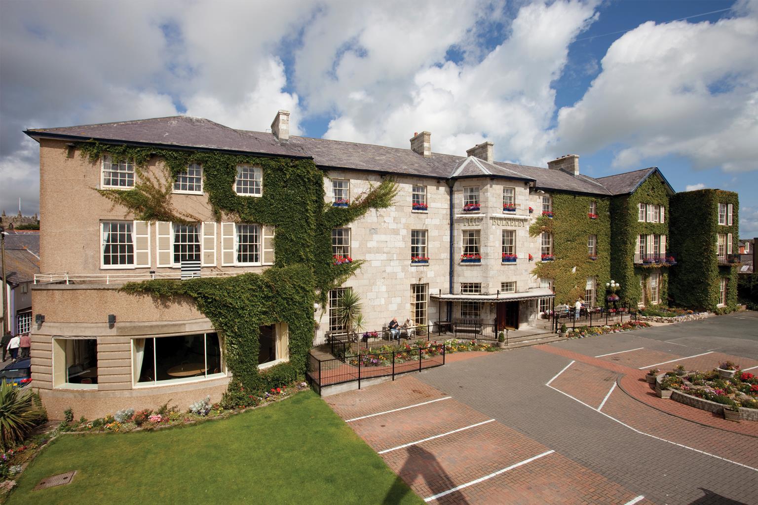
The Bulkeley Hotel
A Grade I listed hotel built in 1832, The Bulkeley is just 100 yards from the 13th-century…

Aber Falls is one of Snowdonia’s most dramatic and accessible waterfalls
Aber Falls
4 miles (6.4kms)
Abergwyngregyn village lies on a narrow grassy plain, where the high Carneddau come down to the sea. ‘Aber’ also lies at the foot of a delightful valley now part of the Coedydd Aber National Nature Reserve, set up in 1975 by the Nature Conservancy Council (now the Countryside Council for Wales) as an example of a broadleaved woodland habitat.
The Romans built a road from Canovium, their fort near Conwy, to Gorddinog near Aber itself, while on the wooded hillside above the village rooftops there’s an Iron Age fort, Maes y Gaer. At the back of some village houses is a mound, part of an 11th-century motte-and-bailey castle. It is likely that this was also the site of the palace where Llewelyn the Great, Prince of Wales, held court in the 13th century. Llewelyn cemented his relationship with the English Crown by marrying Joan, the daughter of his old enemy, King John, but the marriage ended in disaster when she had an affair with William de Breos the Younger, Lord of Brycheiniog. Llewelyn had his wife imprisoned and de Breos hanged. Just to the north of the village, Gwern y Grogfa, which means bog of the gallows, is a dark reminder.
As you walk up the valley you’ll have dark, commercial spruce woods to your left, but in the more swampy ground to the right you’ll see alders. In spring the scene will be coloured with the buttercup-like flowers of the marsh marigold or kingcup. It’s well worth a break to visit the Nant visitor centre, which illustrates how the valley has developed. It tells of a past when the woods were coppiced and harvested for their hardwoods, which were used for railway sleepers and clog making. Above Nant the woodlands become sparser though there are patches of oak wood and mountain ash.
Aber Falls are undeniably impressive. The river plummets hundreds of feet down cliffs of quartz-streaked Cambrian granophyre. The longest single drop is 115ft (35m). Scrub birch trees eke out an existence on the rock ledges, as do liverworts, rare mosses, primroses and anemones. Most visitors backtrack from here but our route loops round the head of the valley, past a smaller set of falls, before climbing to reach a high shoulder with views of the coastline, with the sands of Traeth Lafan stretching nearly all the way to Anglesey.
Go through the gate at the bottom end of the car park (on the western side of the river) and follow the path through woodland. The path crosses the Afon Rhaeadr-fawr on a footbridge. Through a gate on the other side, turn right to follow a clear track south through pastures. After passing under rows of pylons you come upon the visitor centre, which is housed in the old farmstead of Nant Rhaeadr (marked Nant on the maps).
Just before Nant an alternative route to the falls is signposted, taking a rougher track through the plantations. You could use this for variety on a repeat visit, or if you were planning to return down the valley – but as our loop returns via the other side of the valley, stay on the main track.
Beyond Nant, the path climbs steadily through the valley, with the top of the Aber Falls sometimes clearly visible ahead. The path leads directly to the base of the falls – certainly close enough to get a complete view, though you’d need to scramble over boulders, and maybe even wade into the pool, to feel the spray.
Cross a bridge just below the falls and climb steps to overlook the pool – a short detour left gives the best view. Go through a gate in the fence to the right (marked ‘North Wales Path only: no short return to car park’). The path is now narrower and rougher, but still perfectly clear, as it heads beneath the cliffs to cross another footbridge below Rhaeadr-bach (the small waterfalls).
Beyond the bridge the path soon swings north to traverse the western slopes of the valley, and becomes a track on the slopes of Cae’r Mynydd. Watch for a waymark directing you right at a fork, beyond which the track begins a gradual climb. The path levels out before passing between pylons and then runs to a gate just below a narrow conifer plantation.
Curve round left to a second gate, where impressive views of the coast and sea really open up, then fork right down a steep, stony track. Look out for a low waymarked post, where you turn right on a narrow path slanting down towards Abergwyngregyn.
The path reaches the lane near the edge of the village. Turn left to reach Caffi Hen Felin in less than 100yds (91m), or turn right to return directly to the car park.
Well-defined paths and farm tracks
Wild glen, pastured hill slopes, mixed woodland and scree
Farmland – dogs should be on a lead
OS Explorer OL17 Snowdon / Yr Wyddfa
Pay car parks either side of the bridge
At car park on east side of the river
Read our tips to look after yourself and the environment when following this walk.
The county of Gwynedd is home to most of the Snowdonia National Park – including the wettest spot in Britain, an arête running up to Snowdon’s summit that receives an average annual rainfall of 4,473mm. With its mighty peaks, rivers and strong Welsh heritage (it has the highest proportion of Welsh-speakers in all of Wales), it’s always been an extremely popular place to visit and live. The busiest part is around Snowdon; around 750,000 people climb, walk or ride the train to the summit each year.
Also in Gwynedd is the Llyn Peninsula, a remote part of Wales sticking 30 miles out into the Irish Sea. At the base of the peninsula is Porthmadog, a small town linked to Snowdonia by two steam railways – the Welsh Highland Railway and the Ffestiniog Railway. Other popular places are Criccieth, with a castle on its headland overlooking the beach, Pwllheli, and Abersoch and the St Tudwal Islands. Elsewhere, the peninsula is all about wildlife, tranquillity, and ancient sacred sites. Tre’r Ceiri hill fort is an Iron Age settlement set beside the coastal mountain of Yr Eifl, while Bardsey Island, at the tip of the peninsula, was the site of a fifth-century Celtic monastery.
Discover more than 15,000 professionally rated places to stay, eat and visit from across the UK and Ireland.
Choose a place to stay safe in the knowledge that it has been expertly assessed by trained assessors.
Search by location or the type of place you're visiting to find your next ideal holiday experience.
Read our articles, city guides and recommended things to do for inspiration. We're here to help you explore the UK.