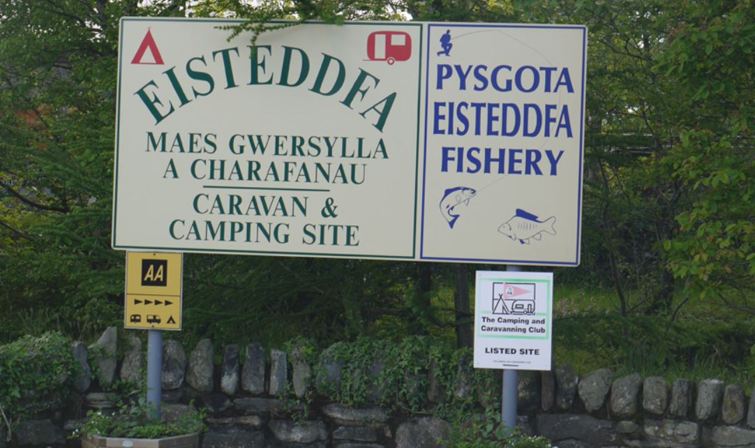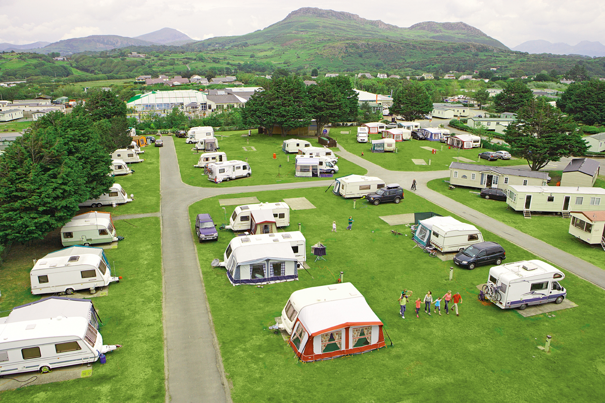


Llwyn-Bugeilydd Caravan & Camping Site
Llwyn-Bugeilydd is a peaceful rural site, close to the coast and Snowdonia attractions, that has…

Llanystumdwy
6 miles (9.7kms)
'As a man of action, resource and creative energy he stood, when at his zenith, without rival... He was the greatest Welshman which that unconquerable race has produced since the age of the Tudors... and those who come after us will find the pillars of his life's toil upstanding, massive and indestructible...'
David Lloyd George (1863–1945) came from modest beginnings in Llanystumdwy. This village on the banks of the Dwyfor is separated from the coast by half a mile (800m) of fields and coastal marshes. When you’re barely out of the car park, you’ll pass Highgate, his boyhood home, and the Lloyd George Museum. In the woods at the start of the walk you will come across the grave and a memorial to this last Liberal Prime Minister of Great Britain.
However, Lloyd George's life was not without controversy. Although he was one of the early pioneers of the Welfare State and led Britain to eventual victory in World War I, he was also linked with several dubious private moneymaking deals and gained a, perhaps unfair, reputation for allowing peerages to be awarded to wealthy political benefactors. A flamboyant, larger-than-life man, Lloyd George just did not fit in with his rather stuffy Edwardian contemporaries.
This walk will take you into the town of Criccieth where Criccieth Castle stands on a huge volcanic crag that juts out into Tremadog Bay. It’s synonymous with Edward I’s ‘iron ring’ but, unlike the others, there was already a Welsh castle on the spot – Edward only had to annexe and enlarge it. The twin-towered gatehouse is believed to have been built by Llewelyn the Great around 1240, some 40 years before Edward took it off him. Yet it was a Welshman who was responsible for the castle’s downfall. In 1404 Owain Glyndwr captured it, then burned it to the ground.
Despite its one-time strategic importance, Criccieth remained a small fishing port until the Victorians’ penchant for sun and sand saw it grow to today’s proportions. You’ll pass rows of Victorian terraces on the way to the rugged coastal path which takes you by the sand and pebble beach back to the Afon Dwyfor and David Lloyd George’s village.
Turn right out of the car park and go through Llanystumdwy village, past the museum, to the bridge over the Afon Dwyfor. Turn right along the lane (before the bridge), then follow the footpath on the left past the memorial and down to the wooded river banks.
After 1.5 miles (2.4km) the path turns right, then goes under a stone archway to meet a tarred drive. Turn left along this, carry on to the B4411 and turn right.
After about 500yds (457m), turn right down an enclosed drive (Cefncollwyn). Beside a gateway on the left, turn half left along a path shaded by rhododendrons. At the end of this short path, go though the kissing gate, then cross the field guided by a fence on the left. Through another kissing gate the path veers right, following a fence which is now on the right.
Beyond another kissing gate the now sketchy route cuts diagonally (southeast) across two fields, separated by a stile, to rejoin the B4411, a mile (1.6km) or so north of Criccieth. These fields are occasionally very wet. If this proves to be a problem, the only practical option is to backtrack to the road and continue along it. Turn right onto the B4411 into town. Keep straight on at the crossroads, and bear left after the level crossing to reach the promenade. This last section may be tricky if the tide is exceptionally high.
Follow the coast road past the castle and continue until it turns firmly inland. From here, tide permitting, simply follow the coast path or walk along the sands. Follow the coast path west through coastal grasslands and gorse scrub to the estuary of the Dwyfor and a boardwalk path, passing crumbled concrete sea defences.
At a second metal kissing gate, waymarkers point inland. Follow these, with the fence on your right. The route becomes a farm track that crosses the railway and passes through the yard of Aberkin farm before reaching the main road.
Cross the main road with care and go through the gate on the opposite side. A short path leads to an unsurfaced lane, which in turn leads to the village centre. Turn right for the car park.
Generally well-defined paths and tracks, some stiles
Riverside woodland, fields, town streets, coastline
Dogs can run free in riverside woods and on the coast
OS Explorer 254 Lleyn Peninsula East
Large car park (free) at east end of village
Near museum at Llanystumdwy and at Criccieth
Small section of coast path is engulfed by highest tides – make sure you know times of tides before setting off; fields after Point 3 can be very wet after prolonged rain
Read our tips to look after yourself and the environment when following this walk.
The county of Gwynedd is home to most of the Snowdonia National Park – including the wettest spot in Britain, an arête running up to Snowdon’s summit that receives an average annual rainfall of 4,473mm. With its mighty peaks, rivers and strong Welsh heritage (it has the highest proportion of Welsh-speakers in all of Wales), it’s always been an extremely popular place to visit and live. The busiest part is around Snowdon; around 750,000 people climb, walk or ride the train to the summit each year.
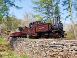
Also in Gwynedd is the Llyn Peninsula, a remote part of Wales sticking 30 miles out into the Irish Sea. At the base of the peninsula is Porthmadog, a small town linked to Snowdonia by two steam railways – the Welsh Highland Railway and the Ffestiniog Railway. Other popular places are Criccieth, with a castle on its headland overlooking the beach, Pwllheli, and Abersoch and the St Tudwal Islands. Elsewhere, the peninsula is all about wildlife, tranquillity, and ancient sacred sites. Tre’r Ceiri hill fort is an Iron Age settlement set beside the coastal mountain of Yr Eifl, while Bardsey Island, at the tip of the peninsula, was the site of a fifth-century Celtic monastery.
Discover more than 15,000 professionally rated places to stay, eat and visit from across the UK and Ireland.
Choose a place to stay safe in the knowledge that it has been expertly assessed by trained assessors.
Search by location or the type of place you're visiting to find your next ideal holiday experience.
Read our articles, city guides and recommended things to do for inspiration. We're here to help you explore the UK.