"A gentle ramble through Mid Devon’s red-earthed farmland to a delightful 12th-century church."
Walk directions
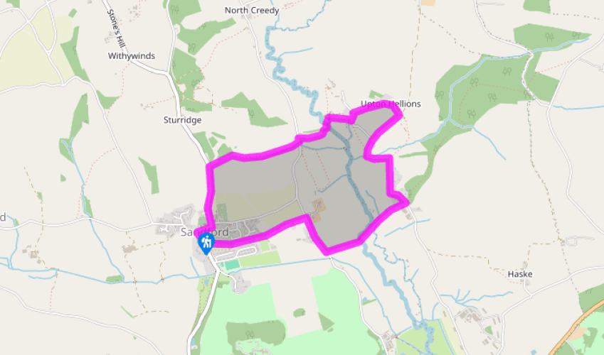
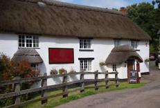
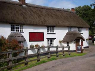
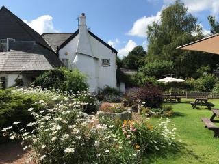
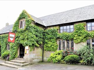
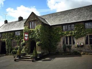
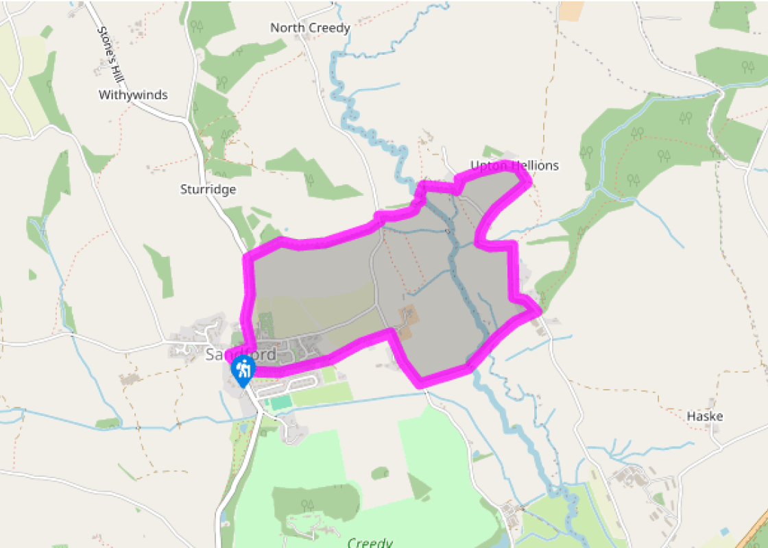
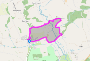
The walk starts from the Lamb Inn. Facing The Square, turn left up Church Street, past St Swithun’s Church. On meeting Back Lane turn left, soon passing the primary school, and follow the lane uphill out of the village.
Where the lane levels, turn right at a footpath sign, down a hedged path with a plantation to your left. Descend to a gate into a field, walk straight across and go through a gate. Keep along the right edge of the next field, and through another; continue in the same direction and through a gate onto a lane.
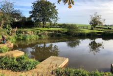
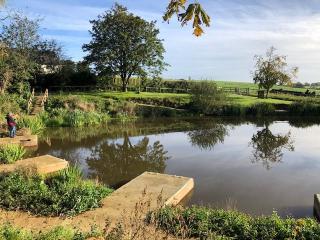
Turn left onto the lane then take the next footpath to the right to then meet the river. Turn left past the weir, soon crossing a stream on a footbridge. Follow the path on and through a gate onto a track, still with the river on your right.
Keep ahead as signed to cross the Creedy on ‘Shaky Bridge’ (slippery when wet). Cross a grassy patch to meet the track, then turn right through a gate. Follow the fence across the field, aiming to the right of the converted Hellions Mill (a mill is said to have existed here since the 13th or 14th centuries). Pass through a gate, then turn right past the building to meet the lane.
Turn left for a few paces, then right through a gate into a field; follow the fence uphill, soon passing through a gate; continue in the same direction. At the top turn right alongside a high garden wall, to pass through a gate. Keep ahead along the drive then the lane to St Mary’s Church (slippery cobbles).
Follow the lane that bears right downhill, later climbing to a junction at Lower Creedy. Turn right downhill to cross the Creedy.
At the T-junction (Thornhedges Cross), turn right uphill past Mooracre Farmhouse.
About 150yds (137m) later, opposite farm buildings, turn left on a footpath. Follow the lane through a gate into a field, soon passing through a gated/fenced section with houses to your right. Cross the next field and go along a gated/fenced path to meet the road. Cross over, and pass the post office and community stores to return to the Lamb Inn.
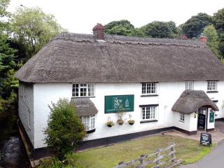
Sandford is a quintessential Devon village, with its thatched cottages, 14th-century church, excellent pub and wonderful community shop and post office, manned largely by volunteers (the average age of the newspaper delivery team was at one time over 65!). Sandford sits within a network of... footpaths and green lanes that weave their way through rolling pasture fields and woodland around the valley of the Creedy, which joins the Exe just north of Exeter. The name Sandford (from ‘sandy ford’) predates the Norman Conquest, and the village is thought to have Saxon origins (6th or 7th century). In a charter dated AD 930, King Athelstan granted land at Sandford to Bishop Eadulf and the clergy of the minster church at Crediton. There are a number of fine houses in the parish. The original house at Creedy Park dated from about 1600, and parts of Dowrich House date from the 15th century. Sandford’s particularly splendid primary school is located opposite the church – a large classical building erected in 1825 by Sir Humphrey Phineas Davie of Creedy Park. St Mary’s Church The walk visits the little hamlet of Upton Hellions, where the simple church of St Mary’s overlooks the Creedy Valley. Now only used at the great festivals, the church has a flagstone floor and box pews and a wonderfully unsophisticated feel – it dates from the 12th century. Look out for the unusual monument of two figures kneeling at a prayer desk, said to be Richard Reynell of Creedy Widger (now Lower Creedy, passed later on the walk) and his wife Mary, who died in the mid-17th century.
Devon sums up all that is best about the British landscape, with its magnificent coastlines, two historic cities, the world-famous Dartmoor National Park and south Devon’s glorious English Riviera. A fashionable and much-loved holiday destination, hiking and cycling in the National Parks is extremely popular among visitors, with a great choice of off-road routes.
"A gentle ramble through Mid Devon’s red-earthed farmland to a delightful 12th-century church."
Walk details
1.75hrs
Difficulty:
Easy
Gradient:
Moderate
Distance:
3 miles (4.8kms)
Ascent:
213ft (65m)
Walk directions
The walk starts from the Lamb Inn. Facing The Square, turn left up Church Street, past St Swithun’s Church. On meeting Back Lane turn left, soon passing the primary school, and follow the lane uphill out of the village.
1 of 8
Where the lane levels, turn right at a footpath sign, down a hedged path with a plantation to your left. Descend to a gate into a field, walk straight across and go through a gate. Keep along the right edge of the next field, and through another; continue in the same direction and through a gate onto a lane.
2 of 8
Turn left onto the lane then take the next footpath to the right to then meet the river. Turn left past the weir, soon crossing a stream on a footbridge. Follow the path on and through a gate onto a track, still with the river on your right.
3 of 8
Keep ahead as signed to cross the Creedy on ‘Shaky Bridge’ (slippery when wet). Cross a grassy patch to meet the track, then turn right through a gate. Follow the fence across the field, aiming to the right of the converted Hellions Mill (a mill is said to have existed here since the 13th or 14th centuries). Pass through a gate, then turn right past the building to meet the lane.
4 of 8
Turn left for a few paces, then right through a gate into a field; follow the fence uphill, soon passing through a gate; continue in the same direction. At the top turn right alongside a high garden wall, to pass through a gate. Keep ahead along the drive then the lane to St Mary’s Church (slippery cobbles).
5 of 8
Follow the lane that bears right downhill, later climbing to a junction at Lower Creedy. Turn right downhill to cross the Creedy.
6 of 8
At the T-junction (Thornhedges Cross), turn right uphill past Mooracre Farmhouse.
7 of 8
About 150yds (137m) later, opposite farm buildings, turn left on a footpath. Follow the lane through a gate into a field, soon passing through a gated/fenced section with houses to your right. Cross the next field and go along a gated/fenced path to meet the road. Cross over, and pass the post office and community stores to return to the Lamb Inn.
Sandford is a quintessential Devon village, with its thatched cottages, 14th-century church, excellent pub and wonderful community shop and post office, manned largely by volunteers (the average age of the newspaper delivery team was at one time over 65!). Sandford sits within a network of... footpaths and green lanes that weave their way through rolling pasture fields and woodland around the valley of the Creedy, which joins the Exe just north of Exeter. The name Sandford (from ‘sandy ford’) predates the Norman Conquest, and the village is thought to have Saxon origins (6th or 7th century). In a charter dated AD 930, King Athelstan granted land at Sandford to Bishop Eadulf and the clergy of the minster church at Crediton. There are a number of fine houses in the parish. The original house at Creedy Park dated from about 1600, and parts of Dowrich House date from the 15th century. Sandford’s particularly splendid primary school is located opposite the church – a large classical building erected in 1825 by Sir Humphrey Phineas Davie of Creedy Park. St Mary’s Church The walk visits the little hamlet of Upton Hellions, where the simple church of St Mary’s overlooks the Creedy Valley. Now only used at the great festivals, the church has a flagstone floor and box pews and a wonderfully unsophisticated feel – it dates from the 12th century. Look out for the unusual monument of two figures kneeling at a prayer desk, said to be Richard Reynell of Creedy Widger (now Lower Creedy, passed later on the walk) and his wife Mary, who died in the mid-17th century.
Devon sums up all that is best about the British landscape, with its magnificent coastlines, two historic cities, the world-famous Dartmoor National Park and south Devon’s glorious English Riviera. A fashionable and much-loved holiday destination, hiking and cycling in the National Parks is extremely popular among visitors, with a great choice of off-road routes.