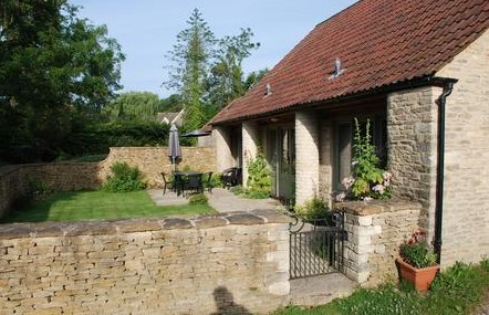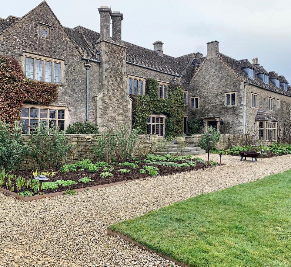
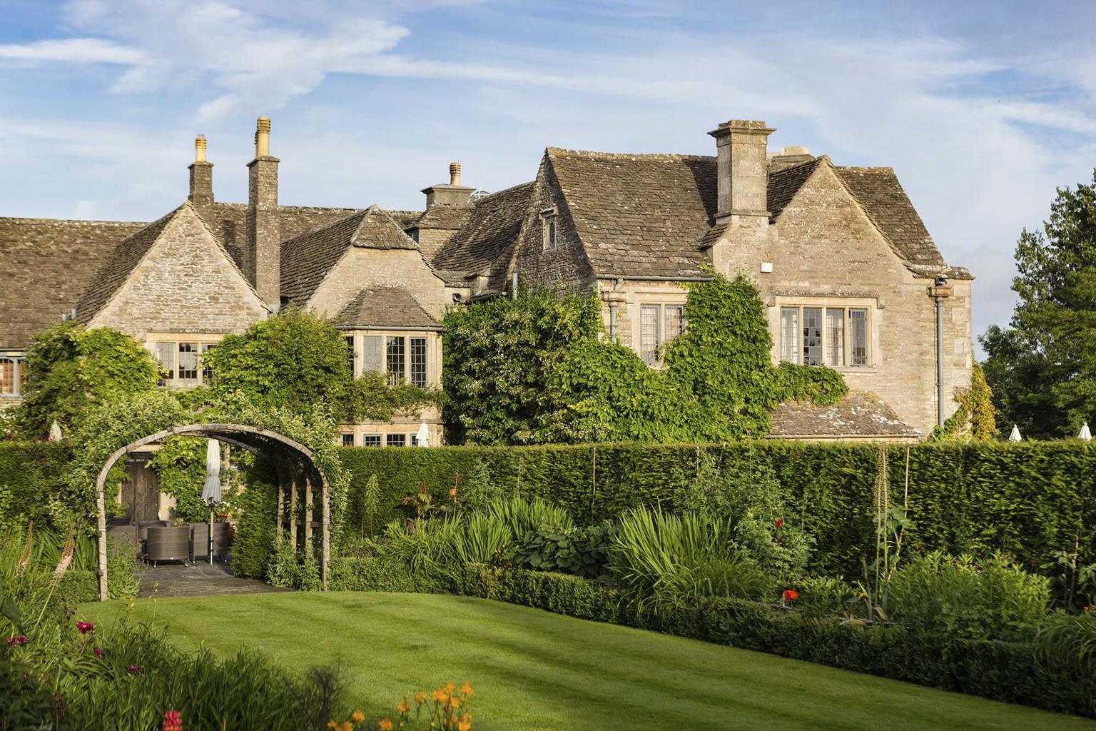

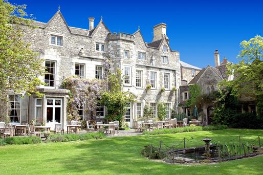

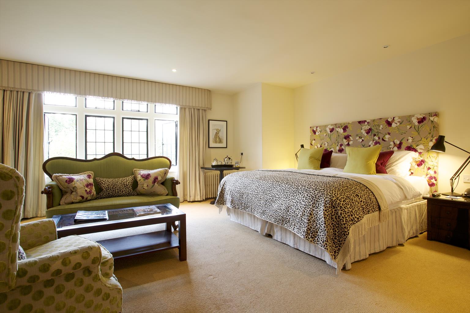
Hare & Hounds Hotel
This popular hotel, set in extensive grounds, is situated close to the Westonbirt Arboretum. The…

The infant Bristol Avon links attractive stone villages on this pastoral ramble on the southeastern fringes of the Cotswolds.
Sherston
6.5 miles (10.4kms)
The Bristol Avon rises in the foothills of the Cotswolds in the northwest corner of Wiltshire and is little more than a wide and shallow stream as it flows through the gently rolling pastoral countryside west of Malmesbury. Despite its size, this peaceful river enhances all the charming little stone villages in this unspoilt area of north Wiltshire, which is typically Cotswold in appearance. In fact, 18 villages between Colerne and Malmesbury are officially part of the Cotswold Area of Outstanding Natural Beauty. Of these, Sherston must rank among the most attractive, with its wide High Street, doubtless once used as a market, lined with some interesting 17th- and 18th-century buildings.
Sherston was a borough by the 15th century and prospered as a result of the flourishing wool trade at the time. It still has the feel of a market town, with narrow back streets and alleys, and continues to be a thriving community. It has been suggested that Sherston is Sceorstan, as chronicled by Henry of Huntingdon, where in 1016 Edmund Ironside won a battle against the Danes who were led by King Canute. The early legend of John Rattlebone, a local yeoman promised land by Ironside in return for service against the Danes, is deep rooted. Sadly, this brave knight was terribly wounded in battle and although he staunched his bleeding with a stone tile and continued fighting, he reputedly died as Canute’s army withdrew. Other traditions say Rattlebone survived to claim his reward. In the 17th century, the antiquary John Aubrey recorded the following local rhyme: ‘Fight well, Rattlebone, Thou shalt have Sherston, What shall I with Sherston do, Without I have all belongs thereto? Thou shalt have Wych and Wellesley, Easton Town and Pinkeney.’ Whatever the truth is, the Rattlebone Inn opposite the church keeps his name alive.
Peaceful parkland and riverside paths lead you downstream to Easton Grey. Set around a 16th-century stone bridge and climbing a short, curving street is an intimate huddle of ancient stone houses, with mullioned windows, lichen-covered roofs and gardens touching the river bank. Set back on a rise above the river is Easton Grey House, a handsome 18th-century manor house surrounded by elegant gardens. It was the summer retreat of Herbert Asquith, 1st Earl of Oxford and prime minister between 1908 and 1916.
On Sherston’s High Street, walk towards the village stores and post office, pass the Rattlebone Inn and turn right into Noble Street. Pass Grove Road and take the footpath left up a flight of steps. Cross a cul-de-sac and follow the metalled footpath to a gate. Continue at the rear of houses to a further gate.
Bear slightly right across a field to a stile, then on to a kissing gate leading out to a lane. Turn right, cross the river and turn immediately left on the lane, signposted ‘Malmesbury’. At the end of woodland on your left, take the footpath left through a gate. Follow the track across Pinkney Park to a gate.
Keep ahead, bearing left beside the wall to a gate. Immediately beyond it turn right for a few paces, then left through a gate. Follow the path right around the edge of a field to a stile. Cross it, then go immediately right over the adjacent stile. Aim for the far left-hand corner of the field to cross the next stile. Keep alongside the fence to the next stile and bear right to a gate.
Bear diagonally left across the field (Easton Grey House is visible in the distance) to a stile in the far left corner. Cross a footbridge to a second stile and keep ahead along the left-hand edge of a field. At the end, join a track downhill to a gate and lane.
Turn left into Easton Grey. Cross the river bridge and turn right uphill. With entrance gates ahead, bear left onto a footpath across a gravelled parking area to an unmarked field gate. Go through and keep ahead, drifting sightly right, to a stile. Maintain direction across the next field and gently descend to follow a track into the next field.
Turn right along the field edge and bear off right in the corner, downhill through scrub to a footbridge. Keep ahead beside a ruin and cross a grassy area to a kissing gate. Continue to a gate and follow the track downhill to a junction with a wider track – the Fosse Way. Turn right and continue for just over 0.5 miles (around 900m) to a road.
Cross straight over and follow the byway to another road. Bear left and keep ahead where the lane veers sharp left. Follow this track for around 0.5 miles (800m), as far as the second footpath on the right. Cross the waymarked stile and follow the grassy path ahead between addocks, then go over a stile ahead and continue along the right-hand edge of a field until just before a gateway on the right. Here, veer diagonally left across the middle of the field as indicated by a waymark post. Halfway across, turn right onto a track by another post.
Skirt to the left of a racehorse gallop, through the narrow gap between a barrier and conifer hedge to a field gate. Walk through scrub to another gate and follow the track ahead to a road. Turn left and continue to a crossroads. Proceed straight on to the next junction and go ahead, following the lane all the way back into Sherston.
Field and parkland paths, tracks, metalled lanes, many stiles
River valley and gently rolling farmland
Dogs can be off lead along Fosse Way
OS Explorer 168 Stroud, Tetbury & Malmesbury
Roadside parking on Sherston High Street
None on route
Read our tips to look after yourself and the environment when following this walk.
A land shrouded in mystery, myth and legend, Wiltshire evokes images of ancient stone circles, white chalk horses carved into hillsides, crop circles and the forbidden, empty landscape of Salisbury Plain. To many M4 and A303 drivers heading out of London through the clutter of the Thames Valley, Wiltshire is where the landscape opens out and rural England begins.
Wiltshire’s charm lies in the beauty of its countryside. The expansive chalk landscapes of the Marlborough and Pewsey downs and Cranborne Chase inspire a sense of space and freedom, offering miles of uninterrupted views deep into Dorset, Somerset and the Cotswolds. Wiltshire’s thriving market towns and picturesque villages provide worthwhile visits and welcome diversions. Stroll through quaint timbered and thatched villages in the southern Woodford and Avon valleys and explore the historic streets of the stone villages of Lacock, Castle Combe and Sherston. Walk around Salisbury and discover architectural styles from the 13th century to the present and take time to visit the city’s elegant cathedral and fascinating museums. And if all of that isn’t enough, the county is also richly endowed with manor houses, mansions and beautiful gardens.
Discover more than 15,000 professionally rated places to stay, eat and visit from across the UK and Ireland.
Choose a place to stay safe in the knowledge that it has been expertly assessed by trained assessors.
Search by location or the type of place you're visiting to find your next ideal holiday experience.
Read our articles, city guides and recommended things to do for inspiration. We're here to help you explore the UK.