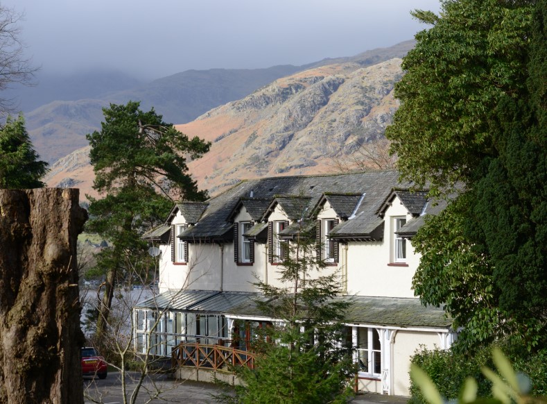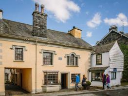


Waingarth Cottage
In the picturesque Lake District village of Satterthwaite, Waingarth Cottage is a traditional,…

Wandering through Cumbria's only 'interactive' woods.
Grizedale Forest
6.4 miles (10.3kms)
Grizedale has always been at least partly forested, from the time when wild boar were hunted here by Norman barons to the present day, when 6,047 acres (2,447ha) are covered, mainly with conifers. Perhaps the guilt of planting all those gloomy Christmas trees got too much for the foresters in the 1970s – it was then that the ‘art in the park’ idea was born. There are now more than 60 permanent sculptures dotted around the forest. Round one corner there may be a wolf; round the next there’s something that you can’t quite comprehend, perhaps waiting for you to give it meaning. Some works, especially those made from natural materials, weather and change over time; and sometimes other things change around them. A good example is the large wood-carved ring that you’ll see on the descent from Carron Crag. This is 17 Degrees South by Linda Watson. Originally it created a perfect frame for the view down to the village of Satterthwaite; now, however, the trees have grown too tall.
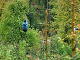
Another aspect of the forest which you’re bound to observe is its immense popularity for cycling and mountain biking. The forest roads cater for all abilities, while more hardcore mountain bikers take to purpose-built trails and the bridleways and byways that cut across the forest. After Carron Crag you’ll have several glimpses of the North Face Trail, especially as you descend from the turning circle (Point 4). This red-graded route (mountain bike trails are often graded in order of difficulty, like ski runs, green, blue, red and black) attracts a range of abilities and this is its main climb.
The route follows the green waymarks of the Silurian Trail almost to Satterthwaite, taking in the summit of Carron Crag, the best viewpoint of the day. To the west the Coniston fells are laid out across the horizon, and to the south Morecambe Bay is a shimmering presence. And all around – you’ll have scrambled up them to reach the trig point – are the Silurian rocks of the Windermere Supergroup, which give the trail its name. They may be a little younger than the rocks of the high fells – a mere 425 million years old – but these slates and mudstones still have plenty of character.
With your back to the café, go under the arch by the shop, out to a lane and turn right. After crossing a stream, the bike routes go left on a track. Go straight ahead up a waymarked path with a few steps. The path leaves and recrosses a bridleway before reaching a forestry road, where you turn right.
Pass another bridleway, then the exit of the black bike route, before forking left up a stony track with green and red waymarks, climbing steadily. After dipping to ford a couple of streams, a narrow path on the left cuts across to a forestry road just above. Turn left and follow the road south. Keep left then, where the track bends sharp left, go straight ahead on a path which wriggles through trees and scrub to the summit trig point.
The path descends to rejoin the forestry road. Turn right to a crossroads of tracks, where you go straight ahead (south). The track ends at a turning circle.
The North Face Trail comes up from the right while our route continues straight ahead as a narrow path that weaves through lovely mixed woodland. Along this section you'll see a series of symbolic art sculptures. Cross the North Face Trail and descend to a forestry road. Turn right, then keep left down into the gill. Fork left before the main track crosses a bridge.
Follow the path over two stone bridges. Where it rejoins the track, go right a few paces then left up a waymarked path, passing a shelter before meeting the track again. Cross at an angle, following green posts, descend and turn left on another track. Leaving the forest, the track becomes a narrow walled lane, Moor Lane, dropping to the Satterthwaite road at a small car park.
Turn left along the lane into Satterthwaite, passing The Eagle’s Head. Bear right after the church, then turn right on a steep lane, which climbs past the cemetery. At the terminus take the left of two lilac-banded waymarks, the Bogle Crag Trail. The path heads north through woodland, traversing wooded slopes. Ignoring paths climbing on the right, continue to a forest road and turn right.
At the next junction, go left (really straight ahead) on a winding forestry trail. Abandon this at a white waymark for a path on the left. Make a winding descent, following signs for Visitor Centre, then join a tarmac track. Keep left at a fork, pass beneath a footbridge, then double back left and follow the path past the striking Yan building and the terraces of the old hall to the car park.
Forest tracks and woodland paths
Conifer plantations and mixed woodland
Most of the route is shared use, with many cyclists around. Keep dogs under close control
OS Explorer OL7 The English Lakes (SE)
Large car park just south of Visitor Centre
At Visitor Centre
Read our tips to look after yourself and the environment when following this walk.
Cumbria's rugged yet beautiful landscape is best known for the Lake District National Park that sits within its boundaries. It’s famous for Lake Windermere, England’s largest lake, and Derwent Water, ‘Queen of the English Lakes'. This beautiful countryside once inspired William Wordsworth and his home, Dove Cottage, in Grasmere is a popular museum. Another place of literary pilgrimage is Hill Top, home of Beatrix Potter, located near Windermere. Tom Kitten, Samuel Whiskers and Jemima Puddleduck were all created here.
Much of Cumbria is often overlooked in favour of the Lake Distirct. In the south, the Lune Valley remains as lovely as it was when Turner painted it. The coast is also a secret gem. With its wide cobbled streets, spacious green and views of the Solway Firth, Silloth is a fine Victorian seaside resort. Other towns along this coastline include Whitehaven, Workington and Maryport. Carlisle is well worth a look – once a Roman camp, its red-brick cathedral dates back to the early 12th century and its 11th-century castle was built by William Rufus.
Discover more than 15,000 professionally rated places to stay, eat and visit from across the UK and Ireland.
Choose a place to stay safe in the knowledge that it has been expertly assessed by trained assessors.
Search by location or the type of place you're visiting to find your next ideal holiday experience.
Read our articles, city guides and recommended things to do for inspiration. We're here to help you explore the UK.