Hanbury and its crater

Investigating the haunting site of the biggest, non-nuclear explosion of World War II.

NEAREST LOCATION

Hanbury

RECOMMENDED BY
DISTANCE

4.75 miles (7.7kms)

ASCENT
240ft (73m)
TIME
2hrs
GRADIENT
DIFFICULTY
Medium
STARTING POINT
SK171279

About the walk

The history of Hanbury starts with the legend of St Werburgh. During the seventh century AD Werburgh, daughter of pagan King Wulfere of Mercia, founded nunneries at Repton, Trentham, Weedon and Hanbury, the latter believed to have been situated to the east of what is now St Werburgh's Church.

St Werburgh

Legend has it that when Werburgh died she was buried at Trentham, but her body was stolen back by the people of Hanbury and buried in a new shrine near the nunnery. As a direct result Hanbury became a major centre for Christianity for well over a century. When the Danes invaded in AD 875, Werburgh's body was again moved, this time to Chester for safe keeping, and it was there, in the cathedral, that she was finally laid to rest.

A wartime tragedy

Today, however, Hanbury is known for a much more recent tragedy. At 11am on 27 November, 1944, the village witnessed the largest explosion caused by a conventional weapon in either World War; only the atomic bombs at Hiroshima and Nagasaki were bigger. In all, 70 people were killed in the blast, and 18 bodies were never recovered.

A distant rumble

The reason for the explosion is unclear, although the site is hard to miss, marked as it is by a crater more than 0.25 miles (400m) across and 100yds (91m) deep. The area around Hanbury is rich in gypsum and alabaster and a number of exhausted mine shafts became convenient storage depots for high explosives during the war. RAF personnel and Italian prisoners of war dispatched this arsenal with heightening urgency as the Allied offensive in Europe got under way, and it's thought that carelessness, inexperience and cost-cutting all had a part to play on that fateful November morning. The first the villagers knew about it was a distant rumble before the explosion proper, which blackened the sky as tens of thousands of tons of soil and rocks were blasted into the surrounding landscape. An entire farm, including its occupants and livestock, disappeared completely, and dozens of underground munitions workers – both British and Italian – were killed. A reservoir for the nearby plaster works burst its dam, unleashing 6 million gallons (27 million litres) of water, boulders, mud and trees onto the factory below, killing 27 workers. The explosion could be heard from London, and was recorded as an earth tremor as far away as Geneva.

Today, nature has healed the scars on the landscape as hawthorn, larch and silver birch have re-colonised both the crater and the surrounding area, providing a habitat for – among other things – a vast colony of rabbits. There's still a gypsum works to the north, below which is an extensive system of mines spread over 10sq miles (26sq km).

Walk directions

From the car park, go back along Church Lane and after 150yds (137m), go right through a car park and through a gate. Cross the field to a pair of stiles over a road and continue across the field to a gate, then to the corner of a hedge. Keeping this hedge to your right, head for Knightsfield Farm.

Go through the farm courtyard and along a rough surfaced track. As it bears to the right, follow a footpath sign, left, across stiles, keeping the hedge to your left. At a turning circle on a driveway go straight across to a footbridge before continuing, with the hedge to your left, to reach the road.

Turn right, then after 80yds (73m) go left at the footpath sign beside the building. Cross the yard into the field ahead to reach the stile at the bottom. Continue up the next field, crossing the stile at the top.

Where the hedge goes left, follow it across another stile and, via fields, aim for the imposing brick buildings of Hanbury Park. Go through a series of metal swing gates into the farm courtyard, then left past the open barn and through a wide gate away from the farm. Continue on the bridleway to Woodend.

At the road head right for 100yds (91m), then go left over a stile, making for a stile in the fence ahead and to the right. Head diagonally left across a field to a stile, then continue straight across the next field to a stile. Cross Capertition Wood to an open field, continuing with a hedge to the left, up a hill, across stiles, then down to another. At the end of the field cross one more.

Skirting to the left of the farm, climb over a succession of stiles before turning sharp left immediately after an iron gate. Once across the stile in the corner, go ahead through three more fields, following waymarkers past a small pond. Drop down to the right-hand end of a bank of trees.

At a path junction turn right up a short hill via kissing gates, towards trees. Head round to the left to see the crater, now re-colonised by nature. Follow the path round to the left, past the memorial stone, to a bridleway leading away from it.

At the end of this bridleway, head left across a field, keeping the hedge to your right. Go through a kissing gate in the hedge ahead and continue straight ahead to a gate at the top. When you reach the end of the hedge on your left, go through a gate and a stile to return to Hanbury.

Additional information
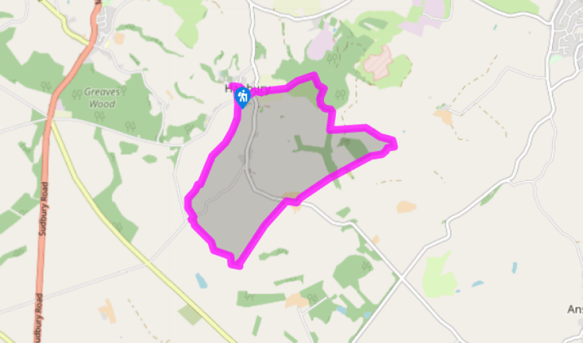
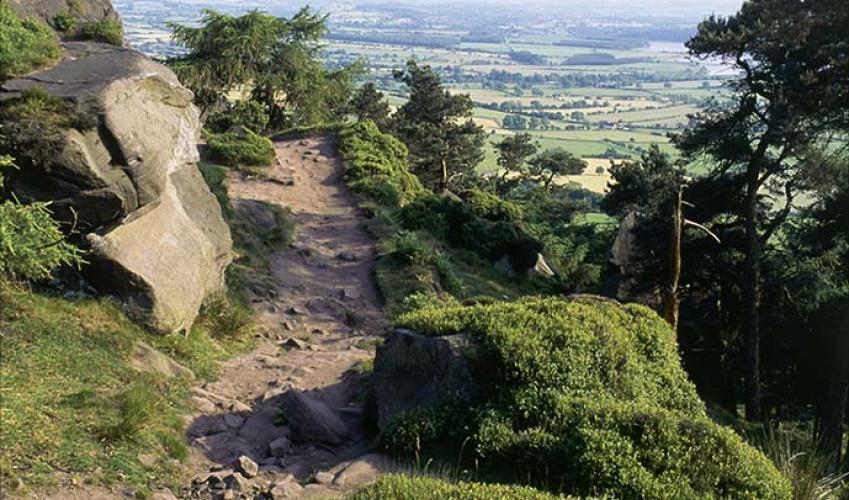
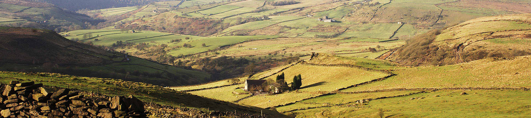
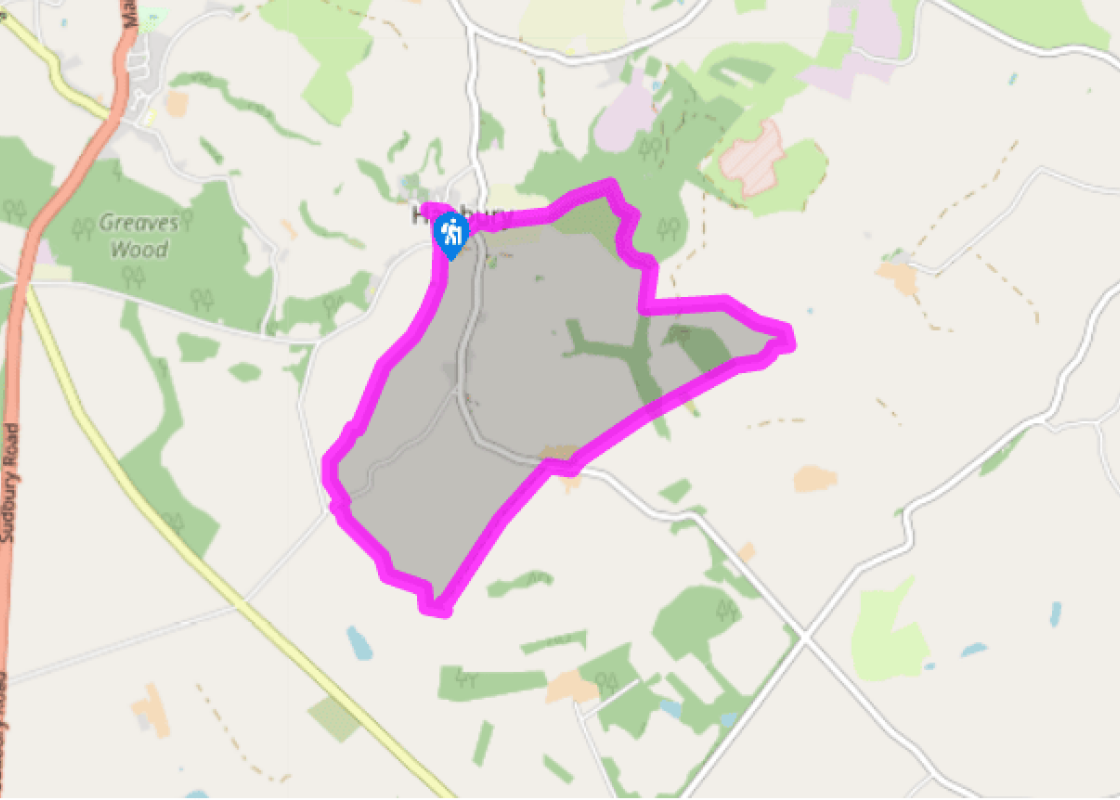
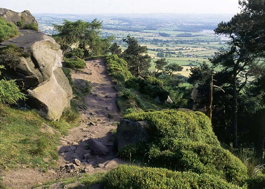
Meadow tracks and bridleways, many stiles

Farmland and bomb crater

Must be kept on lead near livestock

OS Explorer 245 The National Forest

St Werburgh's Church car park

None on route

Been on this walk?

Send us photos or a comment about this route.

Know a good walk?

Share your route with us.

WALKING IN SAFETY

Read our tips to look after yourself and the environment when following this walk.

Find out more

About the area

Discover Staffordshire

It was Staffordshire that bore the brunt of the largest non-nuclear explosion of World War II, when a munitions dump at RAF Fauld went up in 1944. It was also the county’s regiment that once boasted within its ranks the most decorated NCO of World War I, in the person of William Coltman (1891-1974). Going back a little further, George Handel penned his world-famous masterpiece The Messiah on Staffordshire soil. During another chapter of Staffordshire history, the county was home to the first canals and the first factory in Britain, and it had front-row seats for the drama surrounding one of the most notorious murder trials of the 19th century, that of Doctor William Palmer.

In outline, Staffordshire looks not unlike the profile of a man giving Leicestershire a big kiss. The man’s forehead is arguably the best region for hillwalking, as it comprises a significant chunk of the Peak District. This area is characterised by lofty moors, deep dales and tremendous views of both. Further south are the six sprawling towns that make up Stoke-on-Trent, which historically have had such an impact on Staffordshire’s fortunes, not to mention its culture and countryside. This is pottery country, formerly at the forefront of the Industrial Revolution and the driving force behind a network of canals that still criss-cross the county.

Why choose Rated Trips?

Your trusted guide to rated places across the UK
icon example
The best coverage

Discover more than 15,000 professionally rated places to stay, eat and visit from across the UK and Ireland.

icon example
Quality assured

Choose a place to stay safe in the knowledge that it has been expertly assessed by trained assessors.

icon example
Plan your next trip

Search by location or the type of place you're visiting to find your next ideal holiday experience.

icon example
Travel inspiration

Read our articles, city guides and recommended things to do for inspiration. We're here to help you explore the UK.